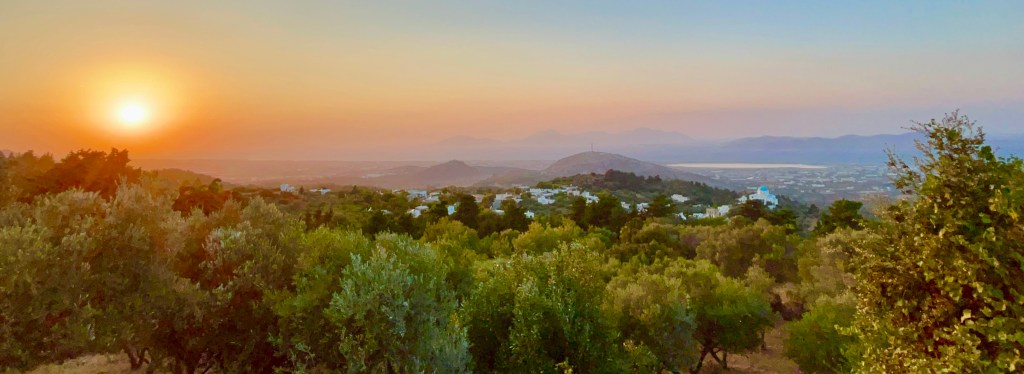
Udaipur is known as the Venice of India. The city overlooks the tranquil Lake Pichola with a location unmatched in Rajasthan and arguably all of India.
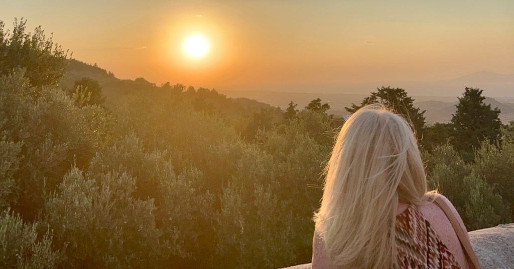
For myself, this iconic and romantic city had very much gone under the radar. After visiting Udaipur it became one of my favourite places on my Indian tour. A very atmospheric location and unlike a lot of destinations, has a very relaxing vibe.
It is famous for its lakes, mountains, beautiful palaces and quaint upmarket old-world hotels. Where you can enjoy a serene boat ride, and walk along narrow crooked streets witnessing the bustle and colour of the bazaars.
During my short stay in the city, I was able to explore some of the sights and attractions it had to offer. My only regret is that I was not able to spend longer in this splendid city. Two days certainly didn’t do Udaipur justice.
Jagdish Temple
A large Hindu Temple situated in the middle of Udaipur along with the Royal Palace it is a major landmark of the city.
The temple is a popular destination with visitors and has been a continual place of worship since 1651. To reach the main shrine we first had to climb 32 marble steps
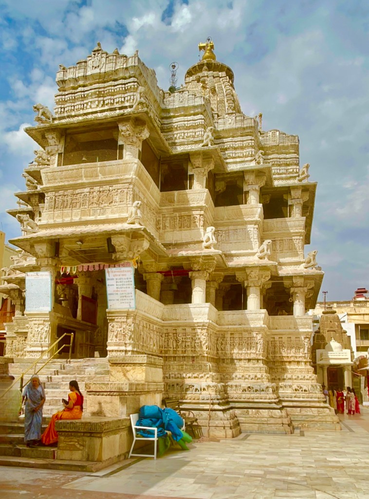
This is certainly a significant monument and is one of the largest temples of the Lord Vishnu. It is a three-story temple which was built on a raised platform with glorious sculptured pillars, huge halls glorious painted walls and intricately designed ceilings.
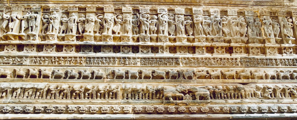
Its outer walls and towering Shikhara are heavily carved with figures of Vishnu, scenes from the life of Krishna and dancing apsaras (nymphs)
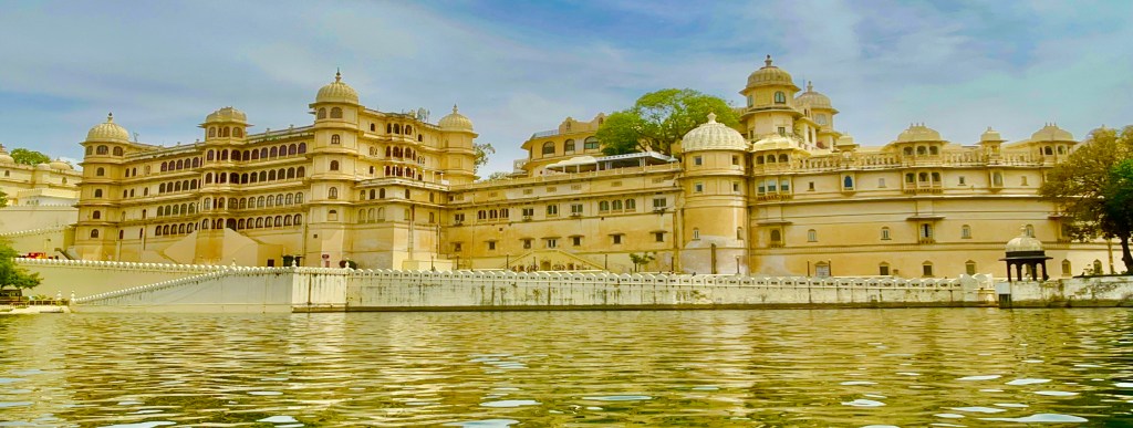
City Palace
Rising from the bank of Lake Pichola the imposing City Palace is a grand icon of Udaipur’s and Rajasthan’s royal past.
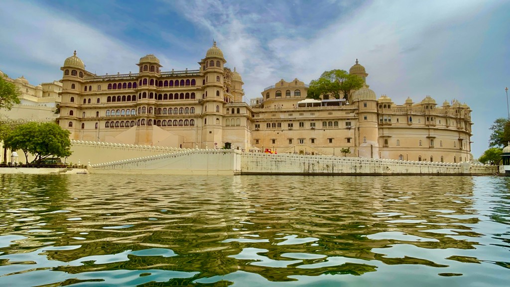
With a facade that is 244 meters long and over 30 meters high. For me, it was certainly a must-see destination when I came to Udaipur. Construction began in 1599 by Maharana Udai Singh II.

The vast palace includes two luxurious palace hotels, a school and the popular City Palace Museum, it is still the official home to the present-day Maharana.
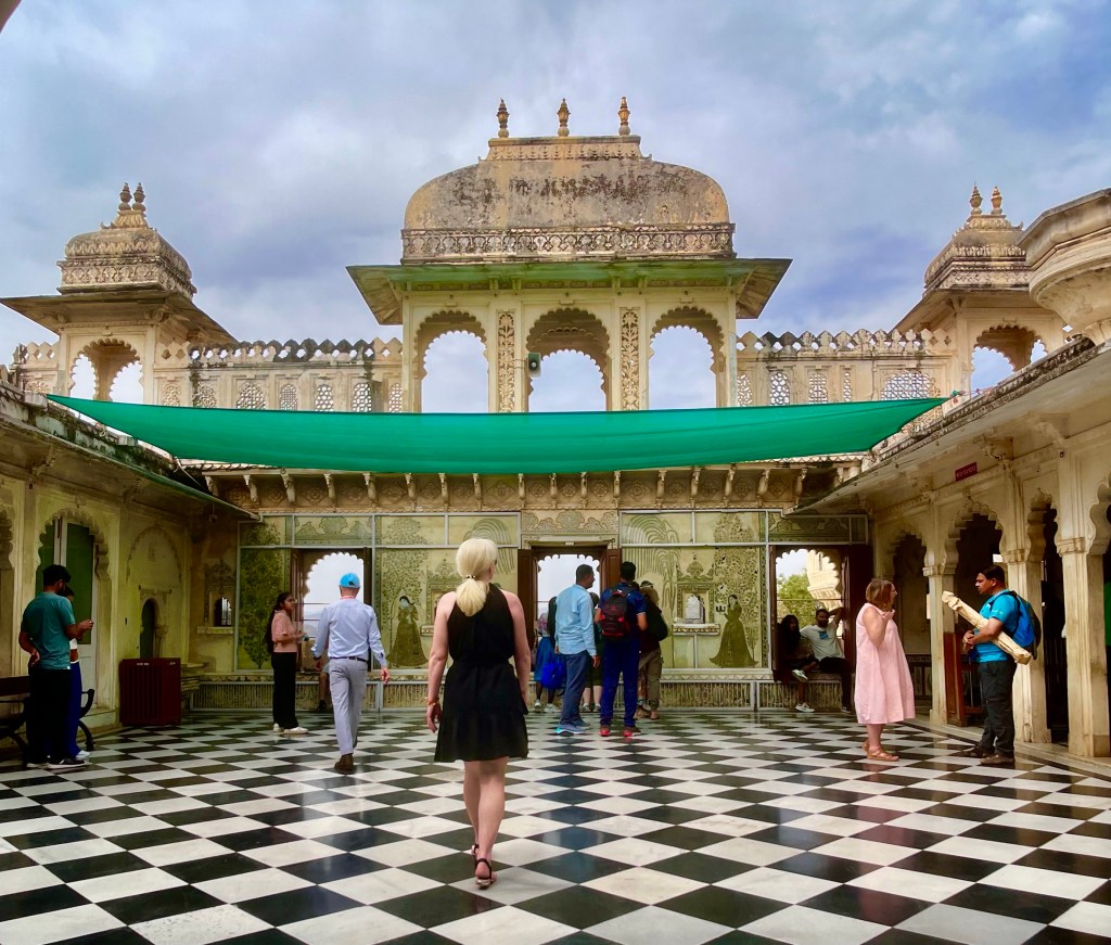
It has a maze of courtyards, pavilions, terraces, corridors, rooms and hanging gardens. Encircled by fortifications the stately palace is built in granite and marble.
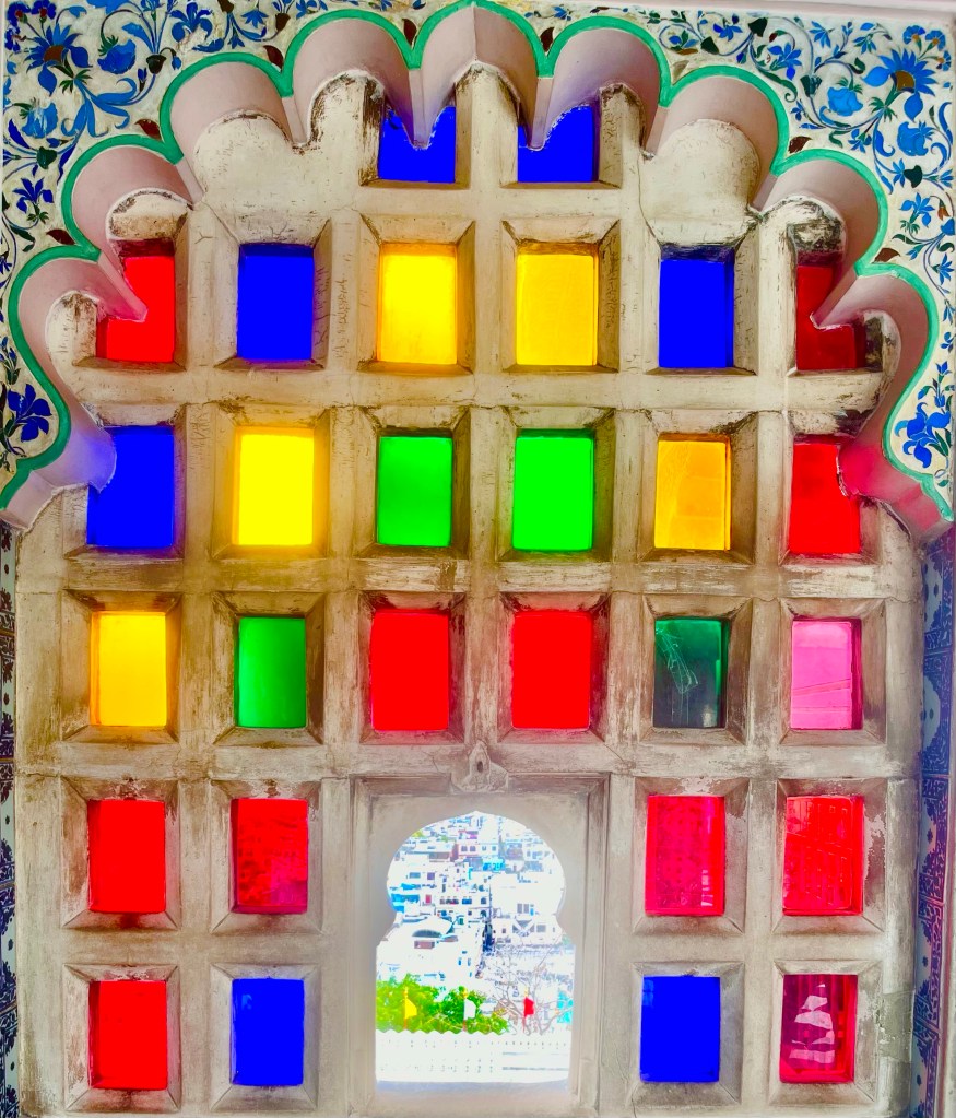
The grand white City Palace is a heritage building and it showcases the best elements of Rajiput Culture and arts. The City Palace certainly didn’t disappoint with a mixture of architectural grandeur and rich heritage, the City Palace was an enjoyable visit.
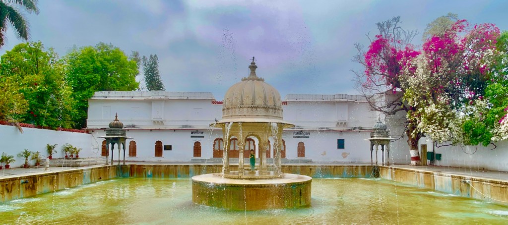
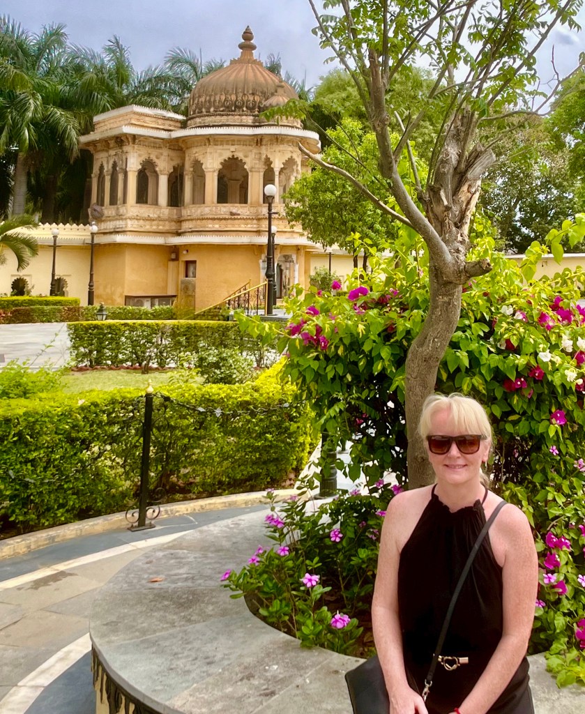
Saheliyon-Ki-Bari

This elegant garden was made by Mewer ruler Maharana Sangram Singh in the 18th century as a recreational space for the royal ladies. Saheliyon-Ki-Bari translates into English as Courtyard of Maidens.
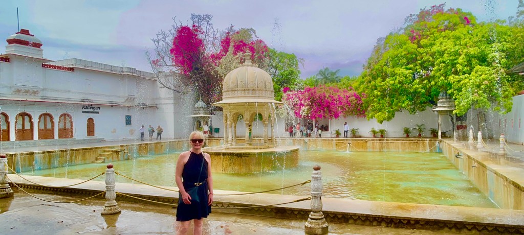
It has lots of beautiful and unique features which include fountains marvel pavilions, lotus ponds, sculptures and plants, flowers and trees.
Being a city of lakes it should come as no surprise that the park have been constructed with water being the centre of attention.
The park is a very popular location for locals to enjoy its peace and tranquillity. It’s not centrally located about 15 minutes from the city centre but well worth a visit and is open from 8 am till 8 pm.
Jag Island Palace
Another island with a royal history with not one but three Maharanas involved in its construction over 100 years, construction starting in 1551 and completed in 1652.
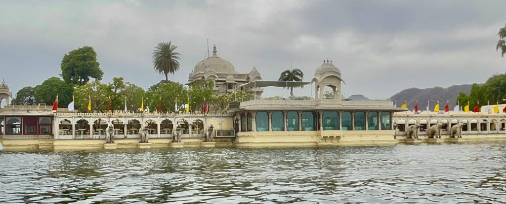
It can only be reached by boat from the jetty located by the Lake Palace. But shuttles run regularly throughout the day from 9 am to 6 pm and take about 15 minutes.
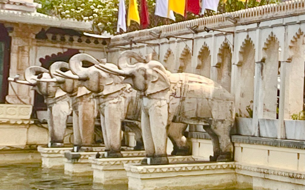
The entrance is flanked by some rather impressive carved elephants. These were added by Maharana Jagat Singh I in the 17th century to symbolize strength and royalty.
The palace has several pavilions, courtyards, gardens and fountains that symbolize the beauty and elegance of Rajput architecture.
Today it is an upmarket hotel with 7 rooms, a cafe, bar, restaurant and spa. It is hired out for lavish Indian weddings and celebrations and is a popular tourist destination. It is a great place to enjoy a drink with a bar and cafe located there, with some fantasy views of Udaipur from the island.
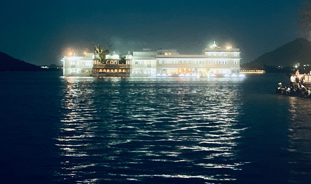
Lake Palace Hotel
Udaipur is home to some fantastic hotels none grander than the Lake Palace Hotel, which seems to float like a beautiful white ship on the waters of Lake Pichola.

It was built in 1743 as a summer retreat for the royal dynasty of Mewar. It was converted into a hotel in the 1960s when the family started accepting paying guests. Upkeep on these buildings is phenomenal and it gives the royal families an income source to still live and maintain these fabulous buildings.
The Lake Palace may be recognisable as it has been used in several films, notably Octopussy, and to this day it certainly oozes glamour and decadence.

It is one of the world’s most photographed hotels due to its unique location on a small island on Lake Pichola, with its white marble glistening on the lake and particularly atmospheric at night. With several viewing points in Udaipur to view the hotel.
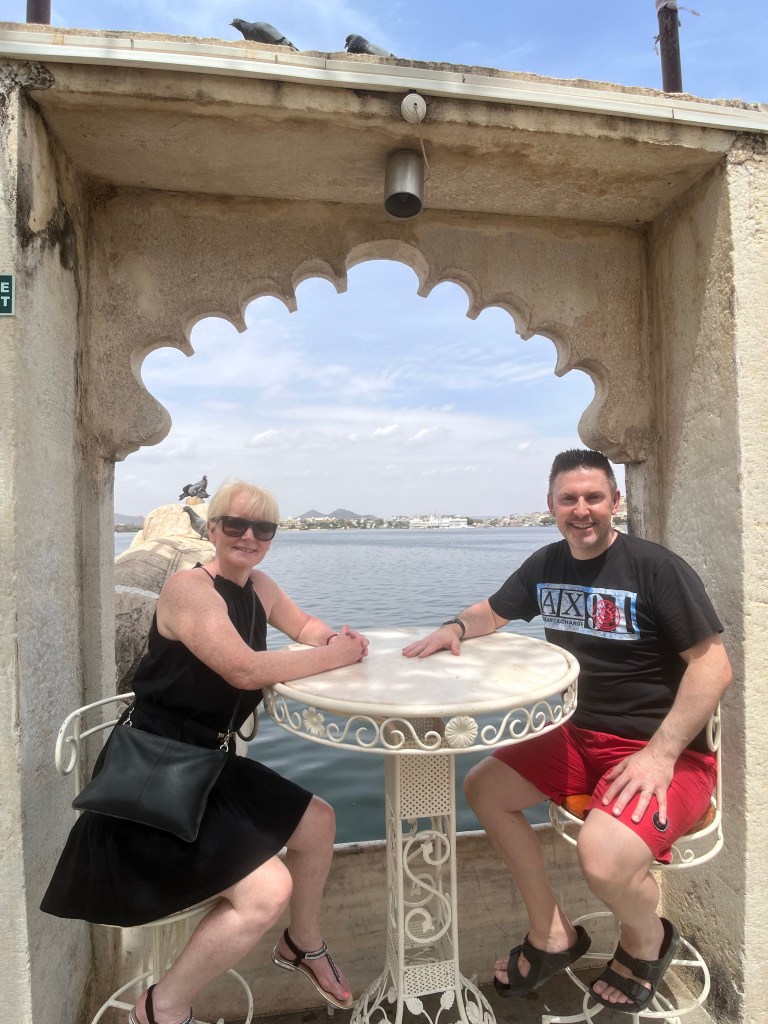
Lake Pichola day and night
The lake was first built in 1362 and is the oldest and largest of the city’s lakes.
A popular activity is to partake in a boat trip. The lake is 4 kilometres long and 3 kilometres wide and this man-made lake is relatively shallow and can dry up completely in times of severe drought.
Boat trips are roughly an hour in duration. Some trips are in combination with a City Palace tour which will obviously cost more. Most boat tours will stop at Jagmandir Island which I have mentioned previously and you can stop as long as you like here as boats regularly transfer back to Udaipur.
From the lake, I could see Gangori Ghat, it stood out beautifully as I was passing on the boat. It is associated with huge courtyards, fountains and archways. It is a popular spot for locals to hang out as there is Rajistanhifold dancing performances most nights.
Although the lake is mainly viewed during the daytime, the lake is particularly beautiful at night with the reflection from the Lake Palace Hotel and City Palace a captivating sight to behold indeed.
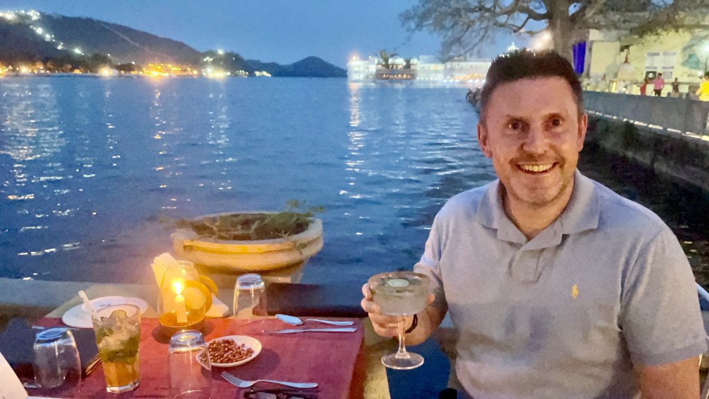
Lakeside dining
Udaipur is renowned as one of the most romantic cities in India. Its lakes and palaces provide an evocative location for a dining experience.
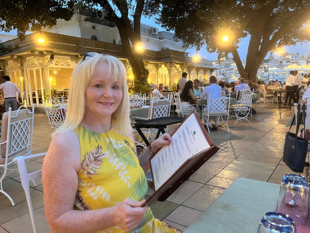
We were recommended a restaurant Ambrai at Amet Haveli and our guide kindly reserved a wonderful lakeside table where we were able to enjoy our food with a memorizing vista.
The main unique selling point of this restaurant is the spectacular panorama of Lake Pichola and the City Palace. It is the only lakeside restaurant in the area so booking is definitely recommended.
The food was nice but in all honesty, it’s the captivating view of the Udaipur waterfront and Lake Pichola which is obviously the main appeal here.
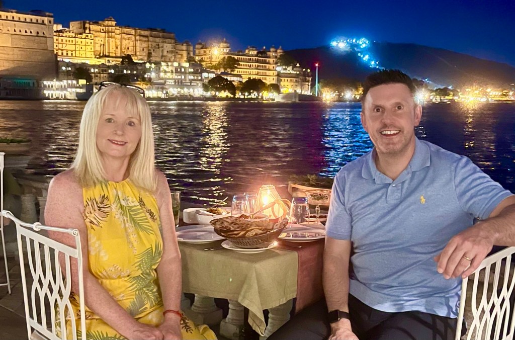
A candle-lit dinner for two in what is India’s most romantic city, this alfresco dining experience was a magical conclusion to our short stay in Udaipur.