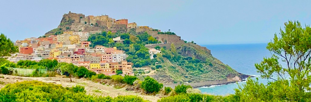
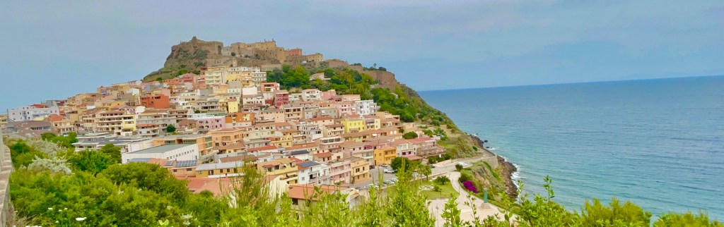
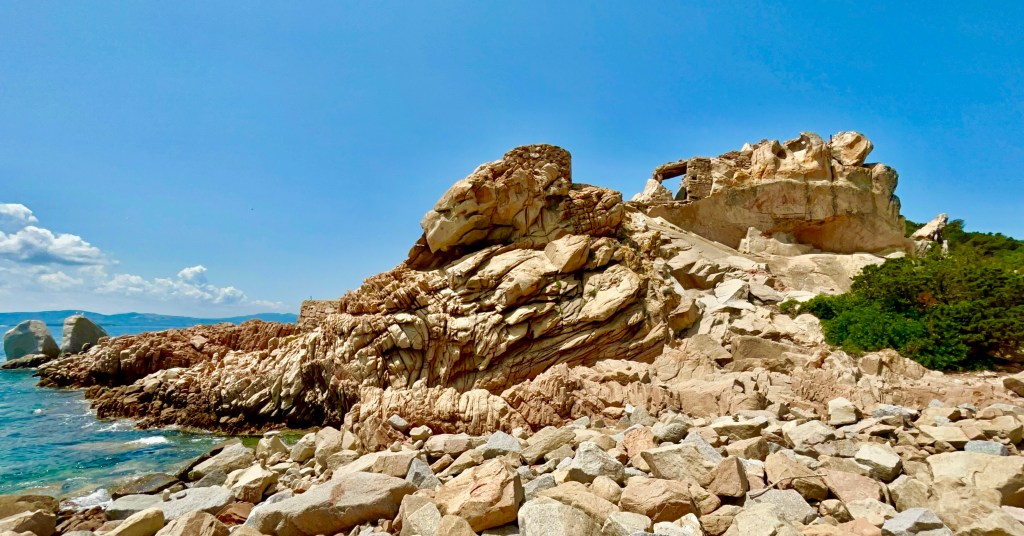
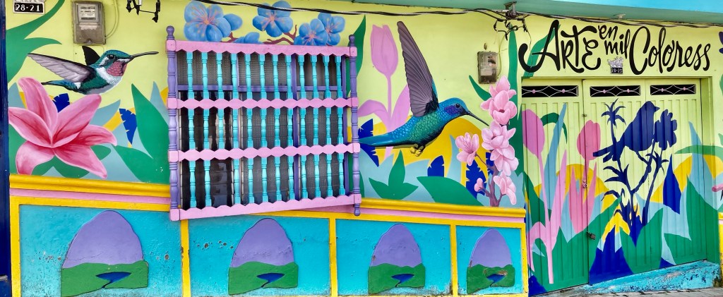
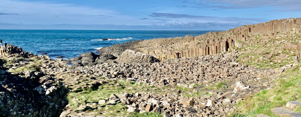
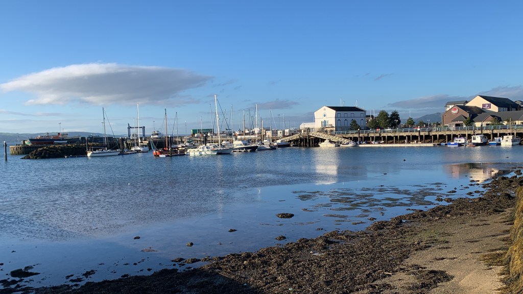
Castlesardo is one of Sardinia’s and indeed Italy’s most picturesque villages. The town sits on a large rocky promontory that juts out into the Mediterranean Sea.
Having decided to hire a car for a few days, our first destination is Castlesardo. A very picturesque historic town on the northwest coast of Sardinia about 60 miles from our base Costa Smeralda.
It took us about 90 minutes to get there through the Sardinian hinterland. The roads are not great, very twisty with some bad bends 🫣 but we arrived safely at Castlesardo. Parking was free as we were outside of the town.
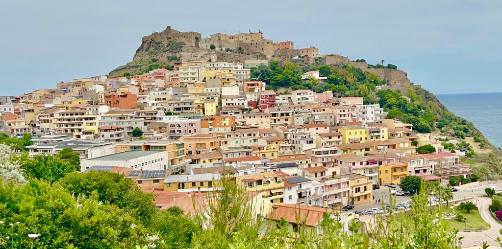
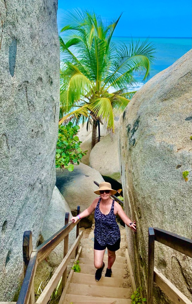
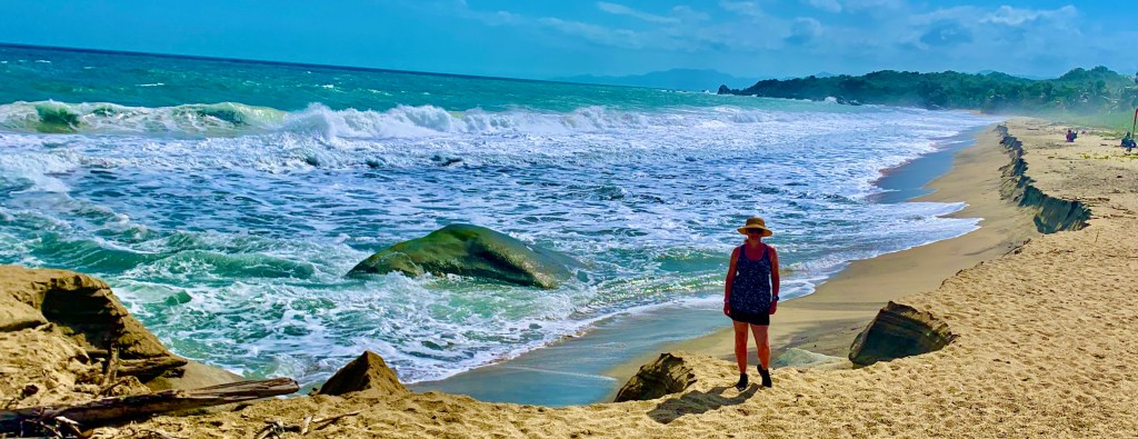
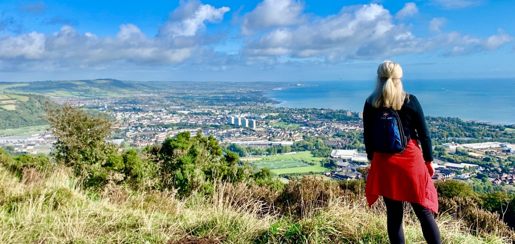
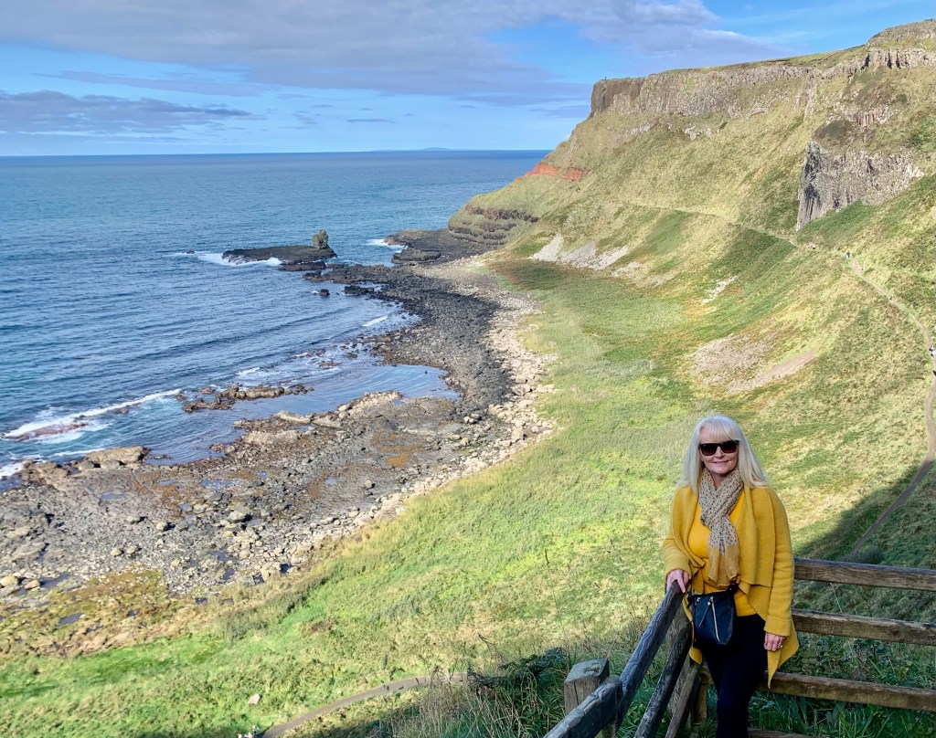
It was about 15 minutes walk into Castlesardo. The walk is definitely worth it as the view of the castle and old town are amazing. This is definitely the location if you want some iconic pictures of Castlesardo.
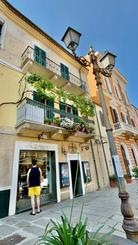
We had a casual stroll through the town making our way up the steep incline to the castle. The new town is a drab affair if I am being honest however as we made our way up to the old town and castle things started to become decidedly more interesting.
We visited midweek in June so the town wasn’t packed with visitors giving us a real feel for what life is like in a town that had stood for nearly a millennium. It is an amazing place to discover on foot however a level of fitness is needed as you negotiate the steep inclines. There are Tuk Tuk tours available if you prefer an alternative option.
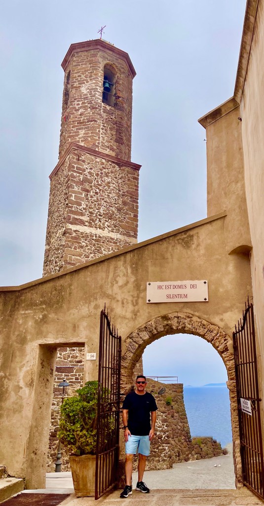
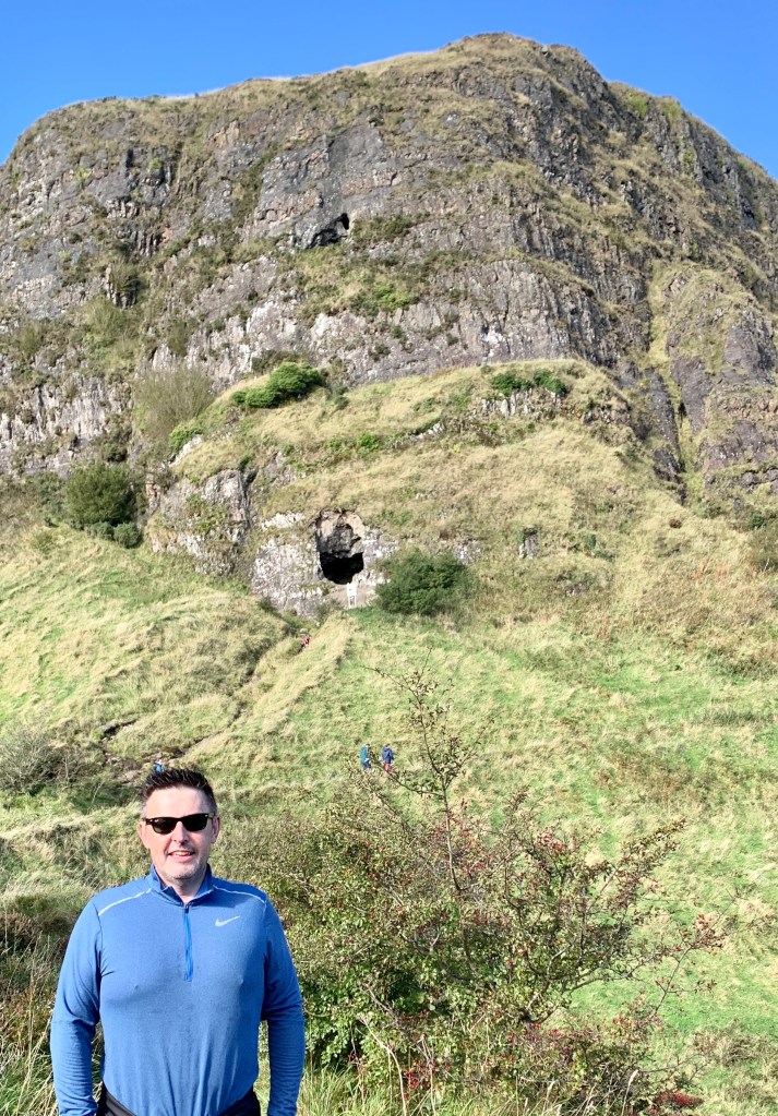
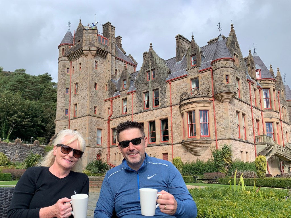
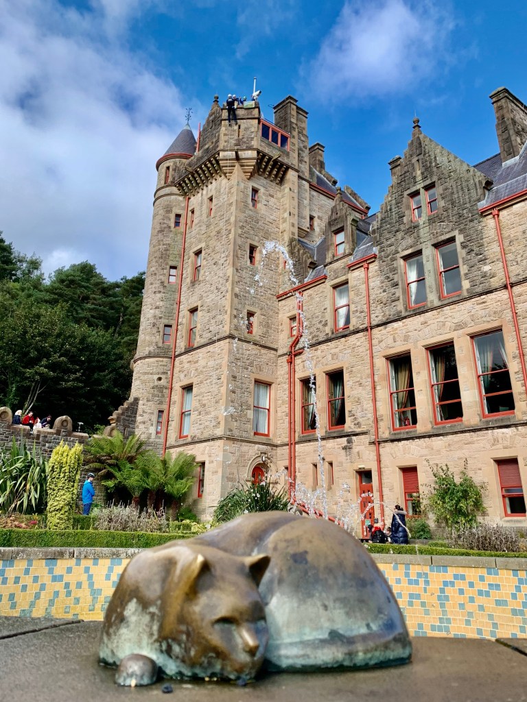
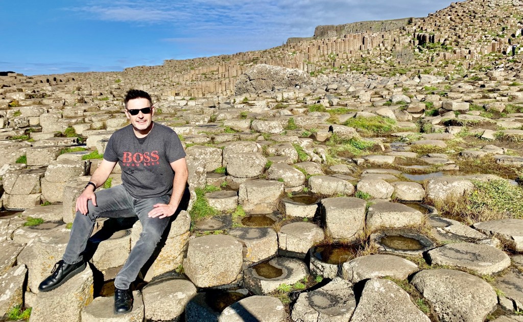
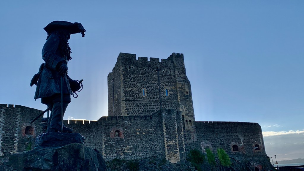
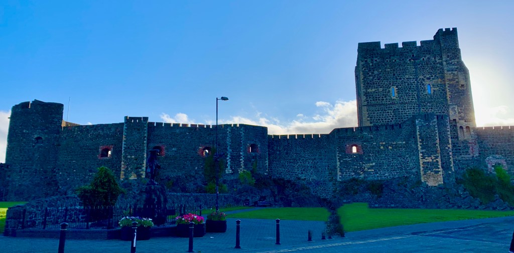
Doria Castle
At the top, we visited the castle which cost €5 admission. The castle was built by the Doria family and has now been converted into a museum with some exhibits about basket weaving which the area is renowned for. It was pretty uneventful, to be honest unless you like basket weaving then it will be one of the best museums you have visited.
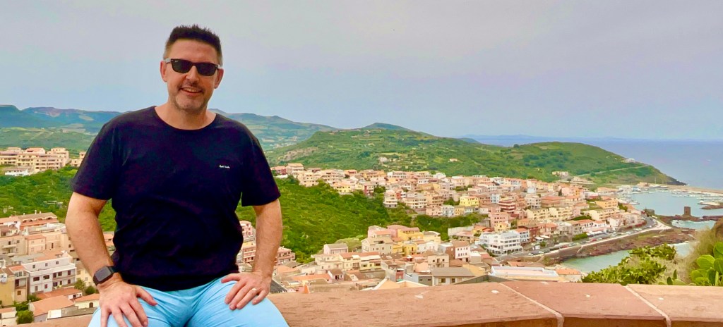
Once outside we got to the best bit of the castle, the terrace situated amongst the battlements which gives fantastic views over the town, along the coast and along the Gulf of Asenira. The views from the castle are fabulous and worth the cost of admission just for this.
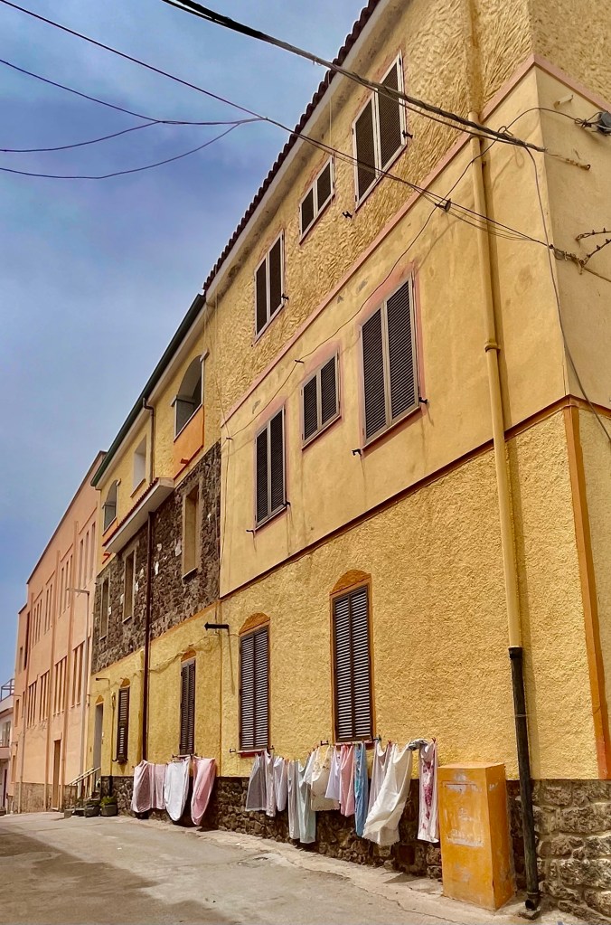
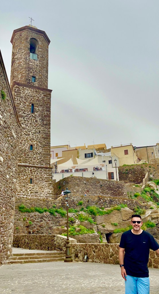
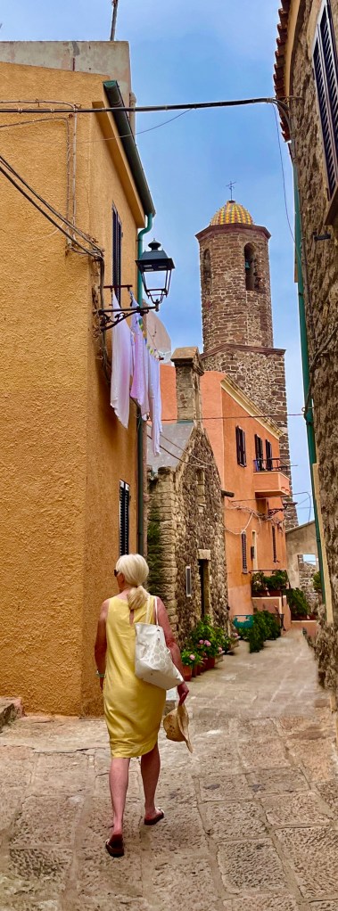
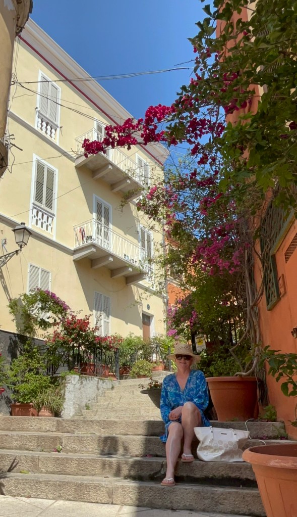
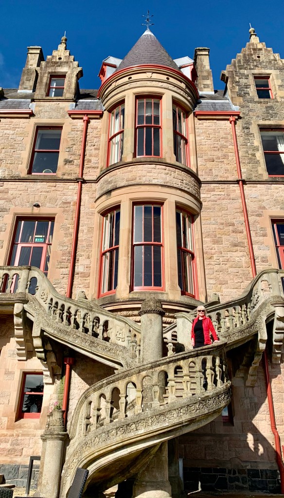
After visiting the castle it was time to discover the old town. It was worth it, exploring a labyrinth of lanes and alleyways walking up and down the slopes of this Medieval citadel. With endless steps we found tall narrow houses and stoned paved streets.
A typical scene within Italy and Sardinia is no different in this respect. We found restaurants and cafes with tables set up among the stairways and alleys in fact anywhere with an open space you will see the opportunity to engage in some alfresco dining.
Castlesardo cathedral is in the heart of the old town. The present structure dates back to its reconstruction in 1597 and is a mixture of Catalan, Gothic and Renaissance elements and overlooks the sea.
The citadel walls were also very impressive with the nearby citadel now covered with blocks of colourful houses. The old town offers a very enchanting vision, everywhere we looked from any prospective gave us a picture-perfect setting.
This very charming town offers up its hidden treasures as we continue to explore the historic lanes that offer an ancient and authentic insight into the medieval side of the island
It’s very difficult not to be impressed by the magnificent ancient architecture which we viewed throughout the town, castles and fortresses. They were all built around the same time as the origin of the town
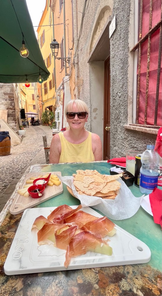
Another highlight of visiting this charming town is the local food. Castlesardo has a reputation of being one of the best places to sample Sardinian gastronomy.
The choices are endless at the top and you will find many fancy restaurants with panoramic views. For a more authentic experience dine in one of the many restaurants situated in the heart of the old town. The food was delicious and prices were very reasonable less than we paid in Costa Smeralda.
Another chance of a majestic view of Castlesardo as we go back to the car park on the outskirts of town on what has been a very captivating visit.
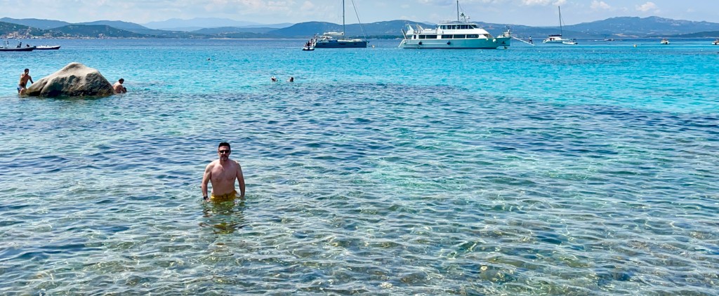
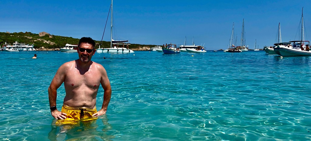
It doesn’t feel like the Mediterranean here. It feels like the Caribbean
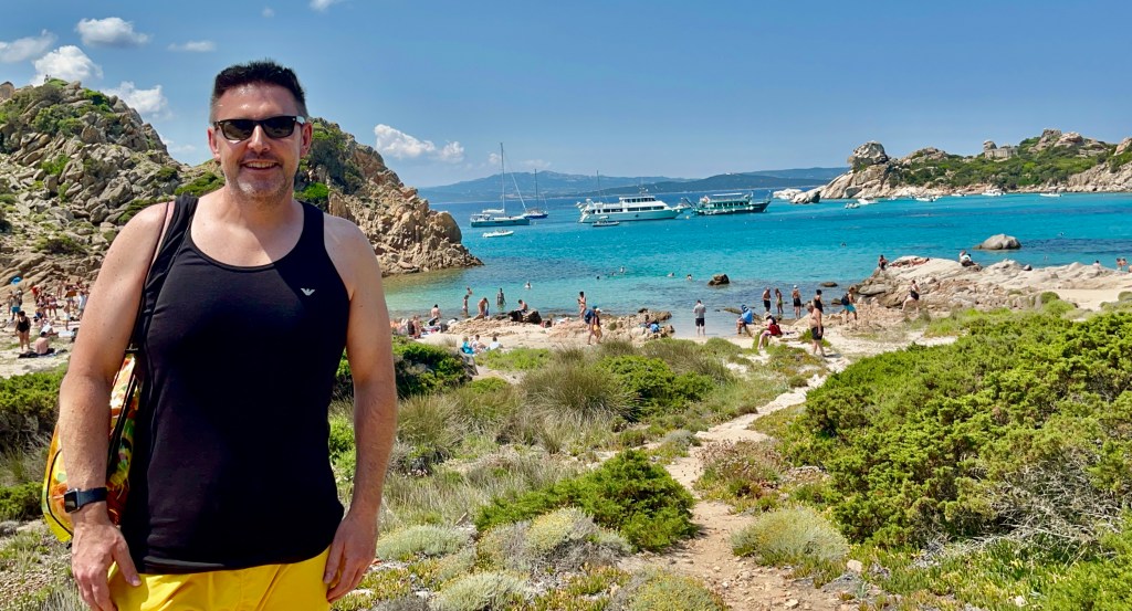
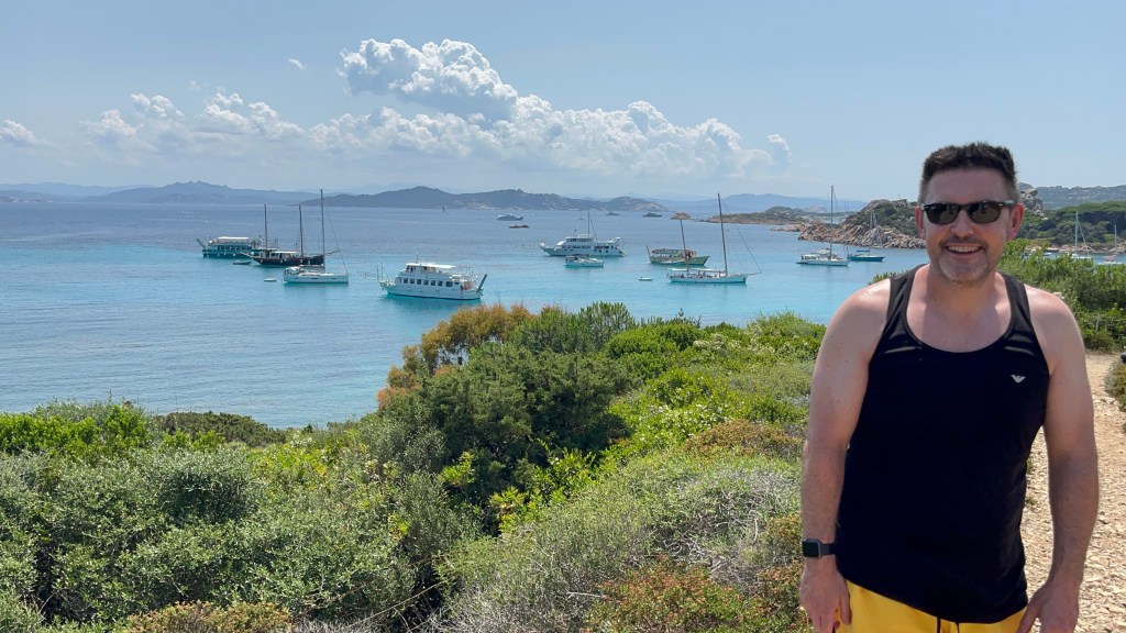
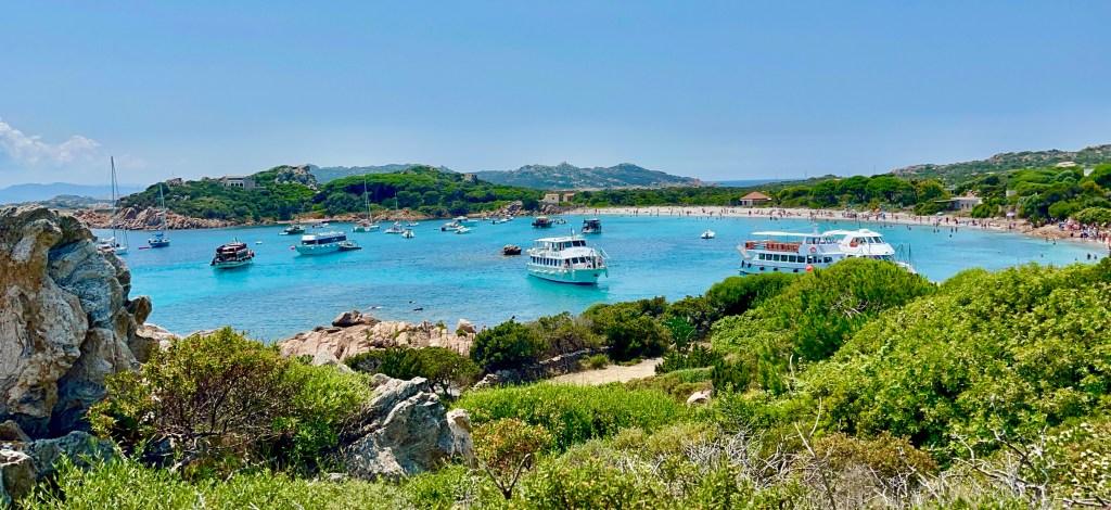
The Maddalena Archipelago to give its official title. A group of sixty islands situated in the Strait of Bonifacio between Corsica and Sardinia. It became a National Park in 1994 and has been shortlisted to become a UNESCO World Heritage Site.
The view of Maddalena Island from Costa Smeralda. It was unmissable.
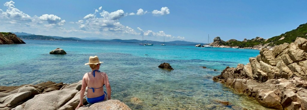
Before I visited Sardinia, I had never heard of the Maddalena Islands. There is a good reason for this as they have only recently started to become a popular location. They have some of the most beautiful beaches in Italy 🇮🇹 and some of the cleanest clear water.
The La Maddelena islands are commonly publicised, as a quiet place of turquoise lagoons, deserted islands and some of the most beautiful beaches in Sardinia. If the reality matched the online portrayal of this location it was worth a visit.
With plenty of ferries operating to the islands and regular boat trips available, it’s not a difficult location to get to and explore. On the main inhabited island La Maddalena, you can even take your car on the ferry.
We decided on a day’s boat trip from Baja Sardina on the Costa Smeralda, as this was the most convenient and cost-effective option for us, rather than having to get to a ferry terminal as public transportation is not really a viable option.
Isola di La Maddalena
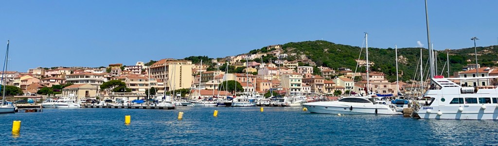
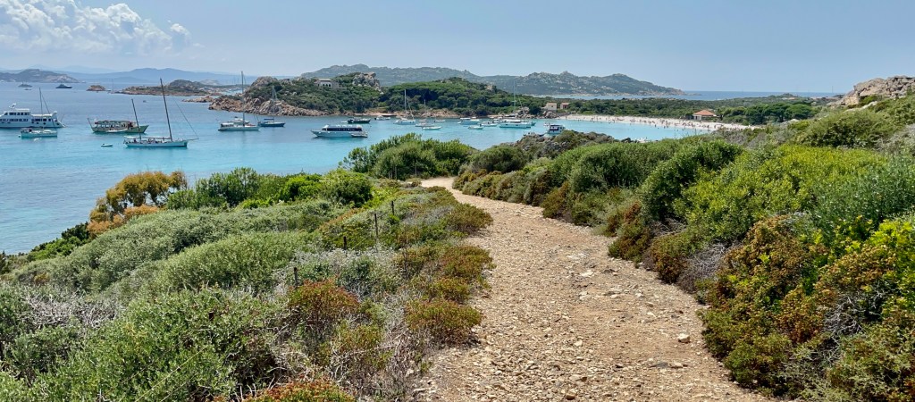
Our first stop was Maddalena Island. Which is the largest and the only island which has a permanent population. It will be the only island with proper infrastructure, with shops, cafes, and hotels.
After a short 20 minutes boat ride from Baja Sardina, we arrived at Maddalena Island. It wasn’t what I had initially envisaged. There we docked at the small port of Cala Gavetta. The deep blue waters and colourful buildings were certainly pleasing to the eye.
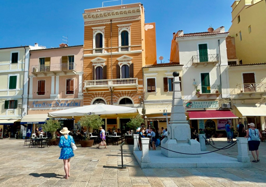
Piazza Garabaldi the main square in the town.
Once off the boat, we were able to explore the town after first navigating the surprisingly busy port. There are lots to see and do but unfortunately for us time was limited and we decided to explore the town. Perhaps an overnight stay wouldn’t have been such a bad option after all.
Once past the main square, we entered the old town. Here we discovered narrow streets and traditional alleys. There are lots of cafes and shops within the old town where you can enjoy a coffee, ice cream or a delicious pastry, luckily for my waistline, I was still full from breakfast.
For such a small place there is lots to do. There is a Baroque church of Santa Marina of Maddelena, Sant Andrea Fort and there is even a small museum to visit.
We had an interesting visit on this island. I just wished we had more time and booked a hotel stay, as there was plenty to see and do and that’s without factoring in the beautiful beaches. All on an island of 20 Square kilometres, but it was time to get back on the boat and visit another island.
Islola di Spargi
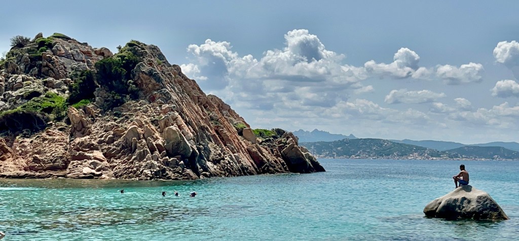
An uninhibited round island, full of granite rock with little shade. Doesn’t sound that great but appearances can be very deceptive, this is certainly a very captivating location.
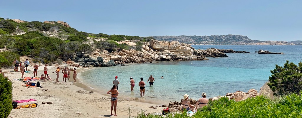
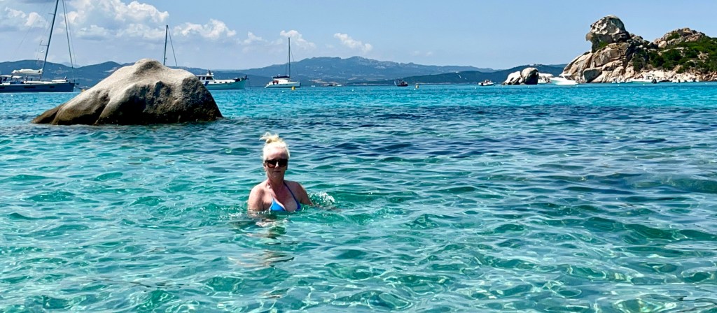
Our next stop was the beautiful island of Spargi. I couldn’t believe the colour of the sea. Different shades of turquoise blue and emerald with crystalline waters, white sand, rocks and vegetation surrounding it.
It lies west of Maddelena Island. It is necklaced by sandy coves and inlets. With 11 kilometres of coastline, it’s the third largest island in the archipelago and is uninhabited.
It was very different to Maddalena Island. Spargi is very often described as the jewel within the Maddelena Islands and I would not disagree with that. The white beaches seemed to have stood still intact and uncontaminated by the modern world
It’s the perfect location to have a swim and satisfy the senses by caressing pristine white sand as you enter the crystal-clear water
On Spargi there is a wild beauty of granite rocks with high and jagged coast, intertwined with perfectly formed beaches which put a lot of Caribbean beaches to shame.
There was certainly a lot of natural wonderment to see at Spargi. A short stay really didn’t do it justice. However, it was still an unforgettable experience relaxing in one of the beautiful bays on this island, with views I will find very difficult to forget.
Isola di Santa Maria
Our final stop for the day was Santa Maria Island. It differs completely from Spargi island as it’s not made of granite. It has a lush green appearance. It can only be reached by boat.
Small and green Santa Maria is not strictly uninhabited as a few houses were built before it had strict planning restrictions imposed by the local government due to its ecological importance and its UNESCO status.
It was first settled by Benedictine monks who were escaping from Corsica and seeking refuge on the island. Being a UNESCO-protected area with lush vegetation it is an important location for wildlife and it’s renowned for having mesmerizing seascapes.
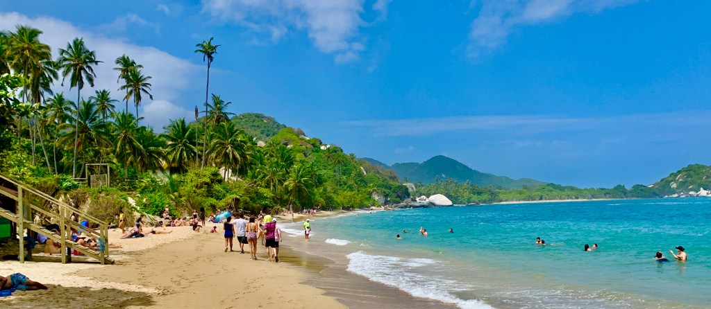
The most popular beach is Grande Cala di Santa Maria, which is also the nearest to where the boats dock. It doesn’t have the dramatic impact of the beaches on Spargi island but is still a very pretty beach, its only downside is that it’s very busy.
Nonetheless, the water is still very clear. The warm sea is unbelievably transparent due to the slowly sloping seabed creating a large natural pool. The vibrancy of colours which can range from light blue to turquoise we’re certainly an extraordinarily beautiful sight. A unique natural spectacle.
All too soon our island-hopping adventure come to an end. It was time to get back on the boat and back to Costa Smeralda which is only 20 minutes away.
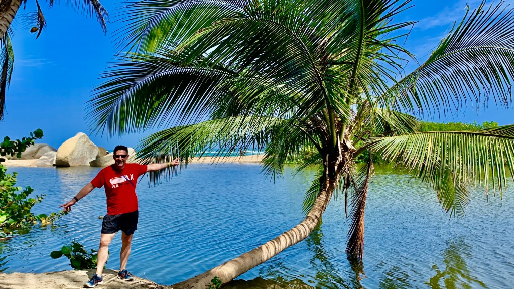
On the way back there was still one more treat in store for us. The Porto Della Madonna is a natural lagoon enclosed by the islands. The name Porto Della Madonna derives from the intensity of the blue sea and the incredible transparency of the waters.
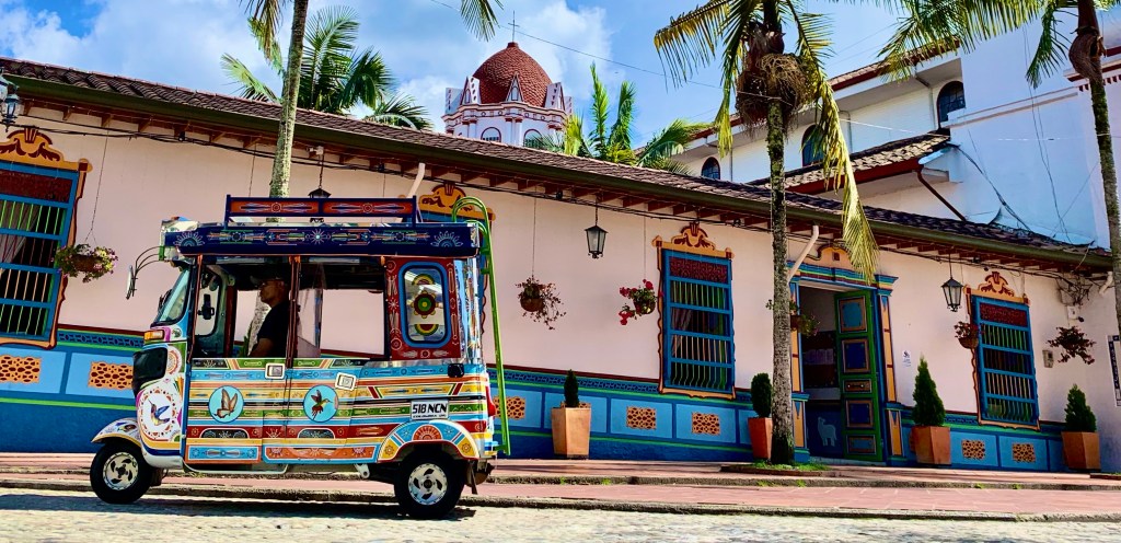
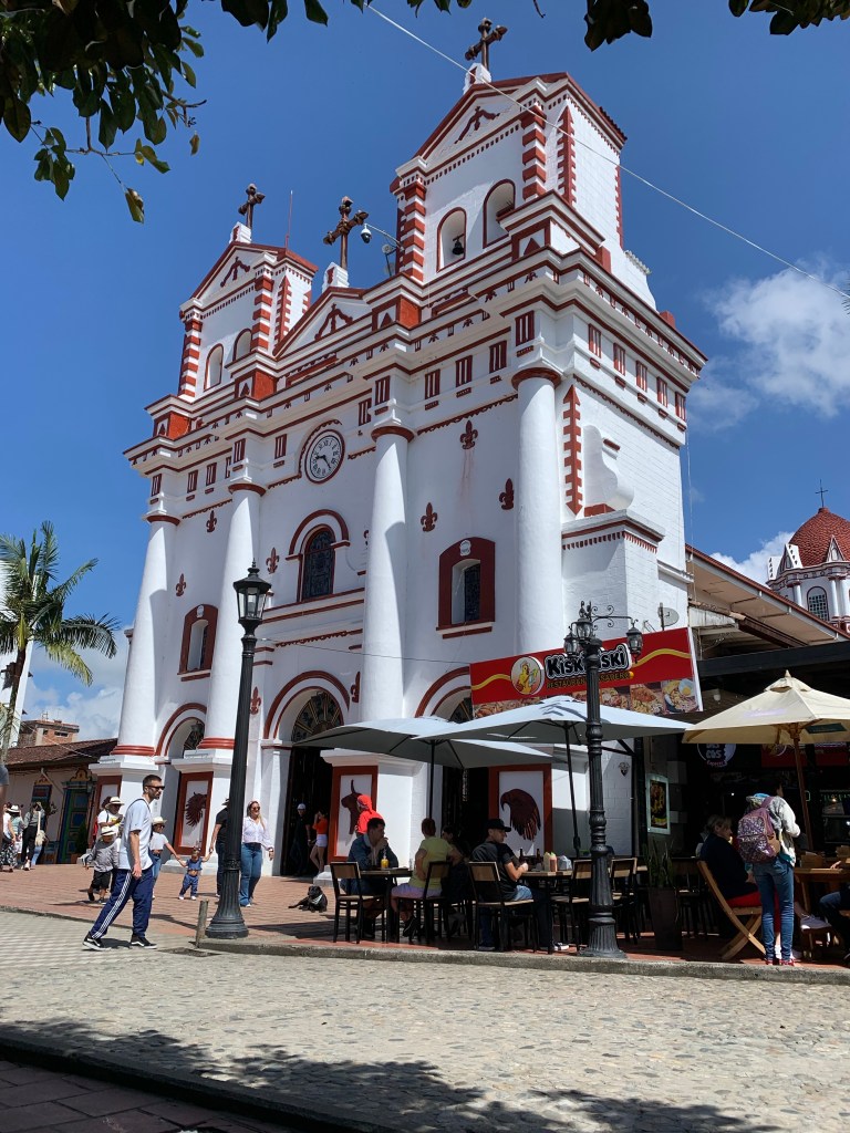
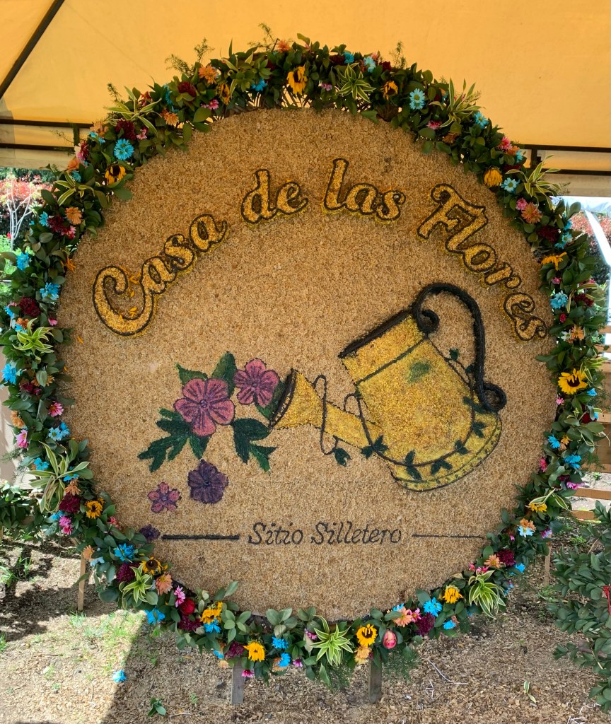
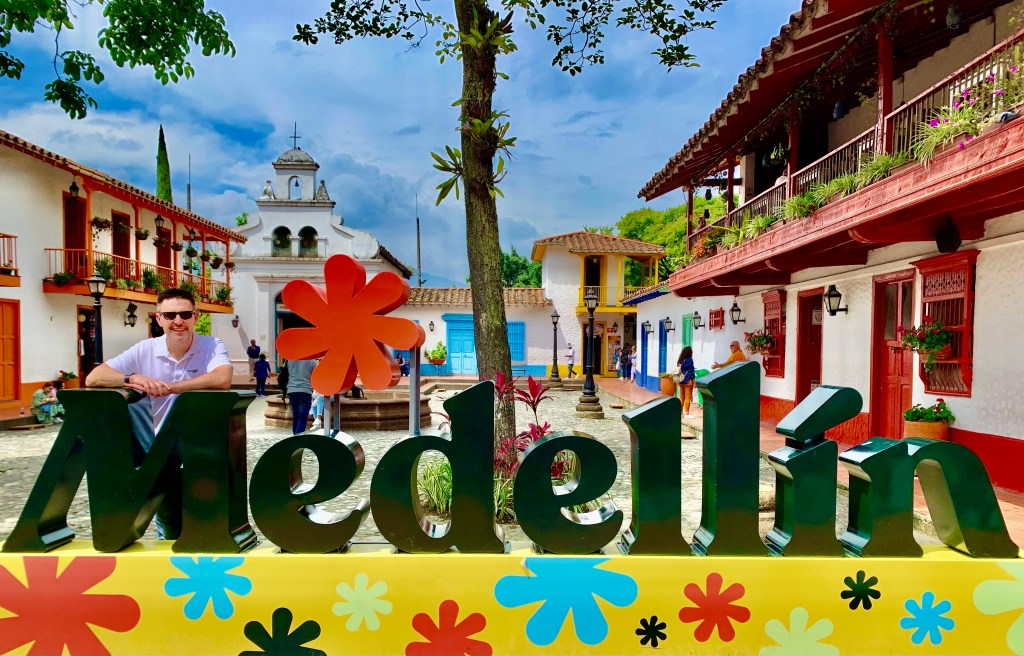
Medellin may well be Colombia’s capital of cool with its cultural experiences, vibrancy and nightlife. However it is also a great base to discover all this region has to offer. There are lots of beautiful locations within a short distance from Medellin showcasing Colombia’s one-of-a-kind culture and natural beauty.
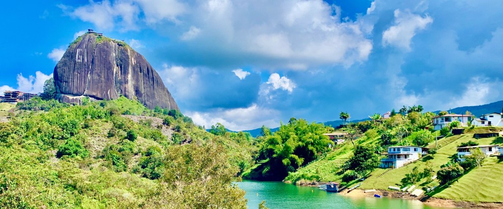
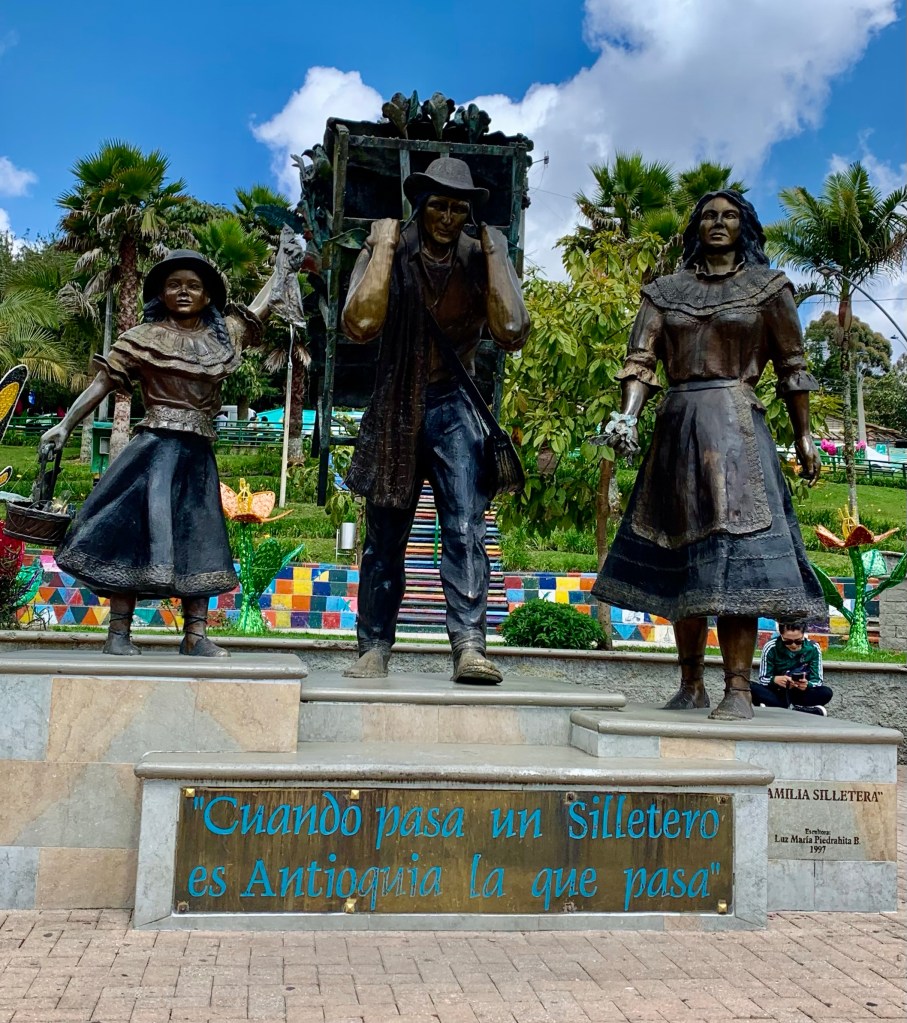
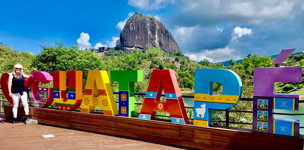
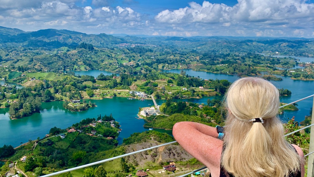
Our next adventure takes us to the area of Eastern Antioquia, situated to the southwest of Medellin. The picturesque Anitoquian countryside has no shortage of attractions in which to engross us. Starting with the colourful town of Guatape where I found many colourful houses and the nearby El Penon de Guatape a large rock which dominates the area.
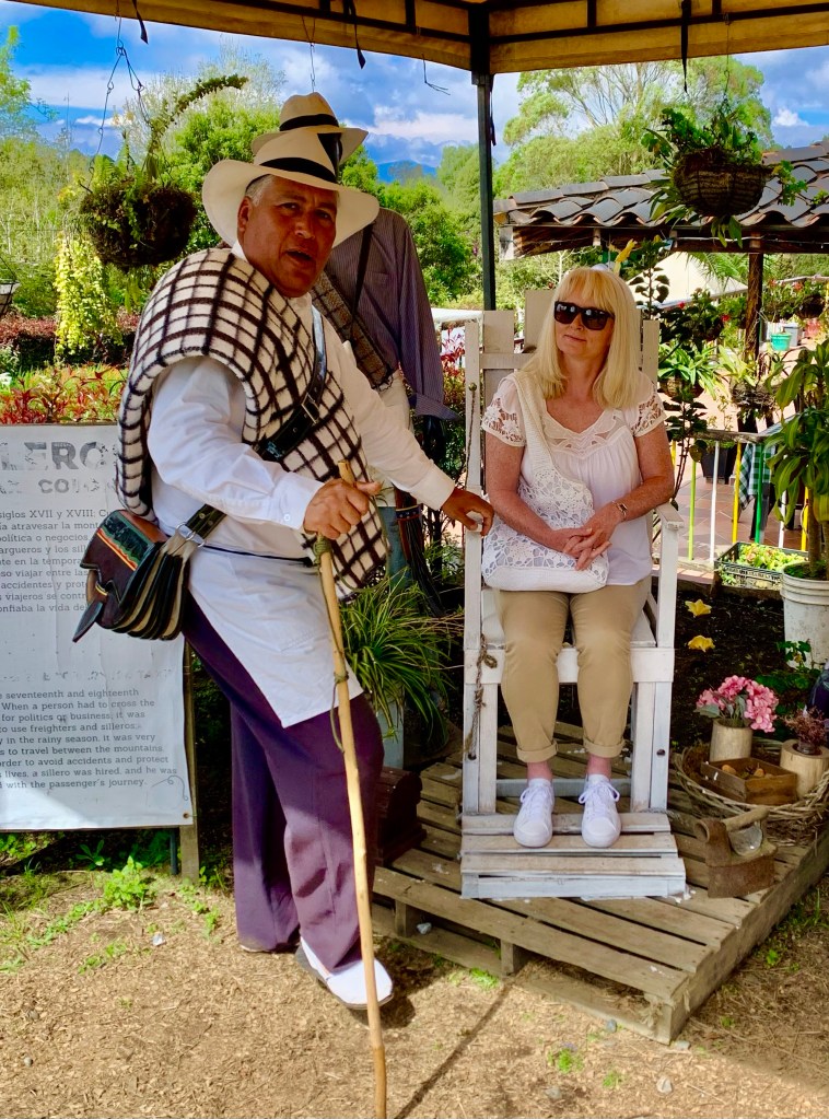
The region is also famous for its flower cultivation with many flower farms in the area. Colombia is the second biggest exporter of flowers, only the Netherlands exports more. We visited Saint Elena which is the birthplace of the Colombian flower industry and is just outside of Medellin.
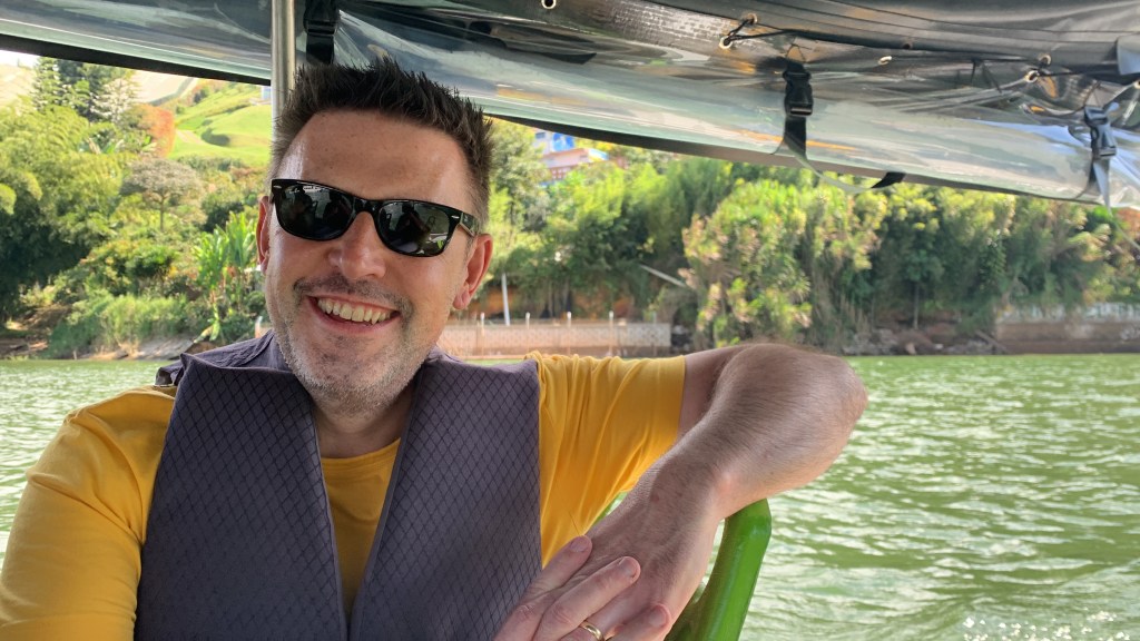
The area is naturally captivating being situated within the Andean Mountain range. We discovered lush national parks, natural wonders, colonial towns and beautiful lakes, where we enjoyed some time on the water.
A different landscape and pace of life await. There is so much to discover in so little time. Some locations were familiar to me, others were unbeknown to me. All great locations to visit and explore. Colombia was certainly a land of contrasting landscapes, peoples and cultures.
El Penol de Guatape
Not too far from Medellin (80 kilometres in fact) is the pretty town of Guatape and the famous granite rock which overlooks the town.
The rock itself is quite a contentious issue. Due to its cultural-historical significance and its value as an iconic tourist location in Colombia, there has been long-disputed ownership of the rock between the towns of Guatape and Penol. This can be seen in the name as it is known as The Rock of Gutatape and The Stone of En Penol.
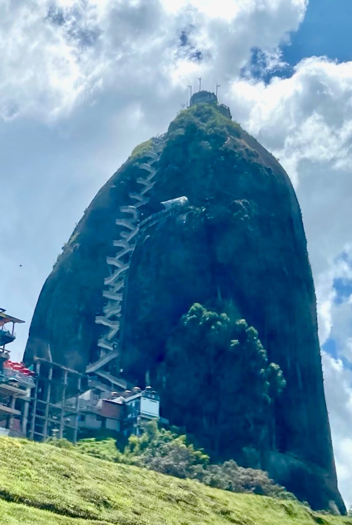
A few facts about the rock itself. It is known as an inselberg, which is a lone prominent rock in a mostly flat landscape. It is ten million tonnes in weight, is over 65 million years old, stands 200 meters in height and has great cultural significance to the local indigenous community.
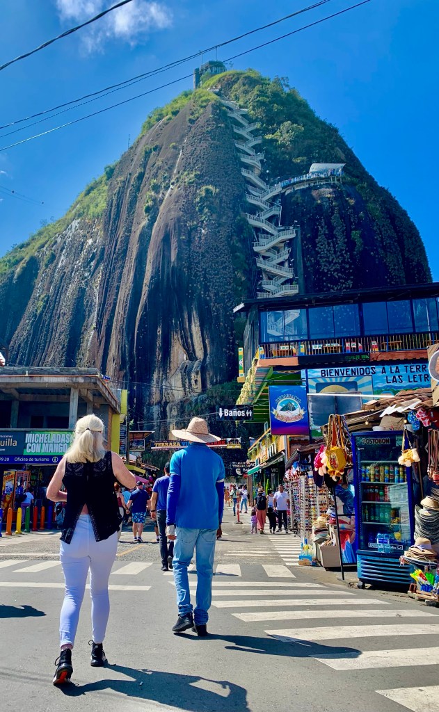
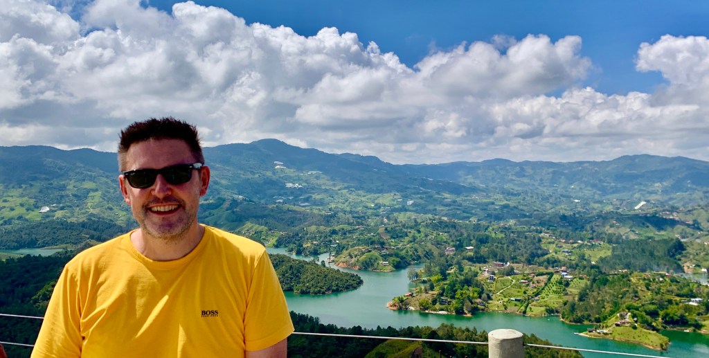
We arrived early as this is one of the most popular things to do in the area. At the bottom of the rock, we found lots of souvenir shops, cafes and food vendors. It was certainly a hive of activity. At the top of the rock, there will be fantastic vistas of the valley and Lake Guatape, as well as more souvenir shops, cafes and food vendors. To do this however we had to negotiate the 675 steps (740 steps if you include the tower) which gets you to the summit of the rock.
Climbing the rock is like scaling 45 flights of stairs so I am told. It took us about 15 minutes although others in our group of 8 took about 25 minutes. Regardless of the time it’s achievable for most people with some level of fitness. The stairs are one way up and another way down, so this helps with the flow of people and eases bottlenecks. The new stairs were constructed by the Colombian government in 2006, prior to this there was only one staircase up and down the rock.
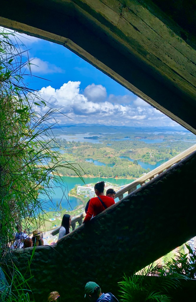
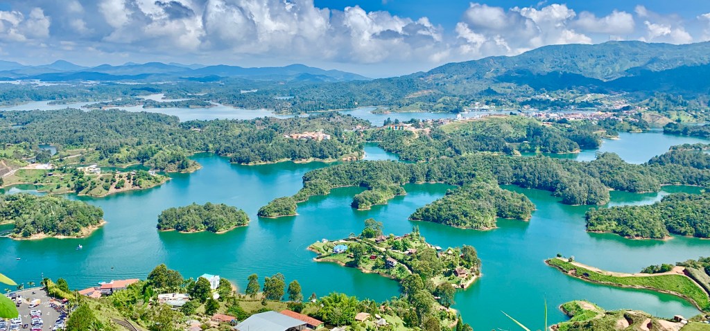
At the top of the rock, we were rewarded with stunning 360-degree panoramic views of the entire countryside. To get to this you will have to walk up a small spiral staircase which takes you to the tower which is on top of the rock. This is the only time when people had to walk up and down the stairs at the same time and was very congested.
Luckily for us, the day was clear and we were able to see for miles and miles in every direction. To the south we had a beautiful green landscape with rolling hills and picturesque villages dotting the landscape
To the north, the topography was different, we had views of Lake Guatape. Surprisingly to me this is an artificial lake which has been created to harness the natural environment to produce cleaner electricity.
It’s well worth spending some time at the top to enjoy the stunning views and location. We spent about 45 minutes there. Then we started our descent back down the other stairs to the bottom.
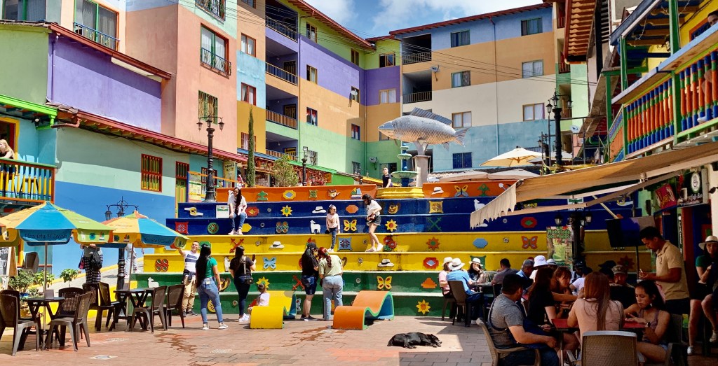
Guatape
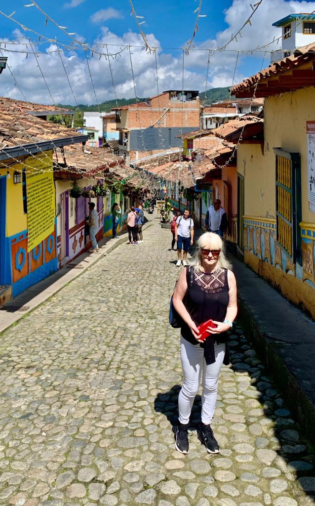
A typical street in Guatape.
Guatape is one of the most colourful towns in Colombia. It is 49 miles from Medellin and is a great combo with the nearby rock which dominates the surroundings.
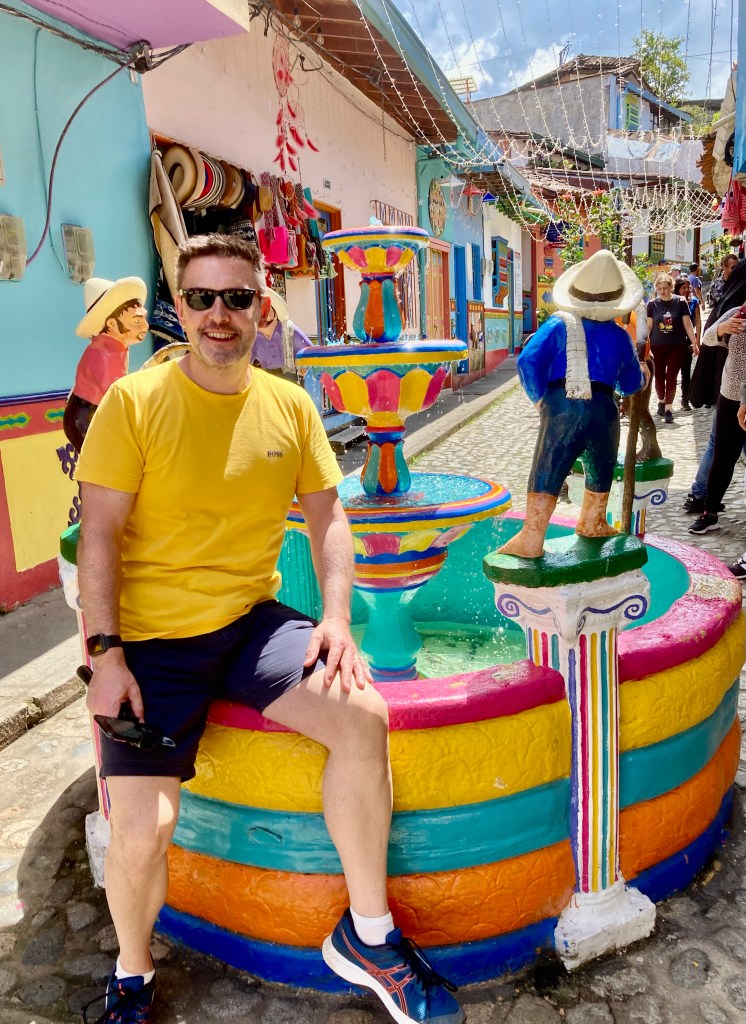
These colourful towns seem to be something of a phenomenon in Colombia. I visited a couple during my visit, and without a doubt my favourite one was Guatape. Although it is a very busy tourist attraction, it wasn’t too crowded to view the many vibrant street art, cobbled streets and interesting squares it had to offer.
The town is very compact and is easily accessible on foot. It was a fantastic place to wander around with my camera in hand looking at the brightly coloured buildings and trying to decipher the meanings of what has been drawn and displayed on the buildings.
One of the more unique creations which we viewedIt doesn’t stop with the buildings these steps were brightly coloured
Traditionally it told the story of the heritage of the family or the business which owns the building. Donkeys, sheep and chickens were quite common, although I did see a few dragons and coming from Wales 🏴, I thought there may have been a Welsh connection. 😆
Around every corner, we saw brightly coloured Zocaloas which is what the locals call them. Rumour has it families painted them on their houses for fun, and the trend caught on and the once quiet town has now become something of a tourist wonder.
One building that seemed to have not been painted in a myriad of colours is the town’s impressive Catholic Church. Although this is Guatape so it’s not totally painted white.
A kaleidoscope of colour awaits at the main square
In the centre of town, we found the Plaza de Zocolas a pretty little square surrounded by cafes and shops, the perfect place for a coffee or buy a souvenir, or if you like people-watching this is the place to be.
Guatape is a fantastic place to visit. It’s free and you don’t need a guide. An hour or two gave us ample time to discover what has been dubbed Colombia’s most colourful town.
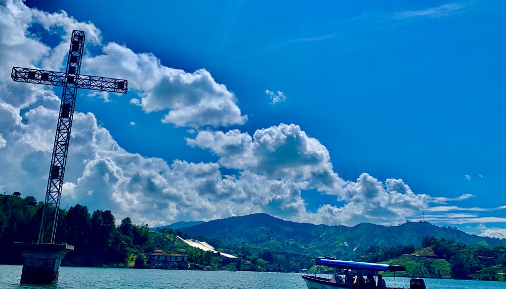
Penol Guatape Reservoir
A fetching waterside location is actually a man-made reservoir with a connection to one of Colombia’s most infamous countrymen Pablo Escobar.
The reservoir was formed when the Guatape River was dammed in 1972 to facilitate a hydroelectric power plant. Some houses had to be demolished as they would have been on the flooded Plains, and some were moved to Medellin as a cultural visitor attraction. Today the reservoir is lined with forested shores and spectacular villas. The area is a popular weekend retreat from Medellin.
Although by far the most famous or should I say infamous place on the lake is one of Pablo Escobar’s lavish holiday homes, La Manuela, which now stands derelict beside the waterside. The site covered over 20 acres, with every amenity imaginable including a helipad and seaplane dock which was kept secure by 120 “guards”
Its derelict appearance is no accident. It was bombed in 1993 by a vigilante group called People Persecuted by Pablo Escobar. Allegedly funded by the rival Cali cartel and other enemies of Escobar. Escobar himself was killed eight months after the bombing by the Colombian authorities.
The area has now been reclaimed by nature. You can visit although probably not recommended as there is widespread disapproval within Colombia. It is seen by many as glorifying the head of one of the world’s most violent drug cartels, fueling “narco tourism”. Best viewed from the water.
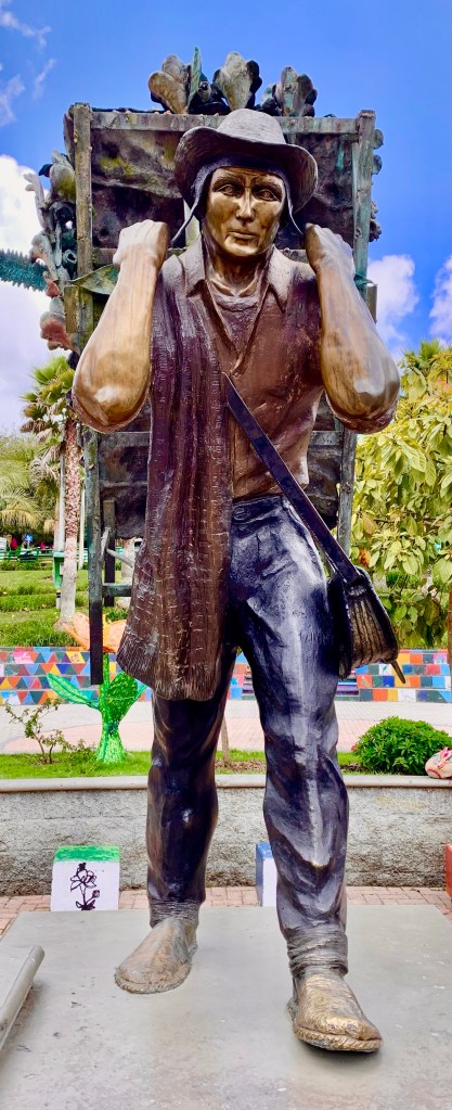
Santa Elena
The small town of Santa Elena is renowned in the area for it’s sprawling flower farms.
While in the area we were taken to one of the flower farms as part of our tour. If I am being completely honest I wasn’t particularly looking forward to the visit and just viewed it as a bit of a “time filler” while we were going to the airport in Medellin later that afternoon.
However, I couldn’t have been more wrong. We were given a very interesting tour of a flower farm by the owner, in complete traditional dress, whose enthusiasm for his flowers was very infectious
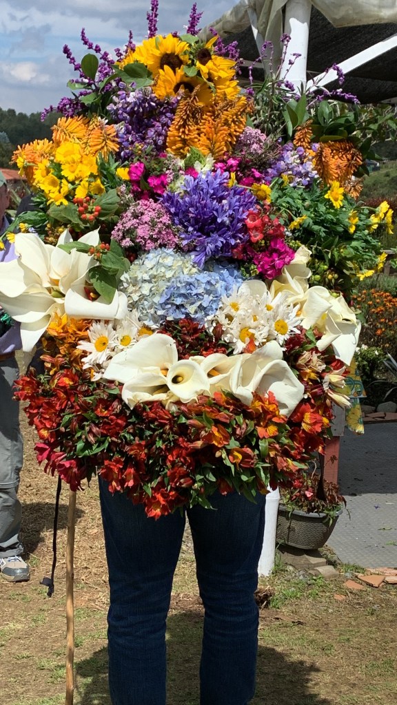
Somehow I don’t think Interflora will be delivering this impressive display.
He told us that the area was rich in horticultural history. Medellin is famous throughout Colombia for its flower festivals and farmers like himself would spend the whole year growing and maintaining flowers to be displayed at the annual festivals, winning brings prestige and a big cash prize. The farm we visited had won the top prize on more than one occasion
The Colombians certainly know how to say it with flowers
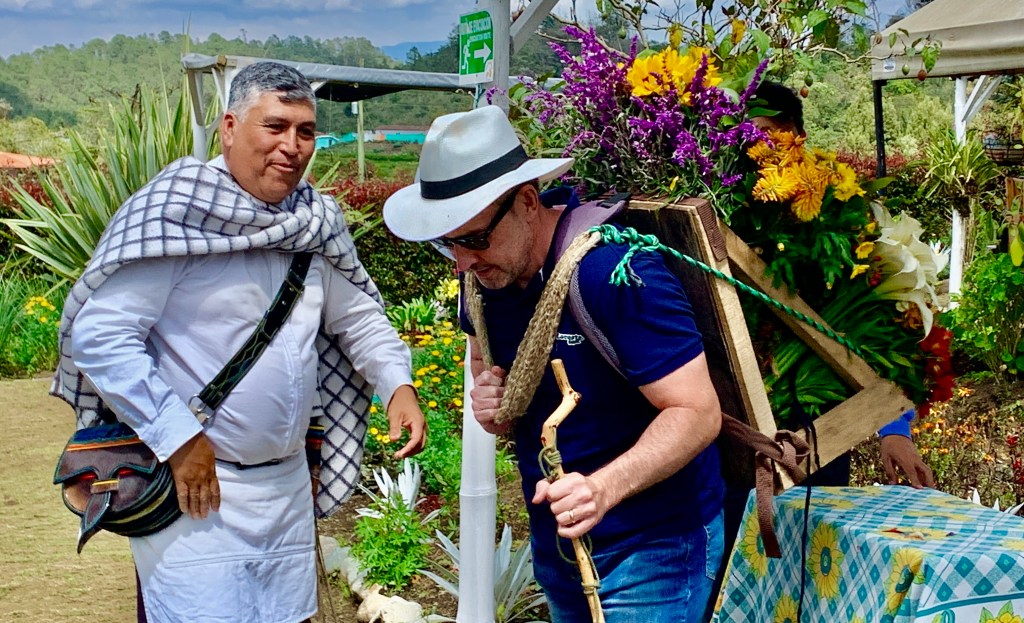
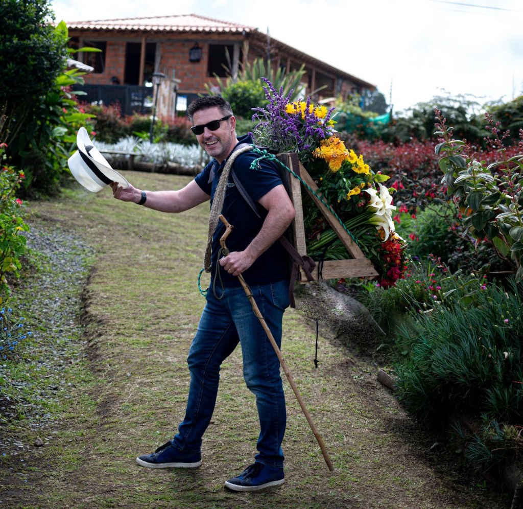
He explained the whole cultivation process from seed to the intricate arrangements that had brought him top prizes in competitions. After all his hard work arranging his flowers in perfect order, he wanted someone to carry his display. Who was I to let him down when he asked me to carry his flowers 😆
The flowers arranged into place probably weighed about 10 kilograms, which isn’t tremendously heavy. When carrying them throughout the day for displaying and judging purposes you soon start to realise you are carrying a weight on your back.
After lunch at the flower farm, it was off to the town itself for a quick visit. Santa Elena was noticeably cooler than Medellin due to its mountain location combined with rainfall, sunshine and nutrient-rich soil, this area has perfect growing conditions for flowers.
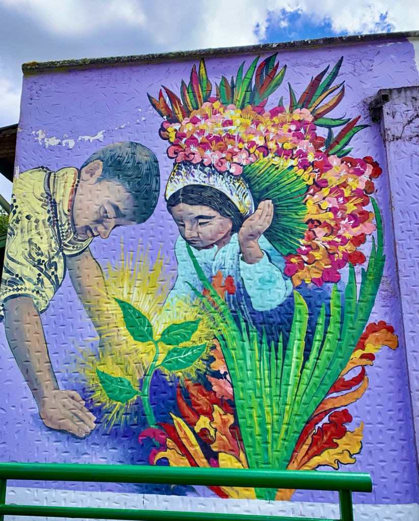
A mural in the town dedicated to it’s floral heritage.
The town truly comes to life in the summer with the annual flower festivals. Starting in the town over 500 farmers participate in parades, they will walk down the mountainside to Medellin which is 10 kilometres away. Entrants come far and wide and the festival is world-renowned within the horticultural community. Medellin and the surrounding area were certainly very intriguing places to explore.
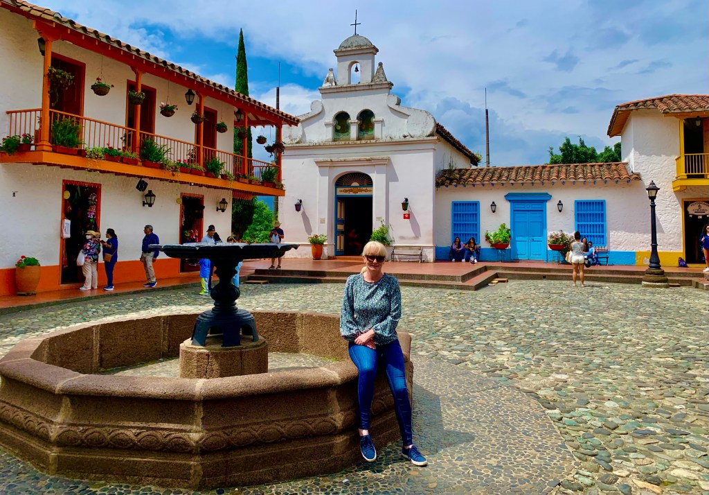
The next part of my Colombian adventure takes me to the city of Medellin, the second biggest city in Colombia.
Medellin
The city was much maligned in the 1980s and 1990s. It was closely associated with the Medellin Cartel and Pablo Escobar. It was infamously dangerous, it was even known as the most dangerous city in the world. However Medellin today is a totally different city and is one of the safest cities in South America.
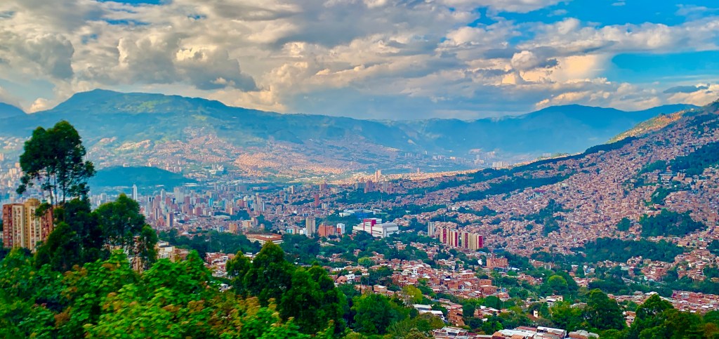
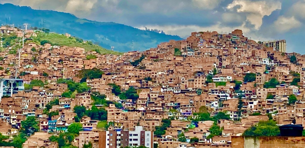
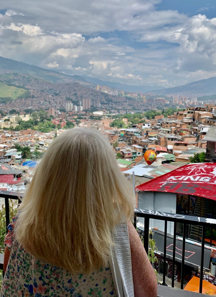
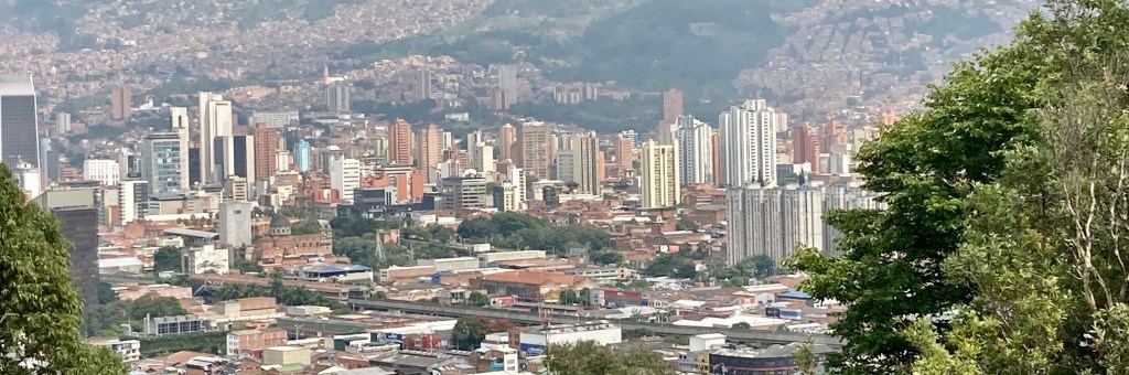
Medellin for me was a fantastic city to visit. My first glimpse driving from the airport had me in awe. Its skyline seems to stretch to the heavens above, with imposing high-rise apartments and office buildings set against the natural backdrop. The city lies within the Aburra Valley at an elevation of 4900 feet (1500 meters) above sea level. The city is built within the valley and surrounded on either side by majestic mountains.
The city is relatively new, the architecture has a decidedly modern feel, this appears to go hand in hand with the open mindset of residents and the progressiveness of local government. Being known as the world’s murder capital in the 1990s, Medellin has pioneered innovative forms of city planning and management. Medellin has been acclaimed as one of the world’s most innovative cities.
One of Medellin’s key elements was to link poorer outlining districts to the city centre by creating an innovative transport infrastructure. This was done with strong support from local communities, businesses and local councils. Doing this has enabled communities to a culture-led rejuvenation providing employment opportunities for local people.
That is not to say that Medellin is not a city without its problems. The pandemic greatly affected the region. Colombia has one of the highest poverty rates in Latin America, and the Venezuelan refugee crisis has introduced 1.75 million Venezuelans to Colombia many of who cannot work legally and live in extreme poverty. These factors have seen crime rates increase albeit nowhere near the level of the 1990s.
Is Medellin still a dangerous place? Take a cue from the locals who have a saying “Na dar papaya” roughly translated this means don’t put yourself in a position to be taken advantage of and you should be fine. I exercised caution in certain areas and I never felt unsafe in any locations I visited.
It is generally a very safe city to visit. Its beautiful weather, modern architecture, cultural attractions and efficient infrastructure will certainly reward you. Medellin packs a punch of a city twice its size and it certainly gave me an incredible experience.
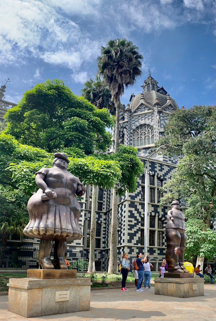
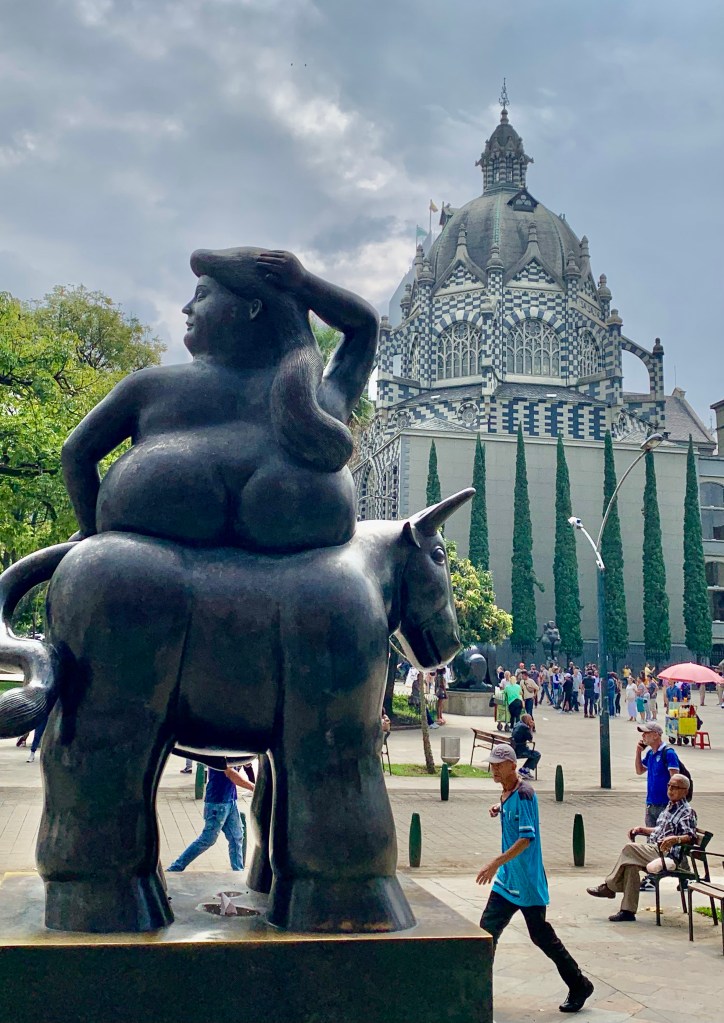
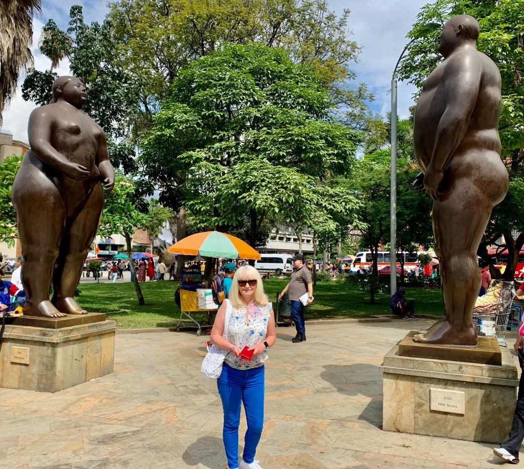
Botero Plaza
One of Medellin’s most traditional and iconic locations.
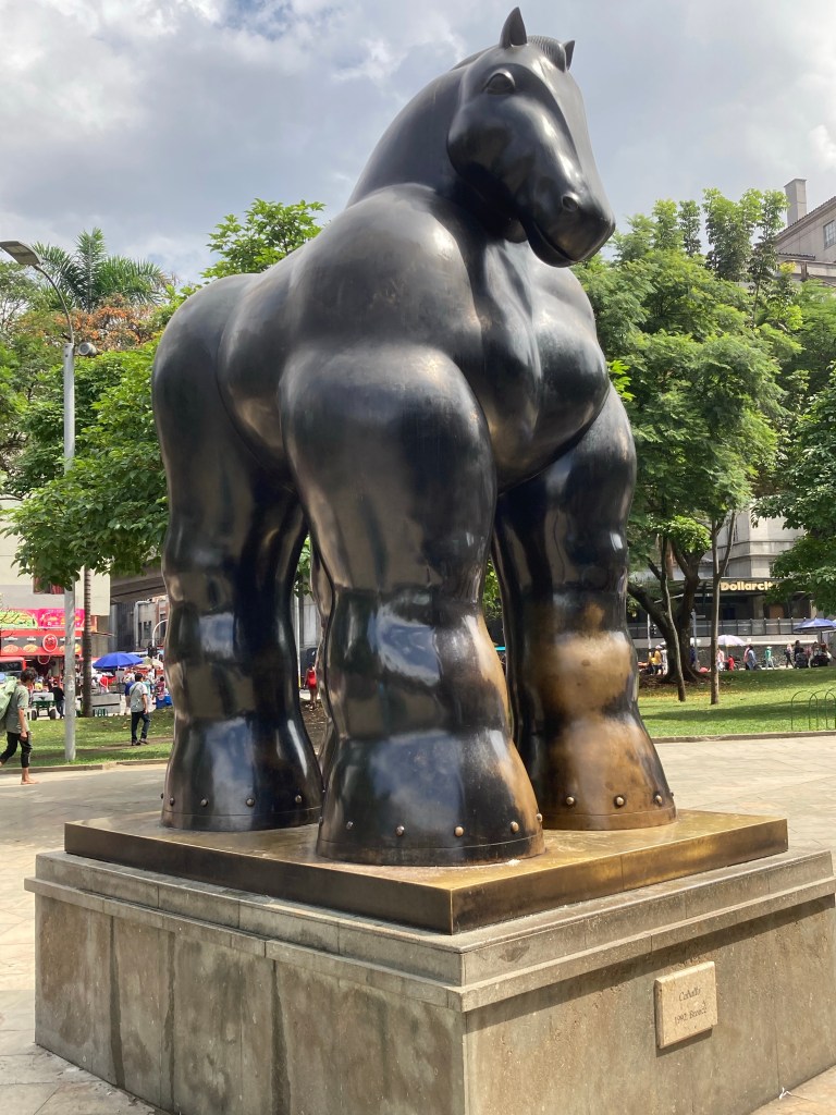
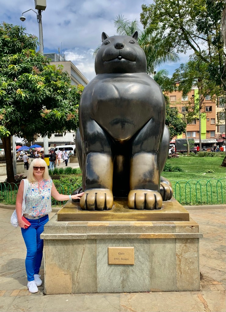
The busy square is situated in the centre of the old town and it is one of Medellin’s most popular and visited locations. In fact, it doubles up as a park which is also an open-air museum with its 23 bronze sculptures.
It is a hive of activity where you will find many vendors selling everything imaginable. They are all very persistent, even somewhat annoying, something you don’t really experience too much of in Colombia. This is one location I would be vigilant with your belongings as it’s an area which is popular for pickpockets and petty theft.
Botero Plaza is located in what is an otherwise rundown area of the city. The sculptures are another example of Medellin’s ability to transform locations that would once be perceived as economically unviable into places of learning, culture and entertainment.
Botero Plaza is home to 23 large bronze sculptures. They have all been sculpted by Fernando Botero one of South America’s most famous artists and a Medellin native. He has an instantly recognisable style that is popular across the globe, his work can be found on the Champs-Elysees Paris, Park Avenue New York and numerous locations within Colombia.
How do you describe Botero’s sculptures? Full figured, big boned, voluptuous, chubby and dare I say the F word fat. Whatever your opinion there is no doubting they are certainly larger than life and that Botero certainly had a unique prospective of his subject matter.
The world-renowned Colombian artist kindly gifted these bronze sculptures to his home city of Medellin so they can be admired in their full big brazen beauty. From the sensual to just outrageously unusual.
The sculptures come in many different forms buxom ladies, smartly dressed men in suits, Adam and Eve, Horses, and dogs. There is an abundance of unique sculptures to be photographed alongside.
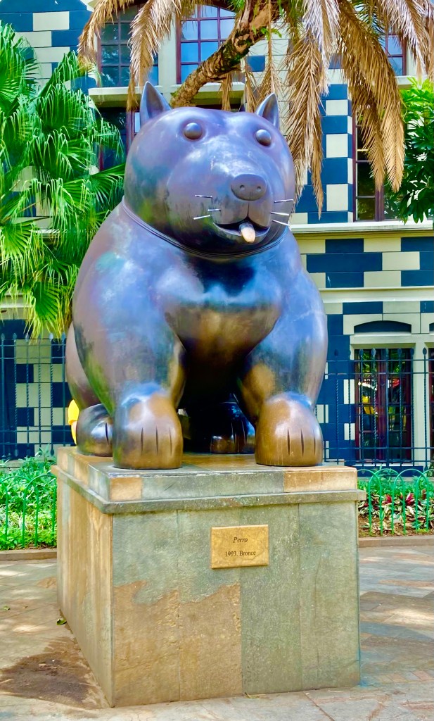
Although my personal favourite was the rather large cat which seemed very cartoonish in appearance, it reminded me very much of my tomcat who himself is somewhat large and larger than life in personality.
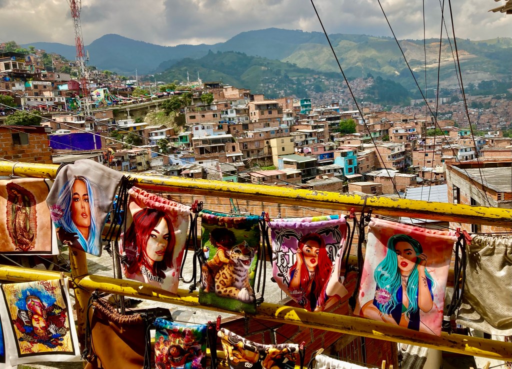
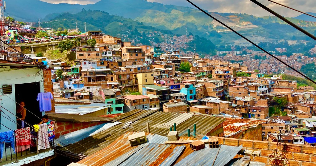
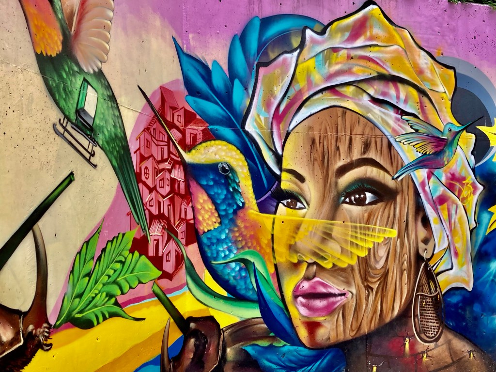
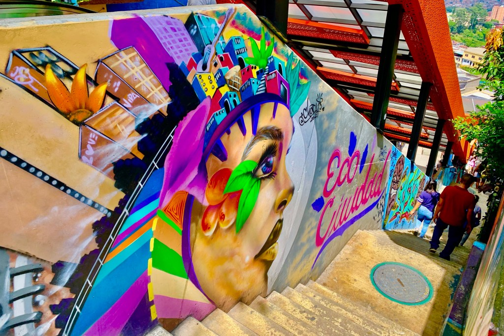
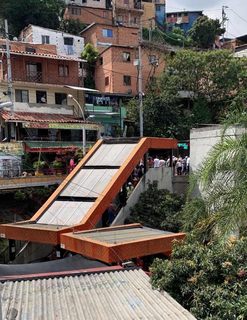
Commune 13
At one time it was Medellin’s most notorious area controlled by drug cartels, now one of the city’s most colourful neighbourhoods and cultural hubs.
In the not-so-distant past, Commune 13 was the most dangerous area in what was the world’s most dangerous city. Tourists wouldn’t dare set foot in there, they had no reason to.
It is a very different story now. Over the last decade, Commune 13 has undergone a complete transformation. The area is no longer known for gang violence, police raids, drug trafficking and cartels.
These days Commune 13 is more readily associated with street art, street performances and walking tours. Numerous people, myself included visited to experience first-hand the transformation and how Commune 13 has become a symbol of Medellin and Colombia’s social transformation.
It was one of the most vibrant and interesting places I visited while in Medellin. It is a celebration of a community turning itself around. Not to be associated with “Narco tourism” which although popular is deeply offensive to locals many of who lived through the horrors of the 1980s and 1990s.
Most people in Commune 13 and Medellin as a whole are choosing to look forward and not back to the dark days of the past. Be sensitive and respectful, best to leave that Pablo Escobar t-shirt back at home.
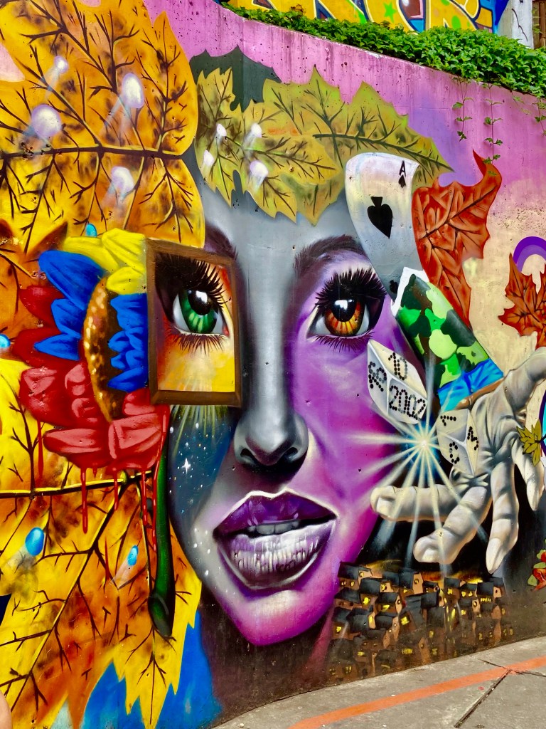
The one thing that there is no denying is the quality of the street art which the area is renowned for. Not only does it look fantastic and gives a perfect background for selfies and Instagram posts, but there is also a political and social resonance to them.
There are numerous large-scale murals throughout the area, many of which can be found near stairs or escalators. Any and every area can be used as a canvas. Much like murals in Belfast, these murals memorialise the past and express hope for the future. Unlike Belfast, the murals are not divisive to different sections of the community.
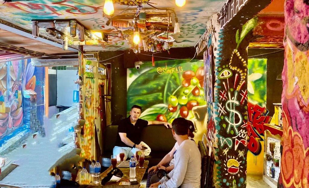
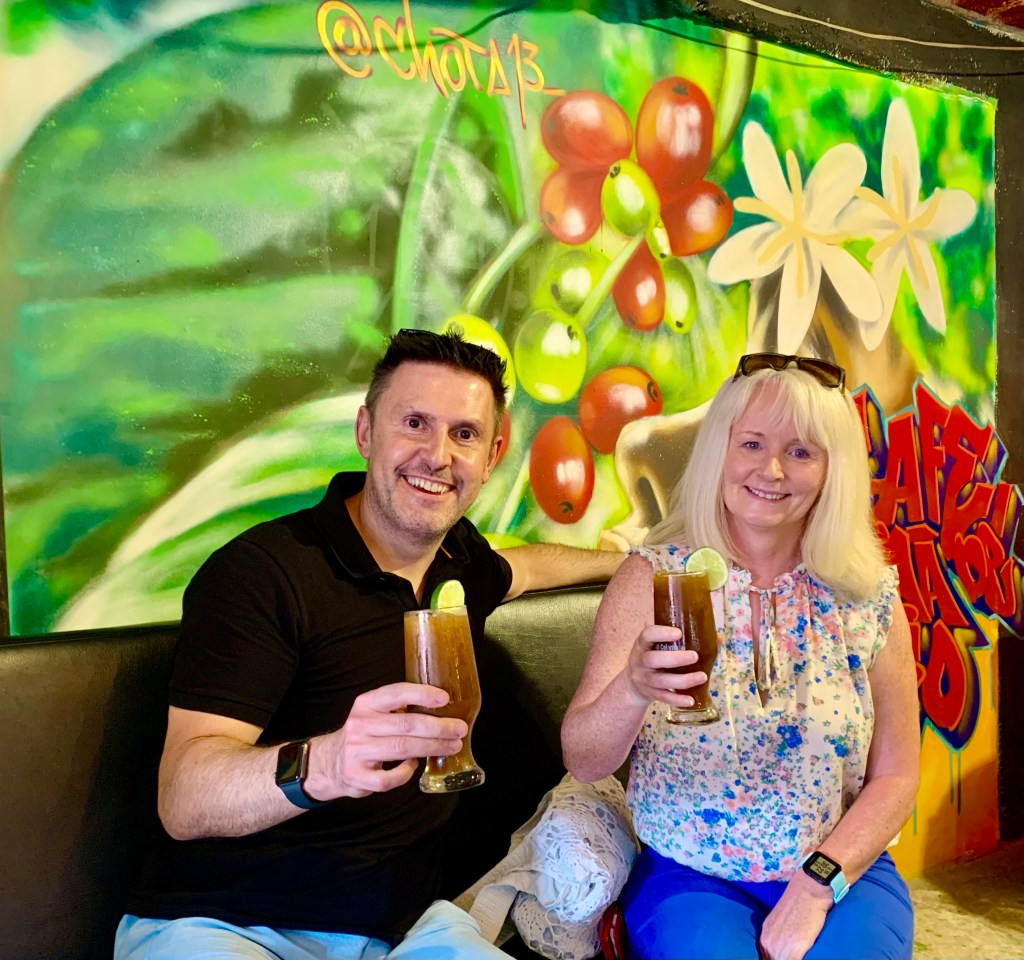
Artwork doesn’t stop in public places. This bar was full of artwork from a well-renowned graffiti artist who now owns this bar. You will find plenty of cafes and restaurants to stop at. There are several small galleries and market stalls in the area
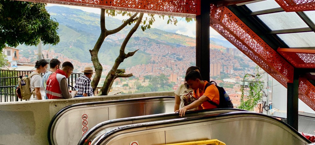
This transformation would have not been possible without the new transport infrastructure. Including a cable car system and six outdoor escalators. This has made life a lot easier for local residents and opened the area for tourists like never before
The outdoor escalators were first introduced in 2011 to regenerate the area with the rest of the city. It had a monumental effect and greatly enhanced the lives of residents with better accessibility. Riding an escalator was a surprising must-do at Commune 13 for me.
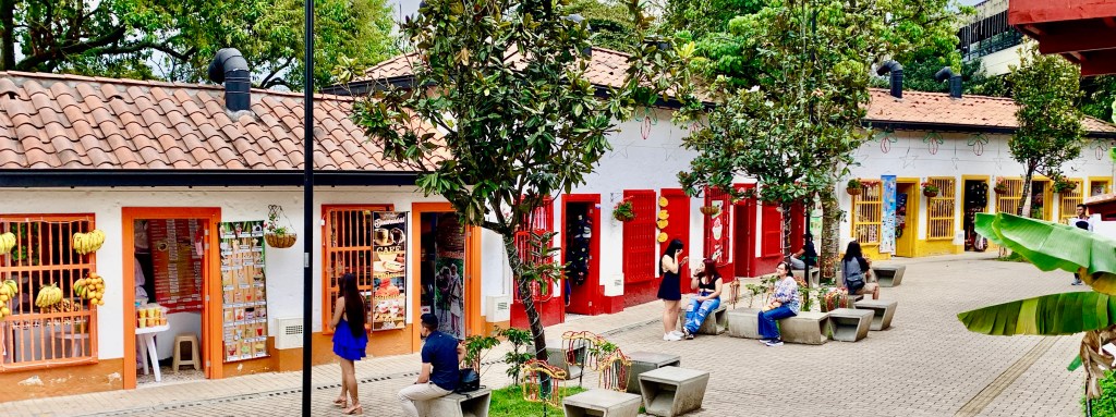
Nutibara Hill (Pueblito Paisa)
A replica turn-of-the-century Antioquian town situated on a high hill in the centre of Medellin. Where you can experience some Antioquian culture and architecture.
If I am being honest these places are not usually my thing, but we arrived early in the morning and our hotel was not ready. Being very tired and this being closely situated we decided this was a nice place for a leisurely lunch while waiting to check into our hotel.
Something that I thought was going to be a bit of a tourist trap turned into an engaging few hours. The history was very interesting. Most of the materials for the village were reclaimed from a real village that was demolished to make way for a hydroelectric plant in the 1970s.
Architect Julian Sierra Mejia built the village using these materials including much of the impressive church rebuilt there. Puebilito Paisa officially opened in 1978 and was renovated in 2021. As well as the church there is a large courtyard with a fountain overlooked by two rows of coloured houses with balconies.
There are numerous restaurants to be found at the location. There are food carts, a small food court and traditional restaurants to choose from. We choose a traditional restaurant with seating on a veranda overlooking Medellin. Fantastic views and a relaxing atmosphere to enjoy our lunch.
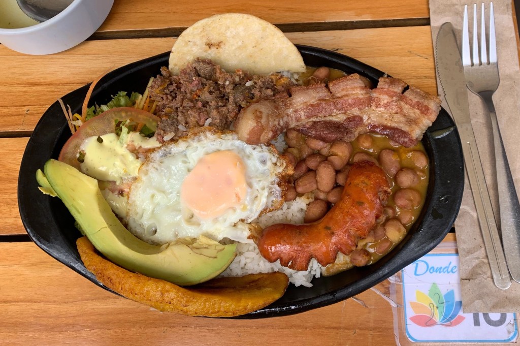
It was a good opportunity to sample some of the region’s traditional specialities. My personal favourite which I ate on a few occasions was the Antiquian heart attack on a plate, babdeja paisa, a dish which is like a fully cooked breakfast on steroids.
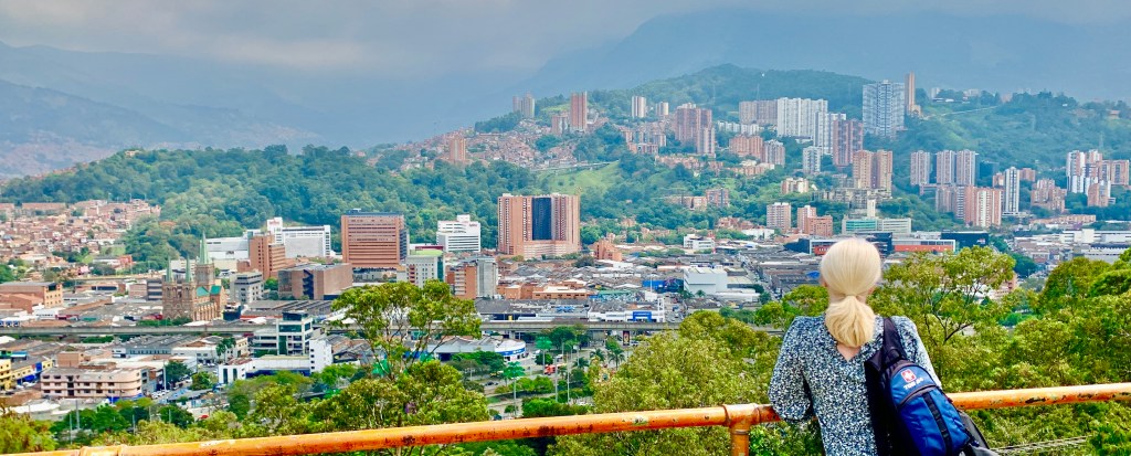
Yet, perhaps the best reason to make the trip up the hill is to see the magnificent views on offer, due to its elevated vantage point in the middle of the Aburra Valley, Nutibara Hill is one of the highest points within the city limits.
We got amazing views of Medellin’s sprawling barrios and high-rise buildings the city encased within the valley. The hill is part of a conservation zone and covers an area of over 80 acres in the middle of an urban setting. It is popular with walkers and nature lovers due to its naturalistic setting. It is home to a sculpture park.
You really feel as if you have escaped the city but are actually still in the heart of the metropolis giving 360-degree views of Medellin. For me, this was the best aspect of the place as the vistas here were spectacular.
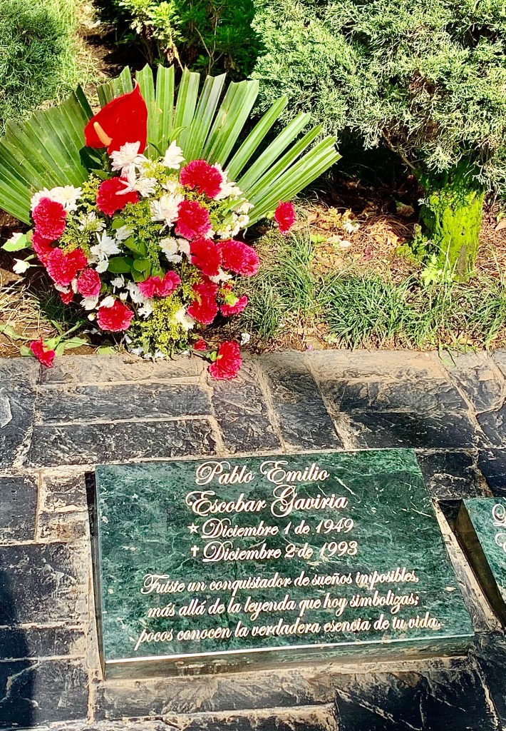
Pablo Escobar’s grave
I don’t have to go into much detail about Pablo Escobar. Medellin’s most infamous son and leader of the Medellin Cartel.
I am not glorifying Escobar in any way, however, he is part of Medellin’s history. However, Medellin is much more than a “narco” tourist destination. To this day Pablo Escobar is a deeply controversial figure that can divide opinions, although he did some good in poor communities, his legacy of murder, bribery, kidnapping, racketeering and drug trafficking can never be justified for his good deeds, although a robin Hood image that he cultivated still holds resonance to this day for some.
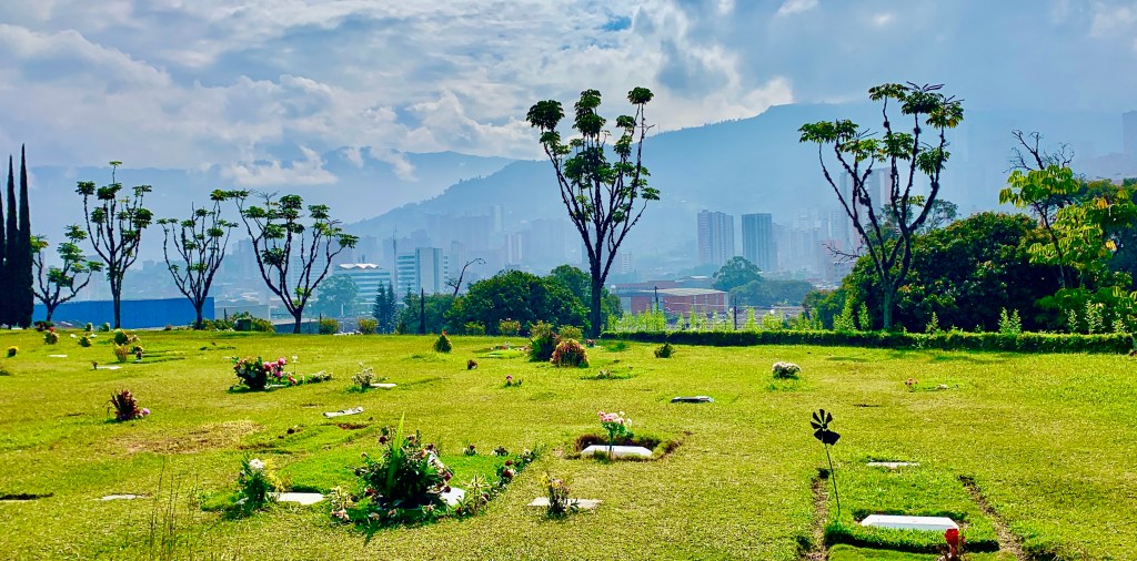
We visited Pablo Escobar’s grave which is situated in Itagui where Escobar grew up. The Jardines Montesacro cemetery is a picturesque location and Escobar is buried in a family gravesite. The grave is the strangely serene resting place for a man whose actions caused so much terror and death and who once supplied 70% of the world’s cocaine.
El Poblado
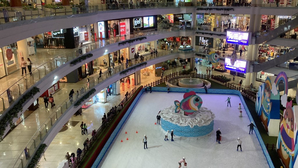
One of Medellin’s most exclusive suburbs. It is nicknamed the big barrio as it is Medellin’s biggest commune in area ( 9 sq miles to be precise).
Not only is it the biggest commune it is also an important tourist area where many boutique and luxury hotels are located as well as bars, restaurants shopping malls and parks. Staying in this area in a high-rise hotel gave excellent views of the area which is full of modern buildings. It was a very central location for all our evening activities.
This upmarket area could feel like California or Florida with its plethora of shopping malls which were absolutely gigantic. The Sant Fe Mall situated next to our hotel had five levels and a skating rink, which was a bit surreal in 25-degree temperatures.
Transportation in Medellin
Travelling around on Medellin’s acclaimed public transport system.
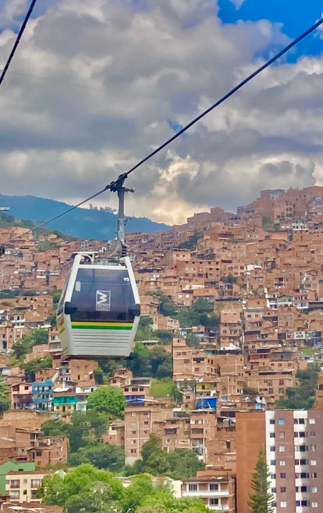
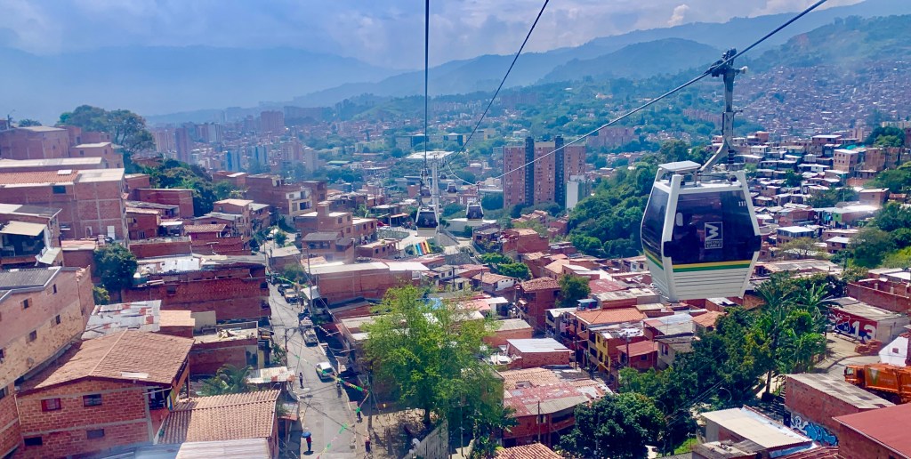
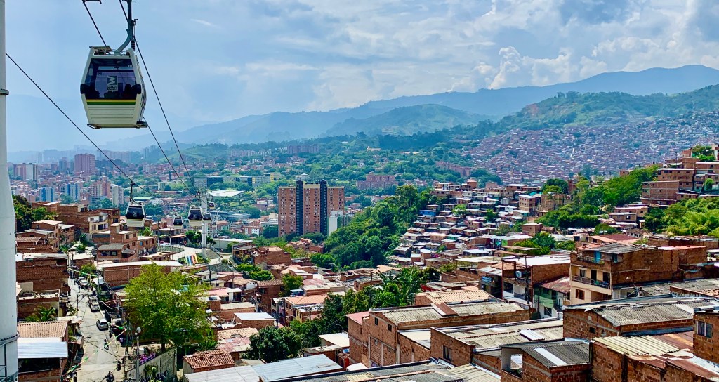
Medellin had spent years developing an integrated transport system, whose many components have garnered worldwide acclaim. With modern trams, a new metro system, a gondola system and good old-fashioned buses.
Conventional transport like buses aren’t well matched to densely populated areas in mountainous terrain. The metro cable system has transformed daily life for the residents of Medellin, especially for those living in Medellin’s historically poor hillside communities
There are now six lines in operation and twenty stations providing residents with easy access to the city centre. The most popular cable car routes can be accessed via the railway station providing an integrated transport system. Cutting travel time from over 2 hours to less than 30 minutes to the city centre.
In fact, cable cars have become attractions in themselves. They have transformed many neighbourhoods into tourist destinations. The sweeping views that come with any cable car ride made them a must-do for us.
Medellin has become a leader in sustainable transport. The city has demonstrated the ability to reinvent itself from the past and become an innovative sustainable city of the future.
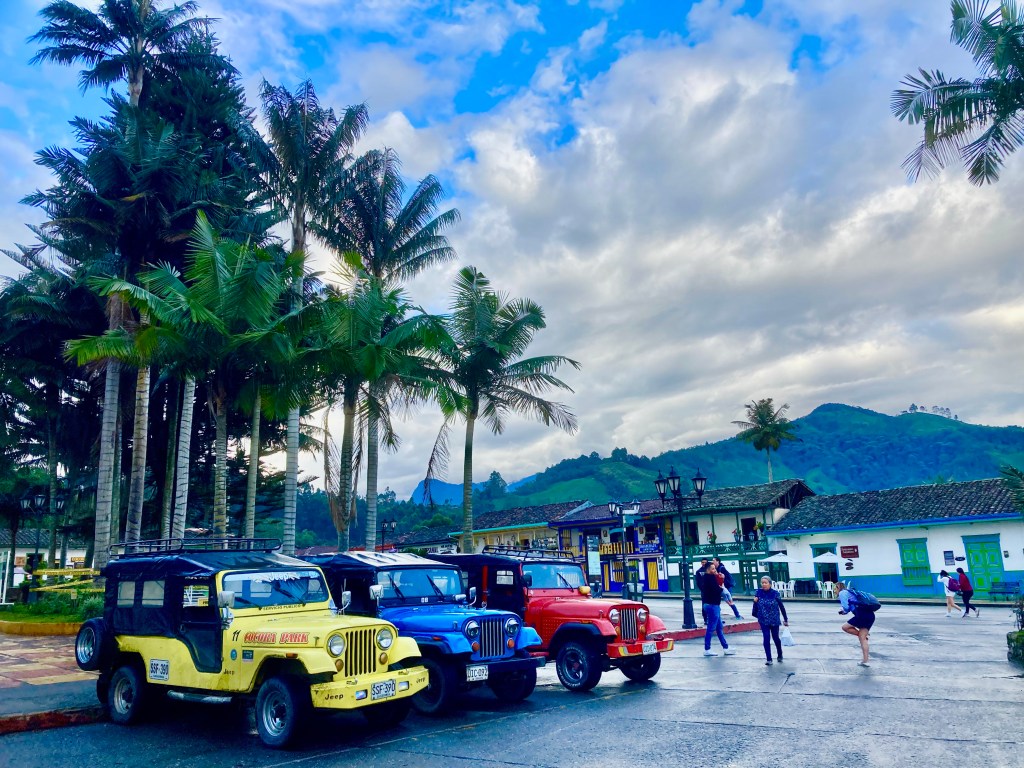
My next adventure in Colombia took me to the city of Pereira. This is officially known as the Coffee Axis. Pereira along with the rest of the area forms part of the UNESCO World Heritage Site which is known as the “Coffee Cultural Landscape of Colombia”
The area is so much more than being the centre of the Colombian coffee industry. Pereira is an influential tourist centre with many attractions within the coffee region. The most well-known of these is unquestionably Cocora Valley and the nearby town of Salento.
The Cocora Valley is famed for its giant wax palm trees 🌴 which are scattered over its captivating lush green hillsides. I discovered stunning landscapes quite unlike any other. It is truly a nature lovers’ paradise.
The nearby town of Salento is another popular location in the area with its quaint coloured houses and is one of the oldest towns in the area.
It hasn’t always been this way. The area used to be a stronghold for guerrilla fighters who had full control of the area. Salento was a place even Colombians wouldn’t visit, which obviously stopped any tourism activity.
Fortunately, as with much of Colombia, this has now changed. Any preconceptions of Coloumbia as an unsafe destination with a reputation for being a “narco-state” where violence and bloodshed are the norms is a very outdated opinion.
What you will find is an interesting vibrant country where people will warmly welcome you. Colombia is no more dangerous than any other location as long as you act sensibly.
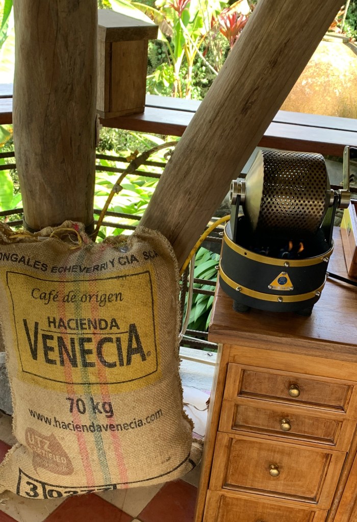
The Coffee Region
Colombia is one of the largest coffee-producing countries in the world. Pereria is the central hub of coffee production in Colombia. It is a UNESCO World Heritage Site due to its unique landscape.
The choice of coffee plantation tours can be bewildering to say the least. You can book tours to large producers, family-run farms, tours on horseback, hiking tours, birdwatching tours and in conjunction with a trip to the Cocora Valley, so a bit of pre-planning is necessary to get the best out of your visit.
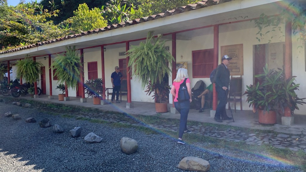
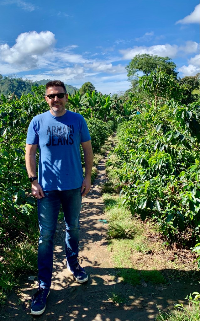
I had never visited a coffee plantation before so a full tour was the best option for me. The plantation we visited offers daily regularly scheduled tours with a guide. This can be done within a group or private tours. We had a private tour as it was included in our tour itinerary.
We had the full tour experience with our guide and lunch at the property. This needs to be booked in advance as it is a more in-depth experience and may include transport to the property. This option is more expensive than doing it independently, but it is a lot more convenient, especially if you are only staying in the area for a short time.
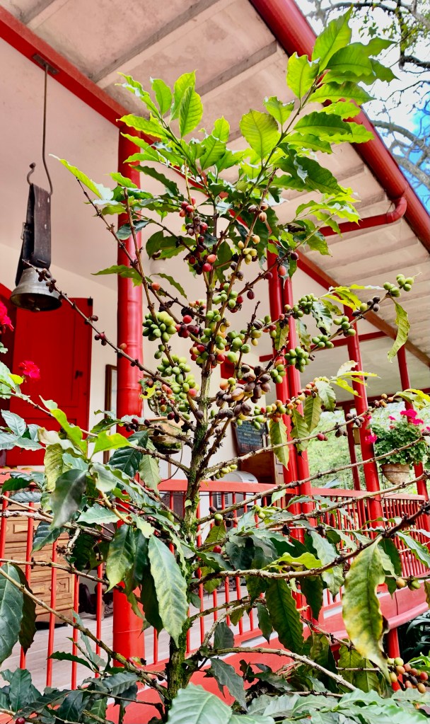
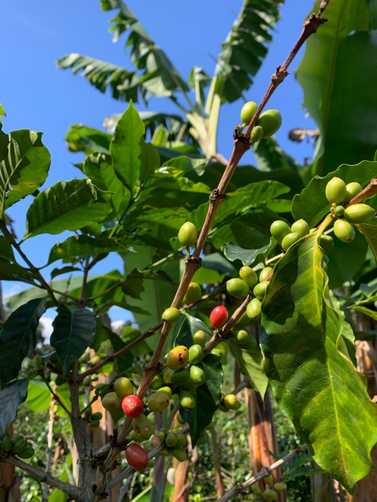
Our tour started with us wandering around the grounds. Our knowledgeable guide explained to us the ideal growing conditions that make this area so productive for growing coffee beans.
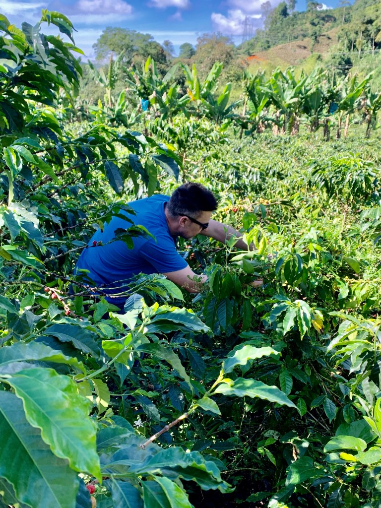
Coffee seedlings 🌱 in the nursery We were able to pick some coffee beans for ourselves
He showed us all the different stages of growing coffee plants and the right time to pick the beans and explained how experienced coffee pickers are much sought after as there is a big shortage of skilled labour in the area.
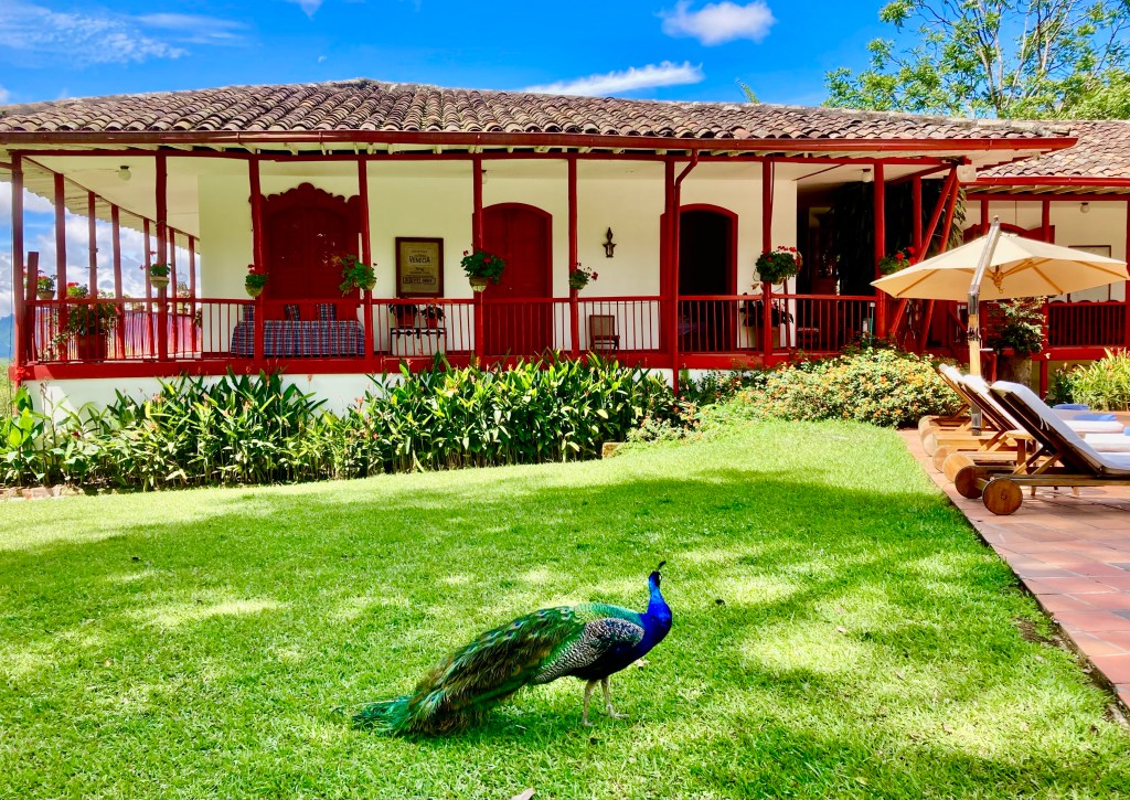
We were given a tour of the grounds and the plantation house, which is now a hotel and restaurant as the coffee farm is diversifying its income. Various birds and animals wander around the property.
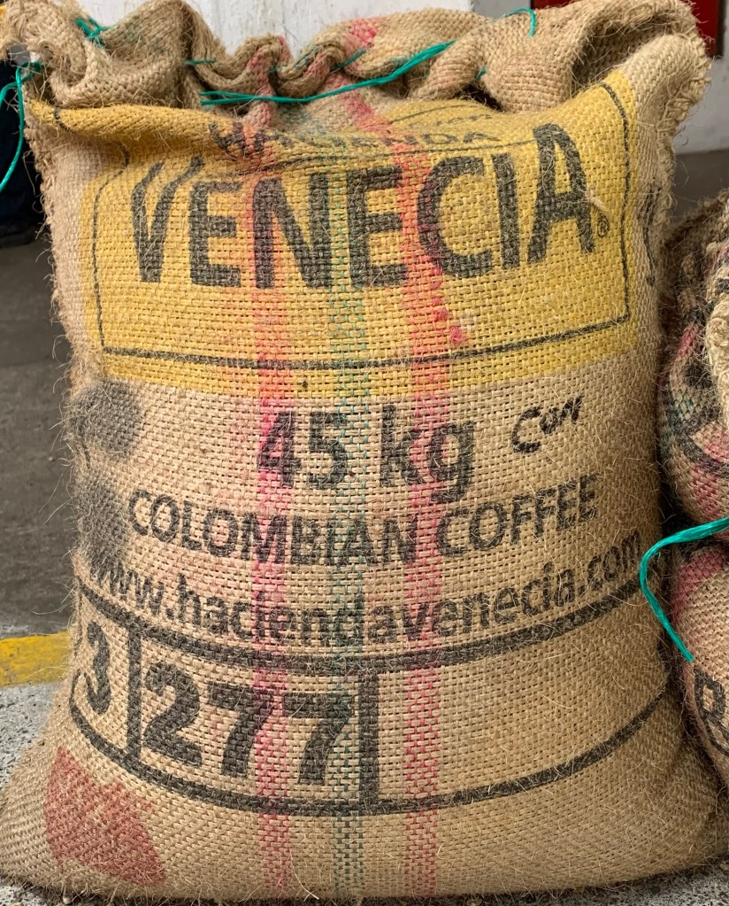
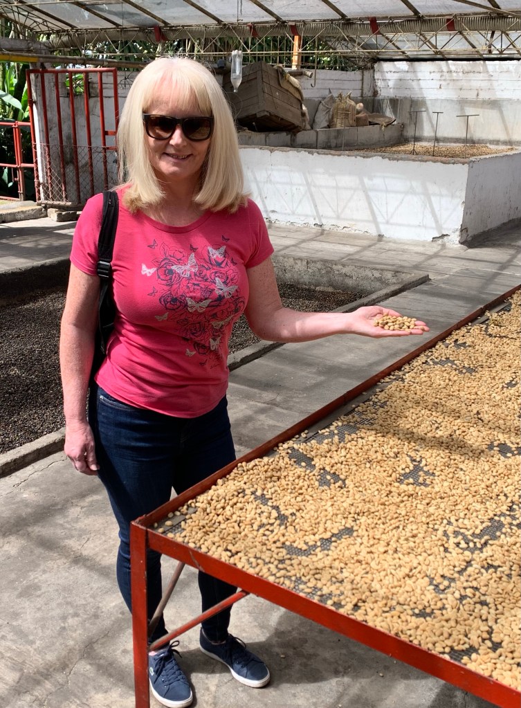
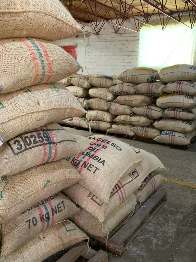
Coffee beans being sorted for quality
We were taken to where the coffee beans are dried out and how they divide the beans for quality. Certain coloured beans are more high quality than others.
Coffee beans being roasted using tradition methods
What really surprised me was the beans of a lower quality are kept in Colombia where they are roasted and sold. It now made sense to me as the coffee I had tasted in Colombia was ok, nothing exceptional. Now I understand the reason why the best coffee beans are exported.
The cat may be out of the bag, but the coffee is ready to goTop quality coffee beans ready for export
At the mill, there was evidence of this. The higher-quality beans are bagged and are ready for export to foreign markets such as North America, Europe and Japan, where they will command a much higher price as these markets are prepared to pay more for higher-quality coffee.
As our coffee plantation tour concluded, it was time to sample the end product. I don’t think asking for cream and sugar will go down that well after learning how much time and effort goes into producing the coffee that we take for granted.
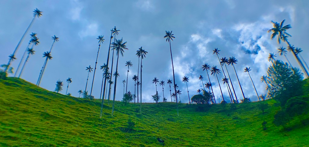
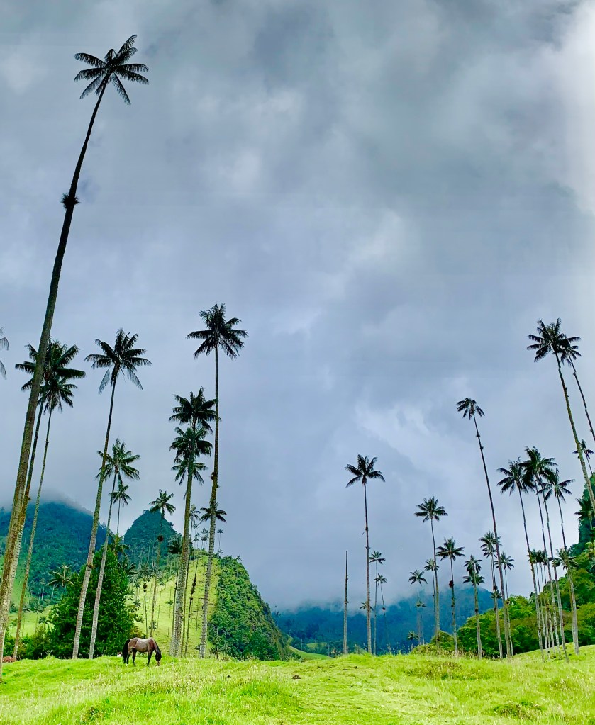
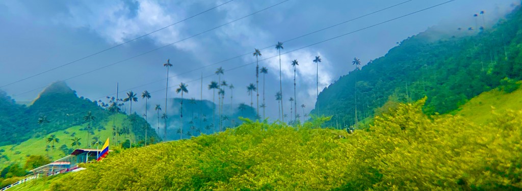
Cocora Valley 🌴🌴🌴🌴
The Cocora Valley is part of the Los Nevados National Park. Incorporated into an existing National Park in 1985 by the Colombian Government. It is one of Colombia’s most visited natural attractions.
Nestled within the coffee triangle. This valley is filled with wax palms that rise over 70 meters (200 ft) in height. This is the main location of wax palms in Columbia. The wax palm tree is the national tree of Colombia
I couldn’t come to Colombia and not visit the Cocora Valley. Images of the valley are plastered everywhere on social media when searching online for Colombia. The peculiar skinny incredibly tall palm trees can be seen set against a backdrop of the glaring sun, enigmatic mist or the broad Andean mountains were instantly recognizable.
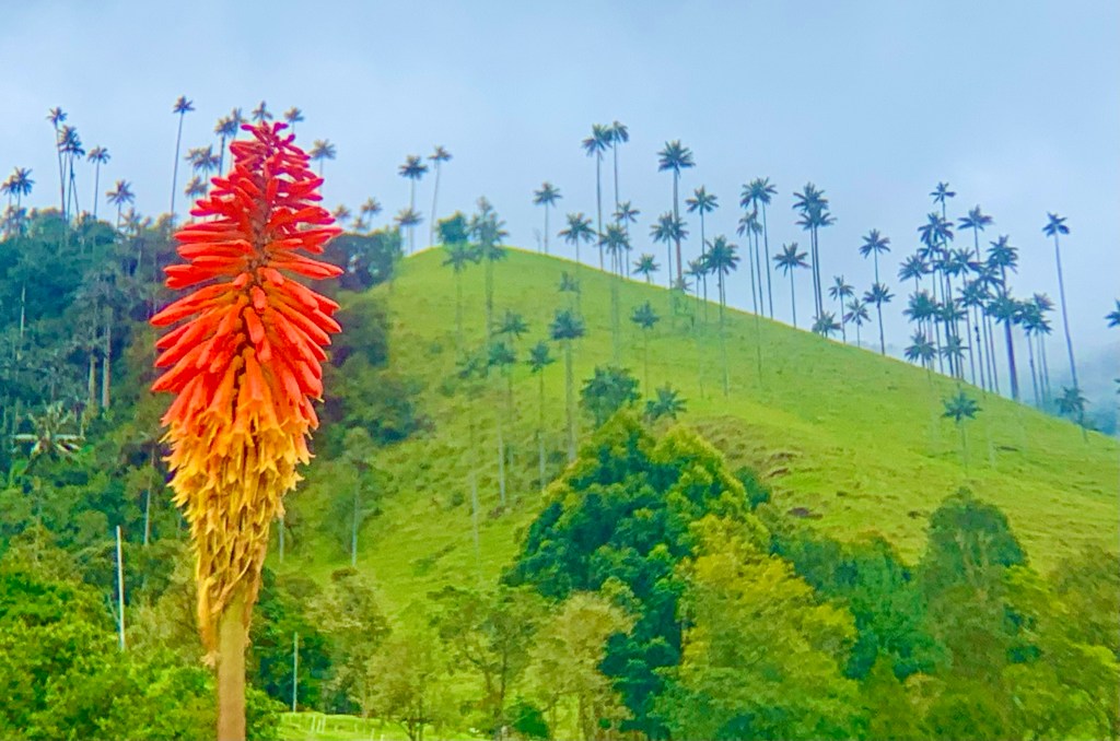
The Cocora Valley is one of the few places on earth to see them in their natural habit. The wax palms can grow up to 70 meters and hundreds of them can be seen in the valley randomly placed among the grassland towering above the grazing livestock.
How they have survived all these years is another natural wonder. Despite their impressive height the wax palm trees don’t seem to be the most robust tree. Even at the bottom, the trees are thin enough to nearly hug yourself around them, yet the tree feels as hard as concrete.
The wax palm trees certainly give you a view of something uncommon and arresting. The valley is 1800 meters above sea level, low clouds often fill the valley and the palms look as if they are scratching the bottom of the clouds.
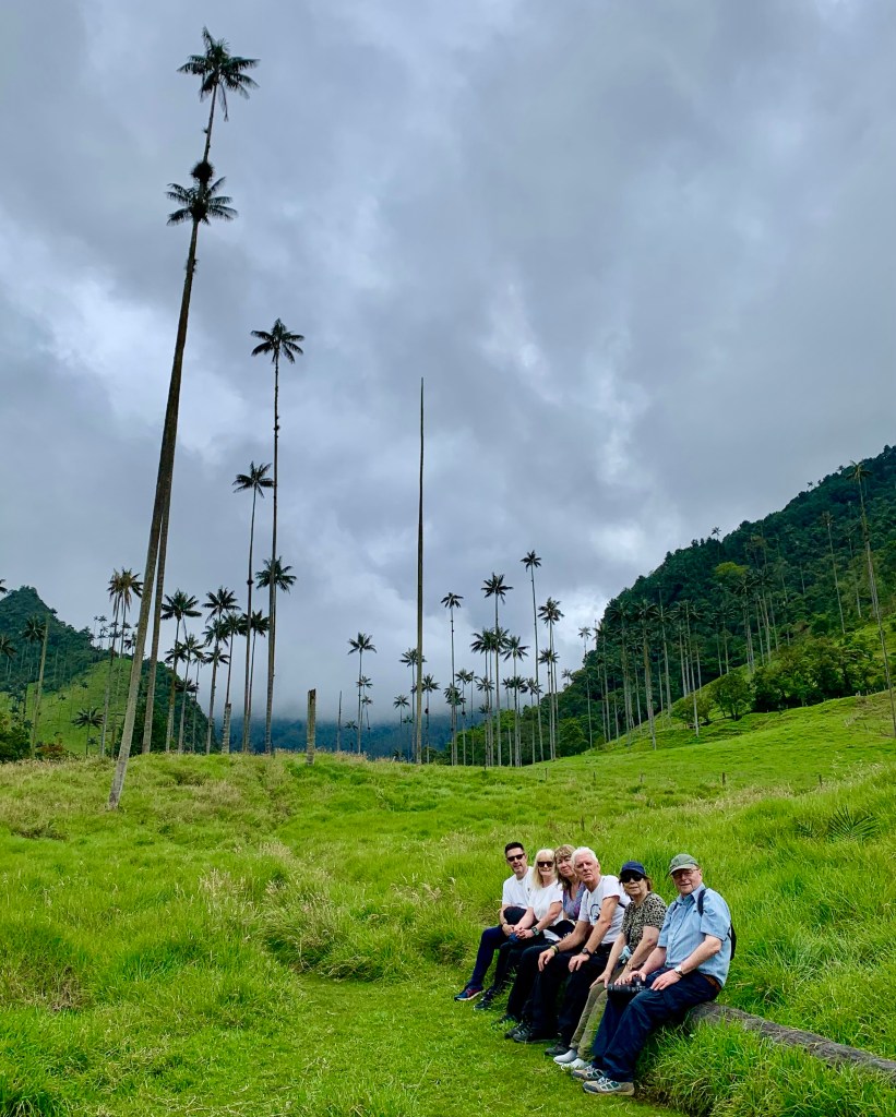
The curious beauty of the valley is immediate. It offers a fantastic trekking experience whatever your fitness as footpaths covers various distances. From 30 minutes in-and-out trail walk to a 12-kilometre valley hike which takes 5 hours. Whatever you choose you will be able to marvel at the beautiful and mysterious landscape.
We spent about 2 hours exploring and we followed the clockwise trail. The trail starts through grasslands taking us directly to the palm trees. After this it’s a relatively easy uphill ascent.
The route then takes you up to some fantastic vantage points before making the ascent back down. These vantage points are popular stops so you won’t be alone there. The route back down is steep and slippery be careful with your footing. I went sliding down the mountain on my back much to the amusement of my wife, no harm was done other than one ruined white T-shirt, fortunately, our guide kindly gave me his sweatshirt. They are certainly very thoughtful people in Colombia.
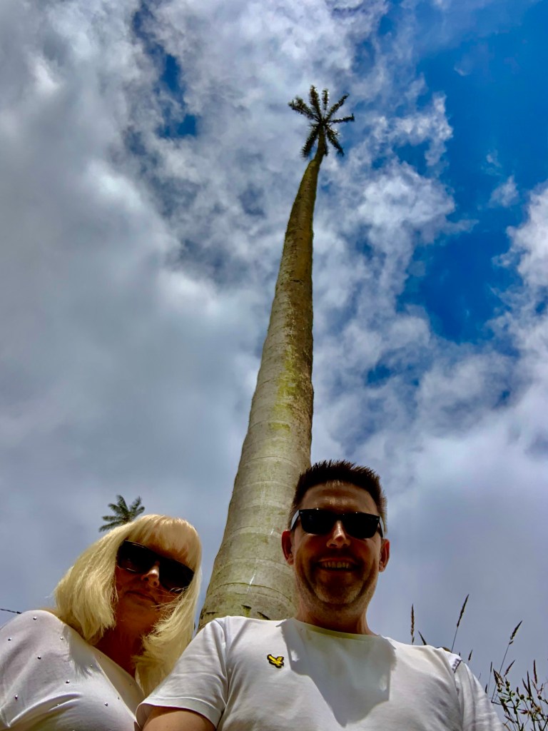
A selfie with a wax palm tree 🌴
The Cocora Valley is a very popular tourist destination. Most visitors arrive from nearby Salento and come for the day, there are also extensive hiking and camping opportunities for the more adventurous. Trips are available from Pereira which is where we were based.
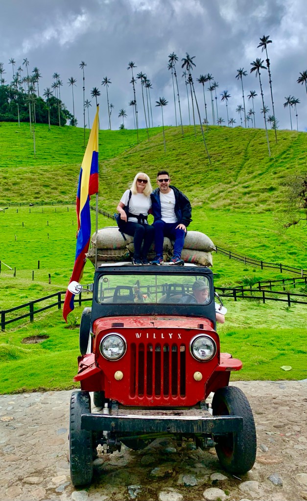
A ride in a Willys is a very popular way of getting there, it is an old jeep capable of transporting up to 12 people. If you are coming independently and don’t have a car this is the only way to get to the Cocora Valley other than by foot or horseback.
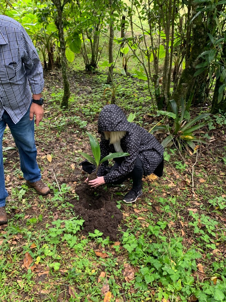
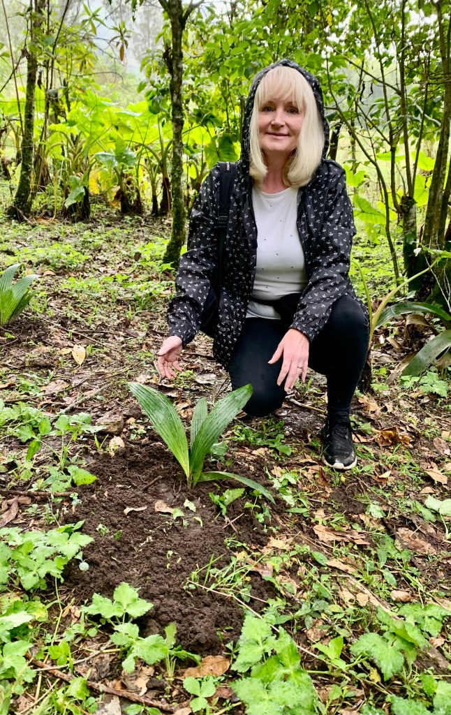
At the end of our tour, we met with a local ecologist. The tour company that we booked have a terrific programme where after every tour they plant a new palm tree. Sometimes I feel these are token gestures and good PR for the company. This is the only tour company that does this. I felt that their intentions are completely genuine.
A lot of these magnificent palm trees are dying. Our local guide George who has been coming to Cocora Valley for 10 years said he had sadly seen a great reduction in these palm trees. In the past, this has been due to the cultivation of trees for their wax and the land being used for agricultural purposes. More recently environmental concerns have come to the fore. They became protected by the Colombian Government in 1985.
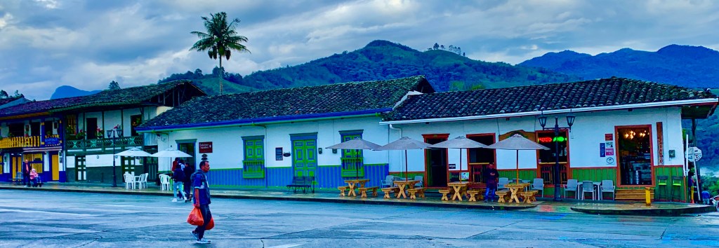
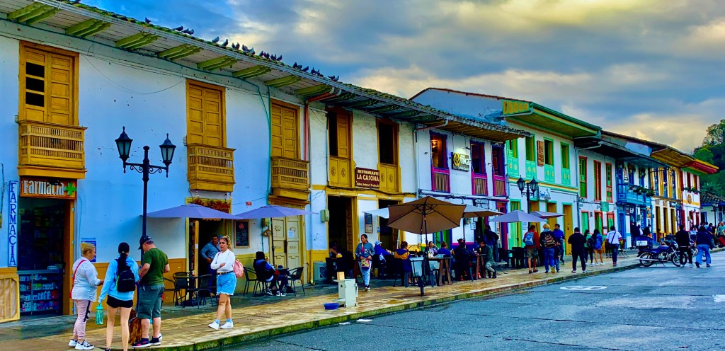
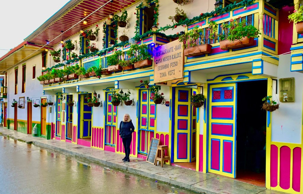
Salento
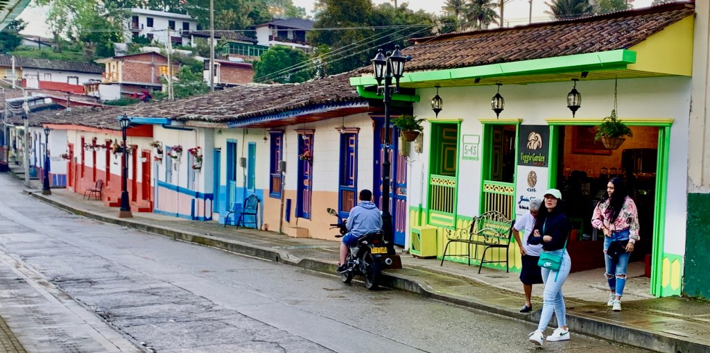
A town of many colours. Founded in 1850 it is one of the oldest towns in the area.
If visiting the nearby Cocora Valley and being in the heart of the Coffee triangle a UNESCO World Heritage Site is not enough, there is also the pretty little town of Salento to visit, often described as one of the prettiest in Columbia.
Four-wheel drive Willys are available for hire in the main square at Salento.
Salento functions as a base for trips to nearby Cocora Valley and its giant wax palms. You will find many businesses offering trips, where you can jump in a Willy (the original jeep and over 60 years old)
Although it is a bit of a tourist trap, it is not without charm and there is no denying it’s a photographer’s dream. If souvenir shops are not your thing then there are many independently owned coffee shops to relax in.
Salento is a small town that is easily navigable on foot and it is worth a visit as the painted colourful houses and tropical background nestled in the Andean foothills are certainly a visual experience to enjoy.
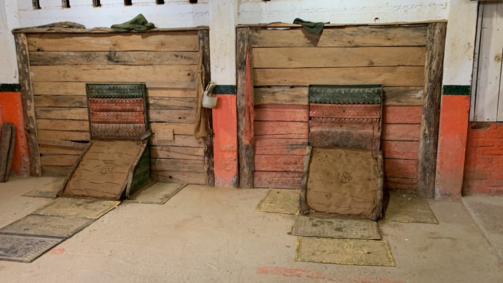
Tejo 💥 in Salento
As it started to rain this was a perfect time to head indoors and experience a game of Tejo.
This game is widespread in Colombia, especially in this region. To me, it looked like a cross between bowling, darts and fireworks, with alcohol thrown in for good measure as it is a game that is usually played on licensed premises. Not a great combination for the uninitiated.
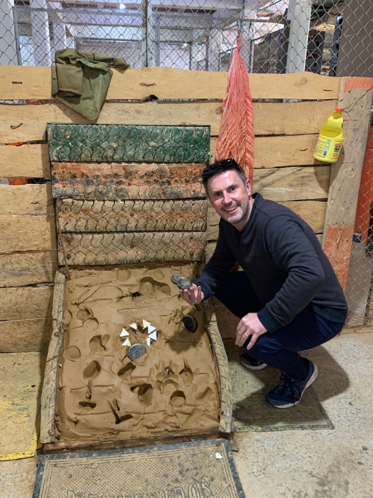
I need to get in the zone 🤣
It is not unusual to see professional teams in cities and large towns as it is second only to football in popularity. It is played internationally in Panama, Ecuador and Venezuela although the game’s spiritual home is in Colombia.
Taking aim ready to hit the target
The game involves tossing a steel ball at targets in the shape of stars loaded with gunpowder across the room. It can be played by up to six people so it is a very sociable game
Although the game looks simple, mastering it is a lot more tricky in practice as you have to hit the target full-on with the steel ball in order for the star, which is made of gunpowder to explode. You then get points which can vary from 1, 3, 6, and 9 if you hit the bullseye.
Not a bad effort but definitely room for improvement
Although I didn’t win it was good fun participating in this uniquely Colombian game. Travel is all about broadening your mind and trying new experiences and playing Tejo definitely did that.
Accommodation in The Coffee Region
Accommodation options within The Coffee Region range from haciendas on coffee plantations to small hostels and boutique hotels. There are no shortage of options to choose from.
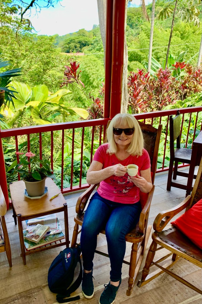
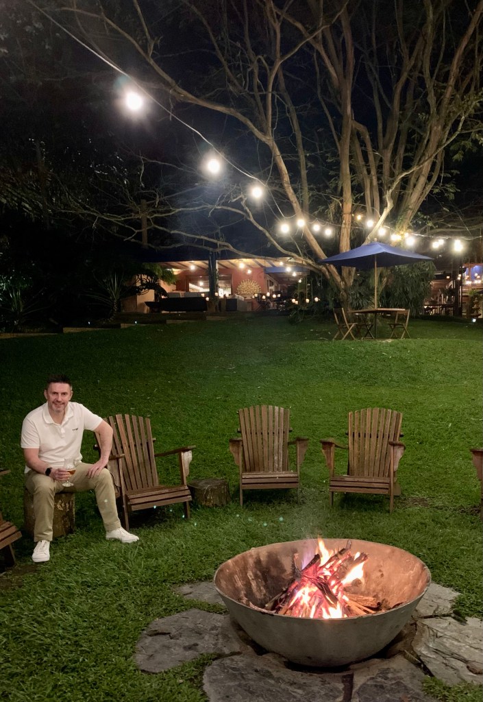
Chilling out after a long day exploring
We were on a tour of Colombia and after busy days exploring all that the area has to offer, it was nice to relax in this boutique hotel. Situated within the heart of The Coffee Region and its cultural coffee landscape.
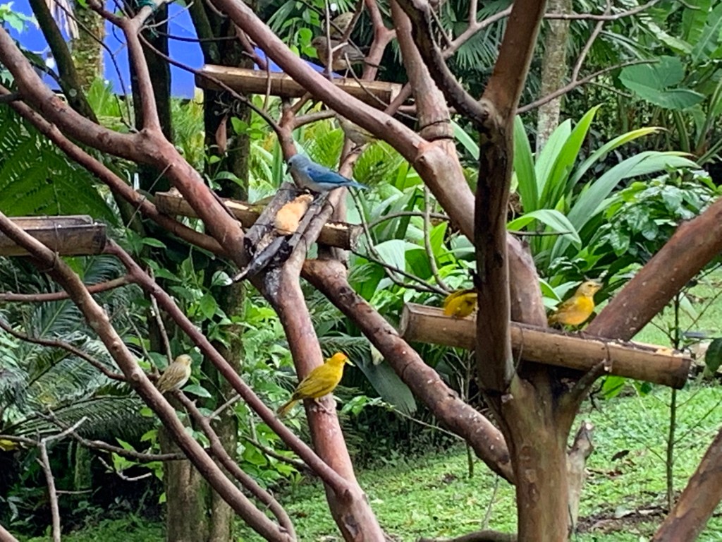
The hotel was more akin to being in a private house with its intimate, cosy and relaxing atmosphere surrounded by captivating gardens, flowers and birds
Alfresco breakfast at the property
Despite the quiet, idyllic surroundings we were only less than 20 minutes from Pereira airport and centrally situated to visit all that this fascinating location has to offer. The Coffee Region and Cocora Valley certainly surpassed my expectations.
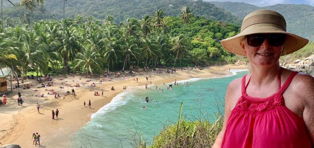
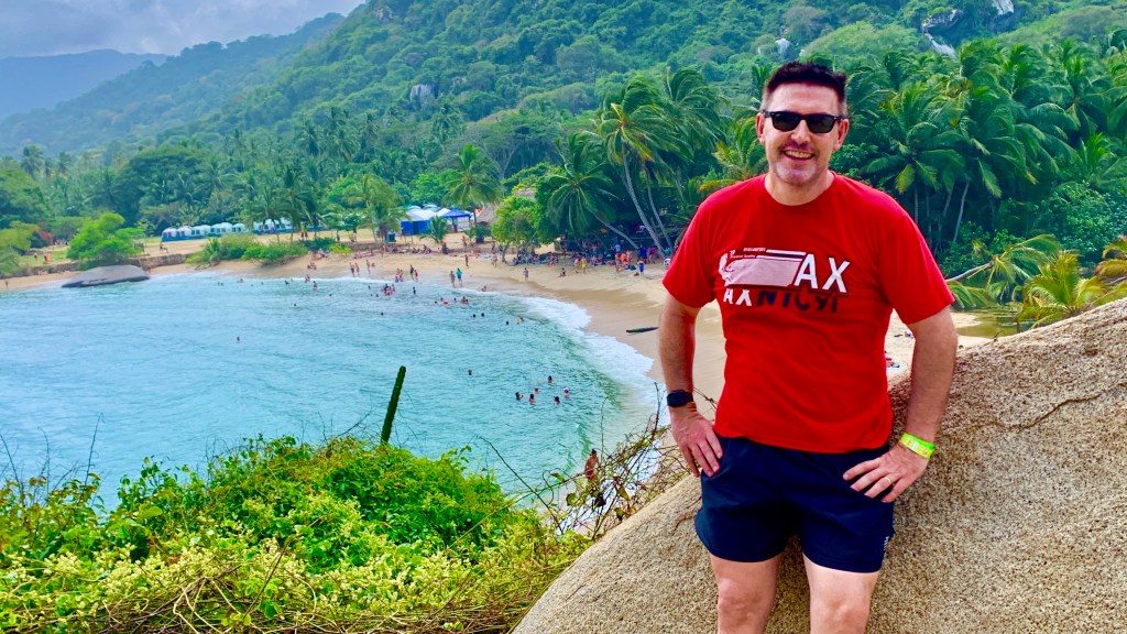
My visit to Colombia certainly enlightened me about its many natural treasures. None more so than Tyrona National Park. Lying on Colombia’s northern Caribbean coast, it offered us a complete contrast to Colombia’s bustling cities.
Although a visit will take some advanced planning, this remote tropical paradise is not the most straightforward to visit.
Factor in the costs and time, as the park closes at 17.00 pm unless you have an overnight permit. Our eco-lodge was less than three miles away and we planned to spend two days there. One day would suffice if you just want to visit a beach, longer if you want a more in-depth visit.
Other important tips would be to arrive early as there will be queues, bring cash with you for entry payments as cards won’t be accepted and you will also need a copy of your passport to gain entry. The whole process is slow and bureaucratic but it is what it is.
A walk in the park which is certainly no walk in the park. The coast is 5 kilometres from the entrance so it is worth paying £1 for a minibus transfer which will give you more much needed time inside the park. Minibuses run regularly from the main entrance.
Time spent in the park
This coastal national park is where the Sierra Nevada de Santa Marta mountains converge on the Caribbean sea. First established as a national park in 1964, its well known for its spectacular scenery and incredible biodiversity.
Despite being a popular inclusion on many itineraries to Colombia, I knew very little about Tayrona. Having visited I realise what an important ecological location Tayrona National Park is and one of Colombia’s natural treasures.
When in the park be prepared to do some walking. The park covers 58 sq mi of land and 12 sq mi of maritime area in the Caribbean sea. It is very busy with just over 500,000 visitors in 2019.
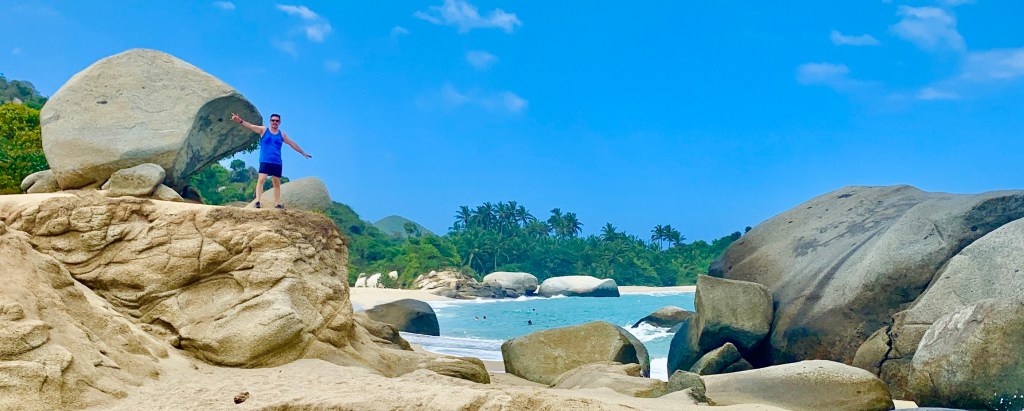
In many ways, Tayrona National Park resembles a miniature tropical paradise. Which involves hiking through a verdant jungle passing giant round boulders. Besides it’s natural beauty it’s also home to various indigenous communities and ruins of past settlements.
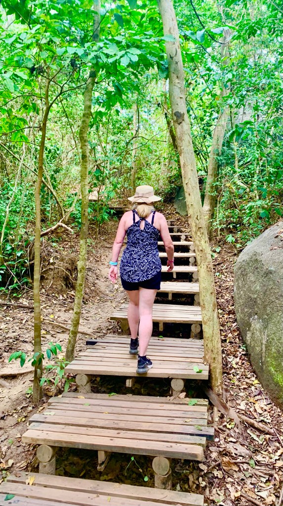
The park is spread over a large stretch of coast, so there is plenty to explore. We entered the park at El Zaino to get to Cabo San Juan. To get to this beach it is a 4.5-mile walk (after a 3-mile minibus transfer) through various terrain from boardwalks, steps, dirt paths, beaches, through water, over rocks and boulders. This took us about 1 hour and 50 minutes.
It is predominantly sheltered, so we weren’t walking in direct sunlight, but conditions are very humid and there are a few gradients to contend with not to mention various types of terrain. A reasonable level of fitness would be necessary to complete a hike to some of the more popular beaches. Appropriate footwear is also a must.
Allow plenty of time as there are lots to see along the way. It’s like walking in a green paradise. We got jungle vibes, tropical forests and endless palm trees. There was always something to see throughout our hike. A bit of preplanning will allow you to get the most from your visit.
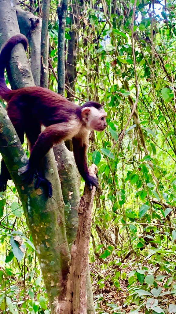
In Tayrona National Park there are over 350 species of birds, condors and white eagles. There are fox dogs and even the mighty Jaguar resides here. One of South America’s apex predators.
There are in fact over 105 species of mammals, 70 types of bats, 31 reptile species, 110 different types of coral, 401 sea and river fish and more than 770 plant species. Tangible evidence that Colombia is one of the world’s most biodiverse countries, second only to Brazil.
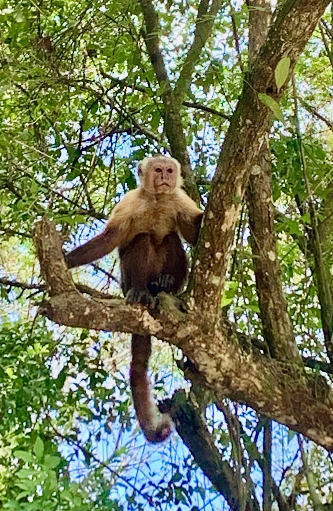
We did get to see plenty of monkeys. There are three species of monkey in the park, the red howler, the capuchin and the cotton-top tamarin.
While Tayrona National Park is a beautiful and picturesque place, treat it with respect for the benefit of future generations. It is a sacred place for many indigenous tribes,
These tribes are the guardians of the land. indigenous people close the park three times a year, protecting the park and the ecosystems it supports, allowing the park time to rest and replenish.
Indigenous groups also perform cleansing rituals and ceremonies. This is an excellent and necessary initiative that will hopefully protect the park for future generations.
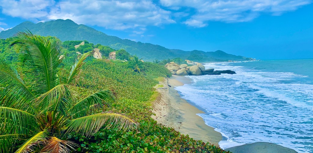
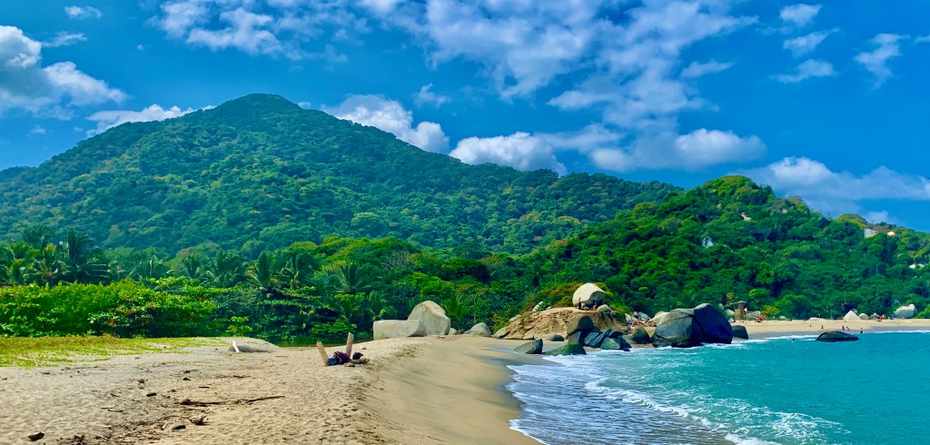
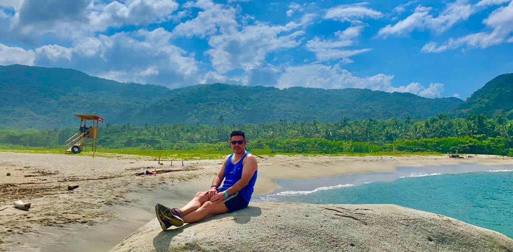
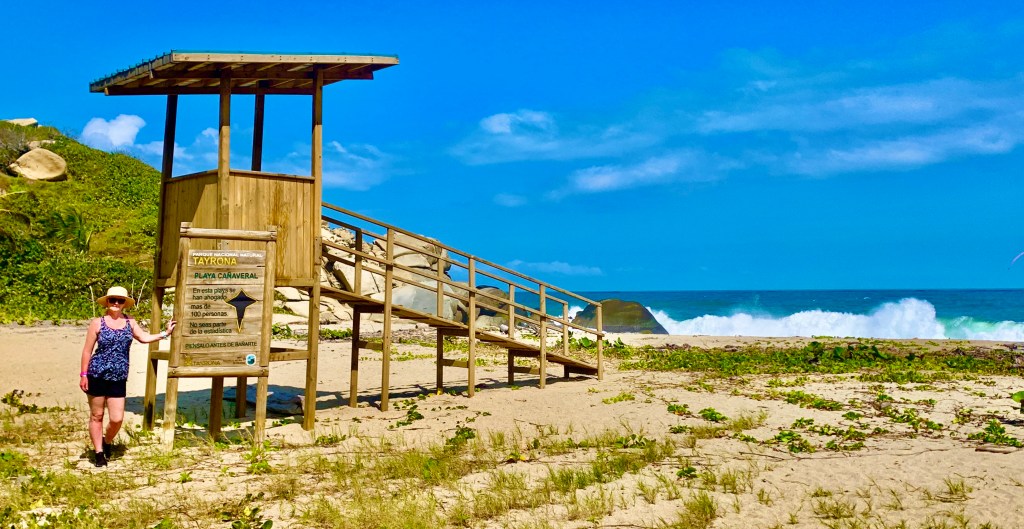
Beaches in Tayrona National Park
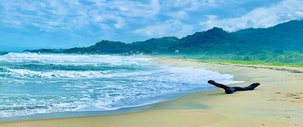
The combination of wild jungles, mountains and paradisical coastline makes Tayrona National Park a very unique destination. The park is famous for its beautiful untouched beaches. After all, we are on the Caribbean coast.
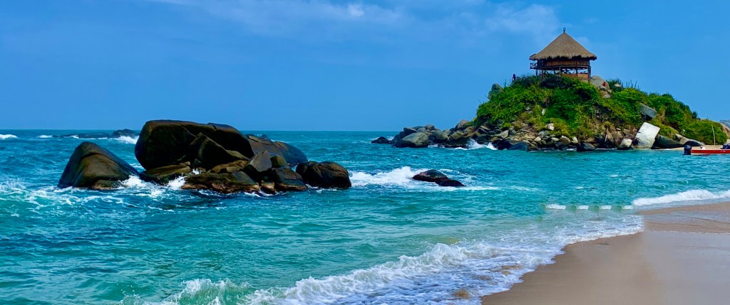
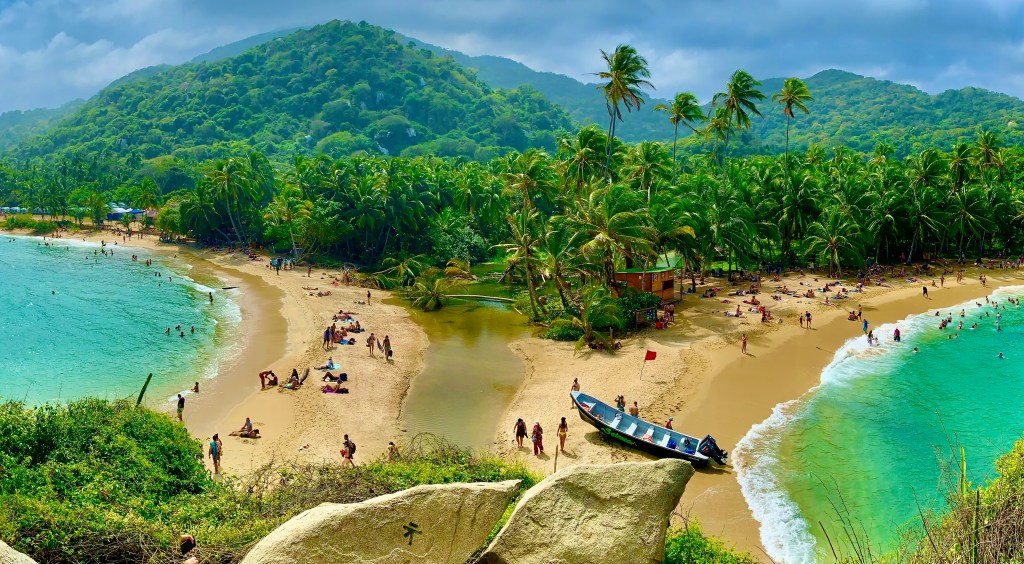
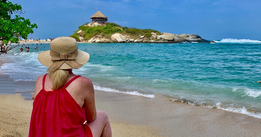
Cabo San Juan
Most probably the most famous beach in Tayrona National Park.
You can get to the beach from the main entrance at El Zaino, this is one of three entrances but the nearest one to our hotel. It is a 4.5-mile hike from the minibus drop-off and took us just under 2 hours with a few pictures stops on the way.
We decided to visit Cabo San Juan first, working our way back to the main entrance. As it’s the most famous and popular beach, and the furthest one away from the main entrance, this would allow us to maximise our time there and visit other beaches on another day.
Cabo San Juan is very popular as it’s a very photogenic location with its double-sided beach and when looking from the bungalow above the beaches they appear to mirror each other.
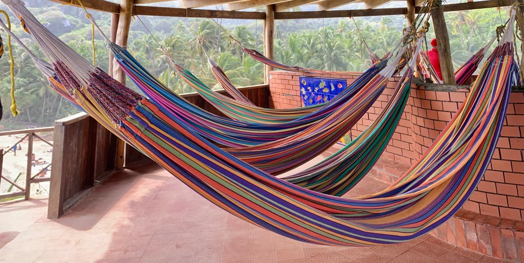
Another reason this beach is very popular is its accommodation options, camping or sleeping in a hammock it can be done here. You can swim here which you are not able to on many of the beaches within Tayrona National Park. There are also a few eating and drinking places located here. An option for a boat transfer from Santa Marta is also available.
The beach itself is in a semi-sheltered cove resulting in less exposure to currents and the large swell you will find on other beaches, there are also lifeguards in attendance, but despite this still take caution as the sea is still very unpredictable.
I had reservations about visiting the beach, not necessarily because of the location, it was absolutely stunning, but because it has become a victim of its own success becoming a tourist hotspot.
Although it was busy it wasn’t unduly crowded, we were still able to get that quintessential tropical beach experience, and it’s well worth the hike to get there. Just factor in enough time to get back because unless you are camping the park closes at 17.00 pm every day.
Arenilla
A very attractive beach situated within a cove framed by massive boulders.
A great alternative beach to the very popular Cabo San Juan. Arenellia is a very pretty beach and it’s not as busy as Cabo San Juan.
The palm trees offer plenty of shade from the sun and inviting clear water you can actually swim in. For me Arenilla was one of my favourite places in Tayrona National Park. Cabo San Juan is certainly a very beautiful beach, however Arenilla had a much more relaxed vibe and in my personal opinion equally as beautiful.
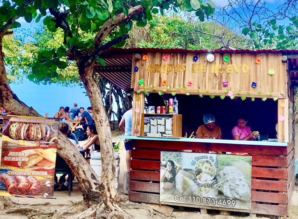
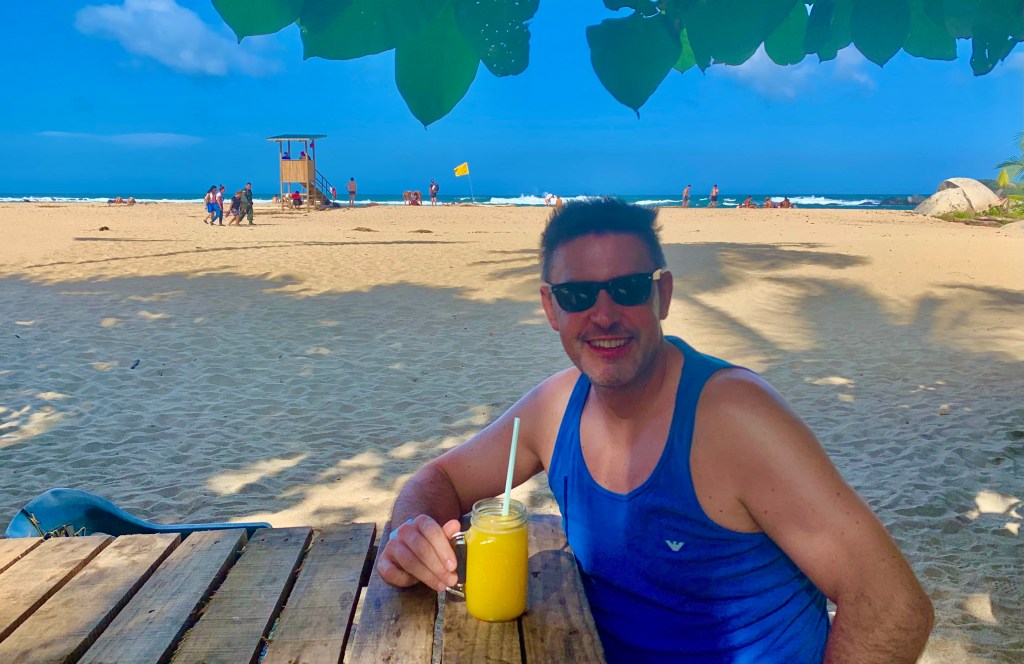
Arenilla is roughly a halfway point between Canaveral beach and Cabo San Juan, a few trails converge here and it’s a pit stop for visitors who are on horseback. So you will find a couple of restaurants located here and is the perfect spot for a drink or light lunch.
After a swim and some time spent at the beach, it was the perfect location to enjoy freshly prepared mango juice, before our hike back to the main entrance. Time was 15.00 pm more than enough time to get us back to the main entrance by 17.00 pm.
Canaveral
A very quiet beach and the closest one to the El Zaino main entrance.
Only a 1-kilometre walk from the minibus dropoff. This is often overlooked compared to other beaches within Tayrona National Park. When we visited there was hardly a soul on the very big beach.
The beach at Canaveral is very beautiful a long stretch of golden sand and azure blue water. Unfortunately, there is a downside for us, there is no shade whatsoever and swimming can be very dangerous due to treacherous offshore currents.
Canaveral Beach is a beautiful location if you want some quiet contemplation and we enjoyed our time there. An incredible location for a beachside walk where you can admire its wild rugged beauty, but if swimming or sunbathing is your thing, this isn’t going to be the beach for you.
Due to its reasonably close proximity to the main entrance and one of the few beaches with a road link, it is a popular place to stay with accommodation options other than camping available here.
Piscina
The clue is in the name. Piscina is Spanish for pool, and swimming is permitted here.
A popular beach within Tayrona National Park it’s mainly due to the fact that you can swim here, not always the case when you are at the beach at Tayrona. We didn’t stop here just took a few pictures.
Arrecifes
A beautiful beach, but a beauty which is deadly. There have been over one hundred drownings in this one location.
You feel as if you have hiked through the jungle to get here and the beach is surrounded by huge boulders. It’s a very naturalistic location where the full force of the sea can be seen as the waves violently crash onto the coast. It is a very captivating location but very brutal, best enjoyed from a safe distance.
This beach is now closed to the public. Its reputation had certainly proceeded itself and the park authorities are taking no chances with safety. This is the beach where it’s best to enjoy its beauty from afar. You will get some excellent views from the cliffs that surround the beach.
Accommodation in and around Tayrona National Park
There are a few options available, you can stay in the park where there are camping sites available to rent or even a hammock for the more adventurous.
A room with a view
We choose to stay outside in an ecolodge. More expensive but it gave us a more comfortable relaxed stay while exploring the area.
After a busy time discovering Colombia, it was the perfect location to relax and unwind at the end of our adventure. Its close proximity to Tayrona National Park gave us easy access to discover everything the park has to offer. It was less than 10 minutes away with a taxi transfer.
This part of my journey takes me away from the Petite Cote, in the south of the country, on a lengthy journey, to the far north of the country to visit the former capital and UNESCO World Heritage Site Saint Louis, with an overnight stay in the Lompoul Desert.
A typical scene on the streets of Saint Louis
Saint Louis
Located in the far north of the country close to the Mauritanian border. At the beginning of the French Colonial Empire, it was the most important city in Senegal, if not all of French West Africa.
Carriage ride in the centre of the old town
Known for its French colonial architecture. Saint Louis was the capital of Senegal from 1673 to 1902 and the capital of the whole of French West Africa from 1895 to 1902. It was the capital of neighbouring Mauritania from 1920 to 1957
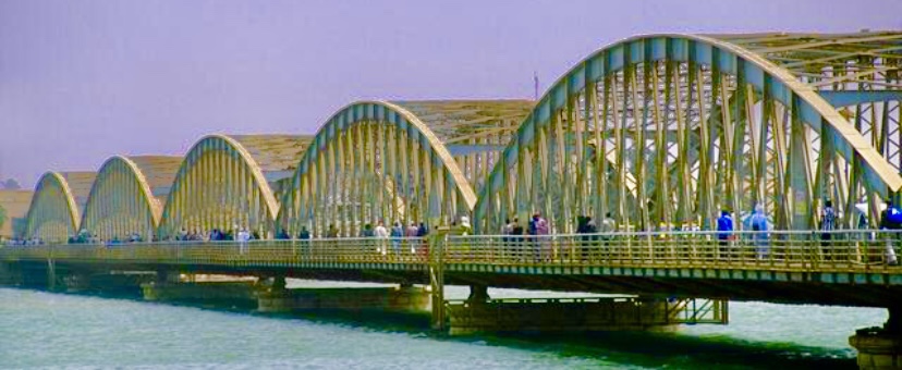
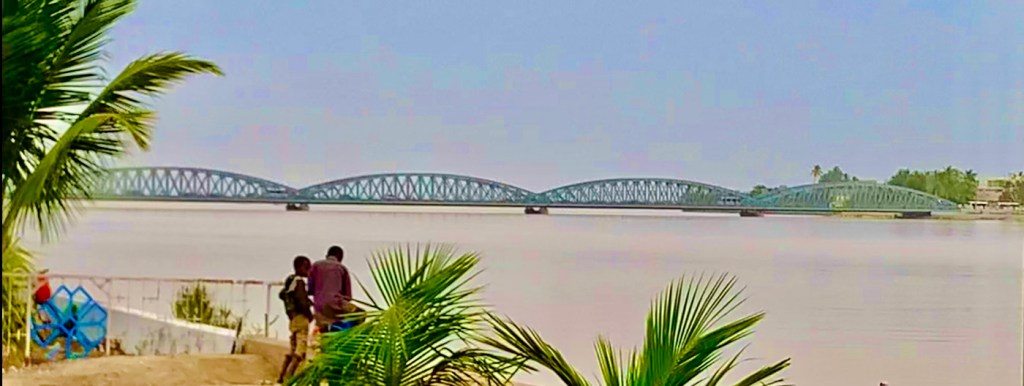
Faidherbe Bridge the symbol of Saint Louis
Although our main reason for visiting Saint Louis was to see the old town on N’Bar Island a UNESCO World Heritage Site. The island is linked to the city by the Faidherbe Bridge, constructed in 1865 and designed by Gustav Eiffel who went on to build the Eiffel Tower no less.
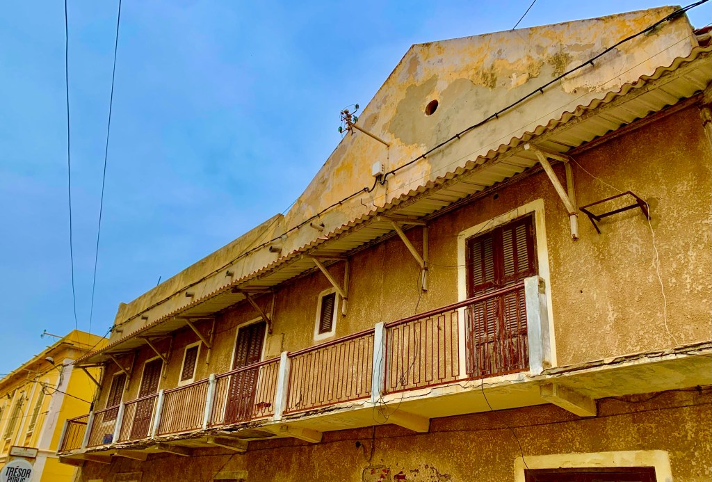
It can be rather quiet in the old town
The city of 258,000 was an important economic centre in the early years of French West Africa, but its heyday has long since passed. Although it’s still a major fishing port and has gained in popularity due to its UNESCO World Heritage Site which it achieved in 2000.
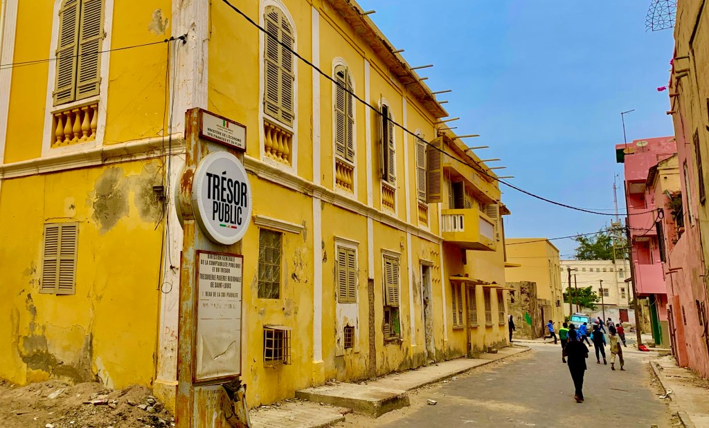
My first impressions here for me were a little mixed. The streets are dusty and narrow. There were also lots of rubbish strewn around the streets under thick layers of dust. If I was being kind it looked well-worn and in need of some love. Scratch beneath the surface and you will find a city with a rich colonial history.
The island of N’Bar is where you will find the majority of the old French Colonial buildings. They all looked a little dilapidated but this for me tells a story of the history of the buildings, documenting the rise and fall of this intriguing city.
The buildings are all colourful in Saint Louis. It’s worth the time wandering around the historic old town, where you will find many crumbling 19th-century French Colonial buildings in various states of disrepair, from total collapse, in need of renovation to being fully renovated into swanky boutique hotels.
Riding through the old town on a horse and carriage
There are a few ways to explore the old town, but I found the best way was to hire a horse and a cart. This was an hour-long tour of the island and the surrounding area, where we experienced how life is for the locals. We were able to have a different vantage point to admire the architecture above us, as well as view what was going on the street level besides us.
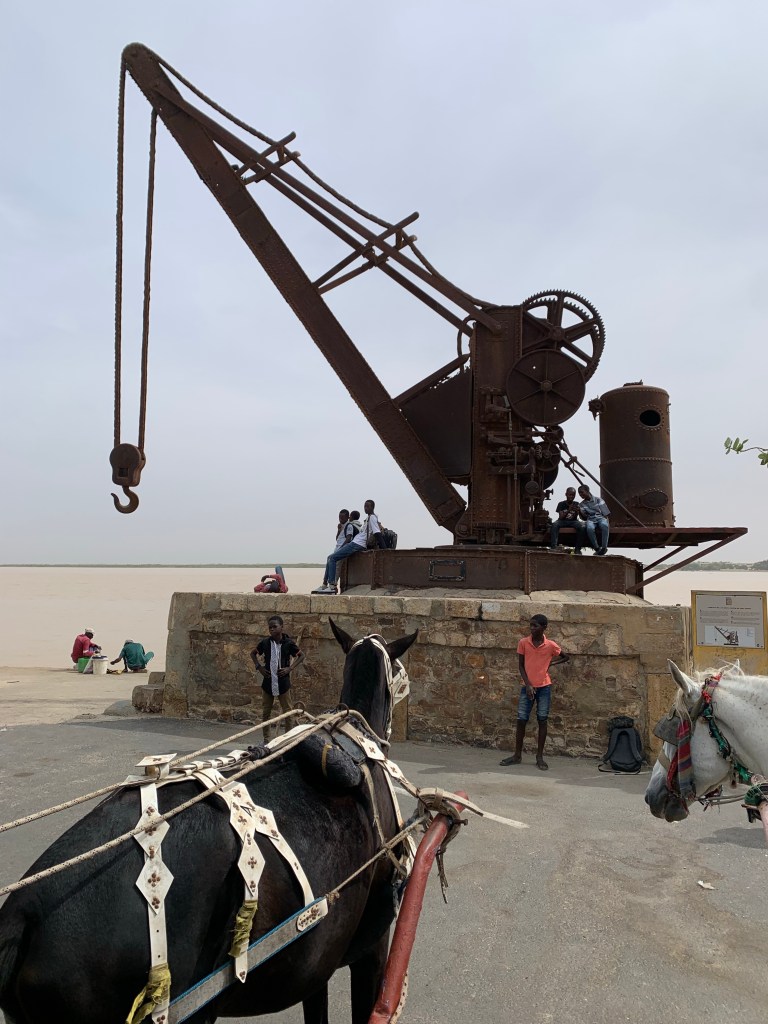
There are reminders all around the island of Saint Louis’s more illustrious past. This old crane in the dock would once have been constantly used in the frantic movement of goods and people,as Saint Louis was one of the main ports for the whole of French West Africa.
Saint Louis is situated at the mouth of the Senegal River.
Saint Louis is crossed entirely by the Senegal River which from the Mauritanian border reaches the city dividing it in two and giving life to the east and west areas. The Faidherbe bridge built in 1897 connects the island to the rest of the city in mainland Africa.
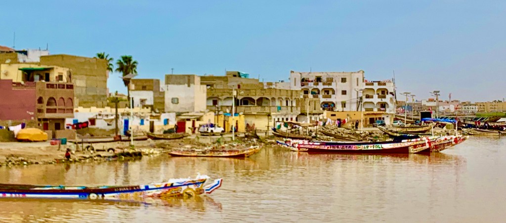
Guet-Ndar
The fishing harbour and home to the fishing community in Saint Louis.
Crossing the bridge over onto the peninsula you will find the centre of the fishing industry Guet-Ndar, where you will row upon row of colourful fishing boats
Although in recent years this way of life has been under threat from two major issues, overfishing and the continual risk of flooding, both of which could have catastrophic consequences for the city and the region.
Saint Louis is vulnerable to climate change, where a sea level rise is expected to threaten the city centre and potentially damage historical parts of the city.
Children playing in the street in the old town
If the old town was quiet, the contrast here was considerably different
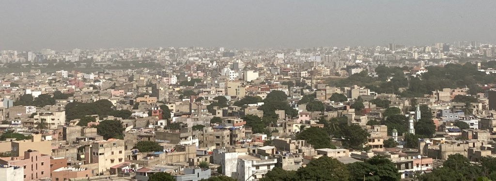
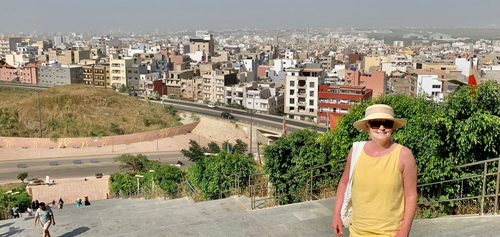
During our horse-drawn tour of the city, it gave an insight into the daily lives of the local people. There are similarities to Dakar which I had previously visited on this trip. Although Saint Louis was more African in look and feel than Dakar with it’s more modern buildings, financial district, shiny SUVs and grandiose buildings.
Saint Louis in contrast had a more rustic feel with its faded crumbling buildings and French Colonial architecture that tells a story of the city’s once illustrious past, where you will find horse-drawn carts rather than shiny new SUVs.
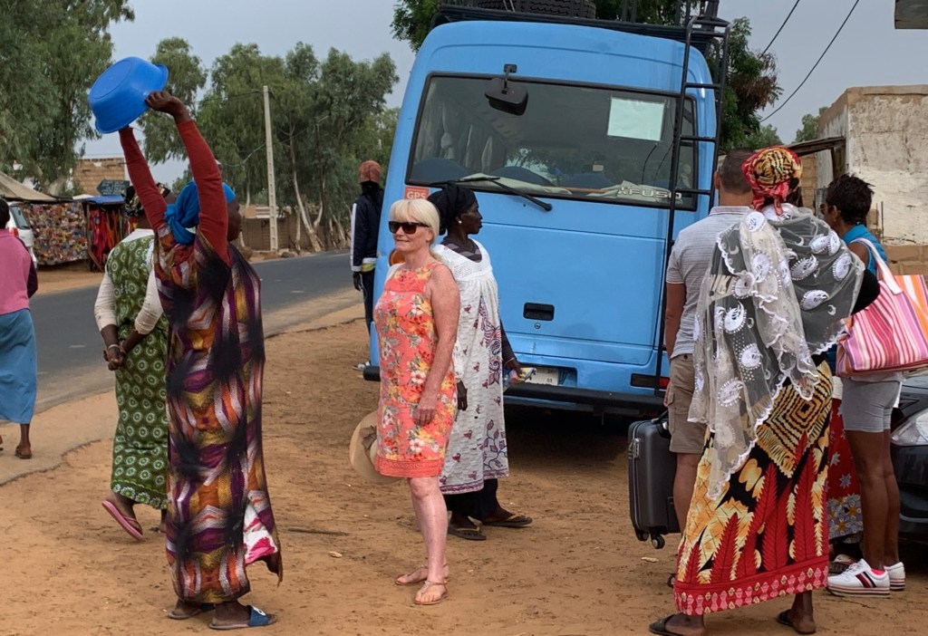
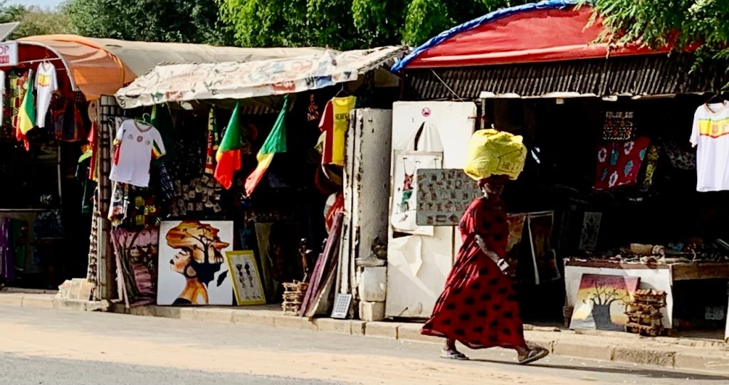
In Saint Louis, there are a lot of street vendors, as you will find in all of Senegal. They can be found in traditional markets, on the street, on the beach and by the roadside. They are characterized by their persistence, resourcefulness and ability to communicate.
Even in the middle of the city, you will see goats 🐐 so many goats, not to mention horses, cattle and chickens
Langue de Barbarie
Translated into English from French it means spit of land
The Langue de Barbarie is a 40-kilometre-long strip of sand, which stretches along the coast of Mauritania down to Senegal The land separates the ocean from the final section of the Senegal River and is Saint Louis’s most westerly suburb.
It has been formed by the mouth of the Senegal River where a small lagoon has been created. It is situated west of the old town by crossing Senegal petit bras (little arm) an offshoot of the Senegal River.
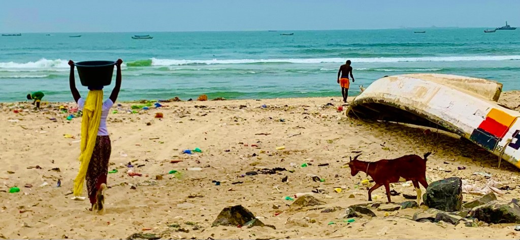
Further along, the coast once you have left the city you will find some nice beaches with soft sand and warm waters. Although there is little evidence of this in Saint Louis, where you will find washed-up rubbish on the beach and discarded fishing materials. The area is in great need of regentrification.
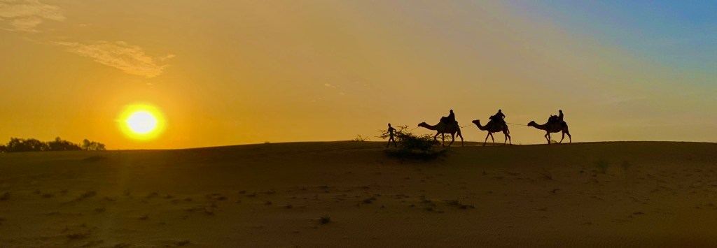
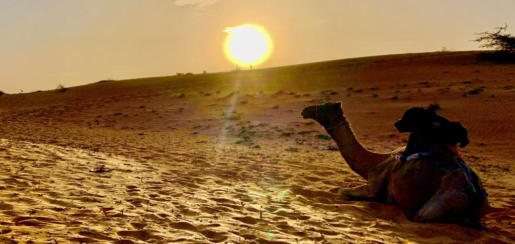
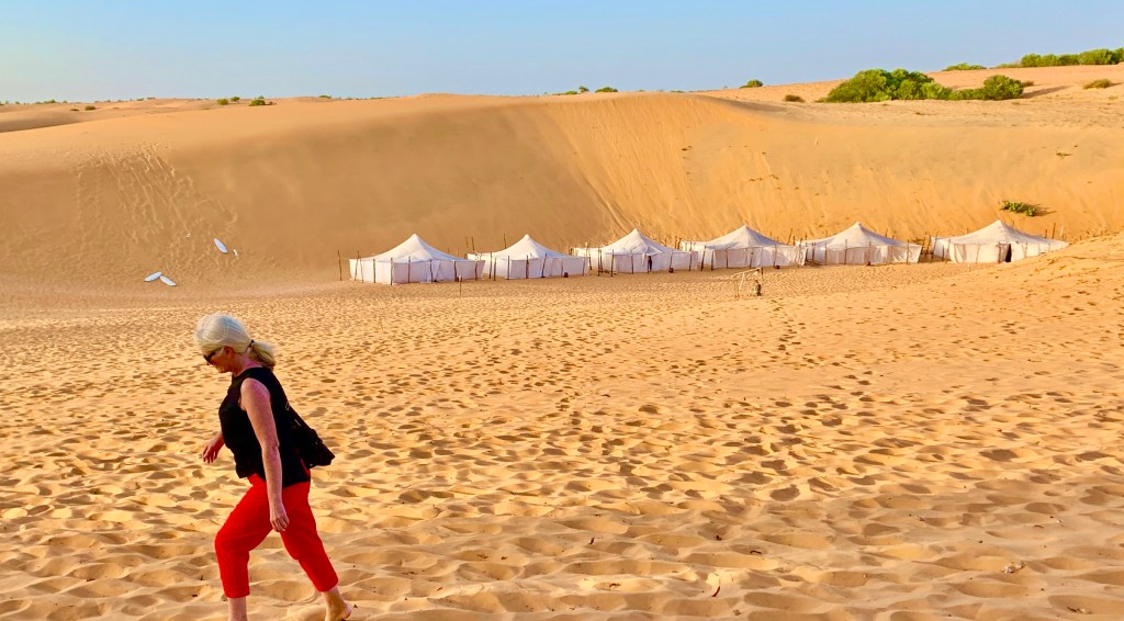
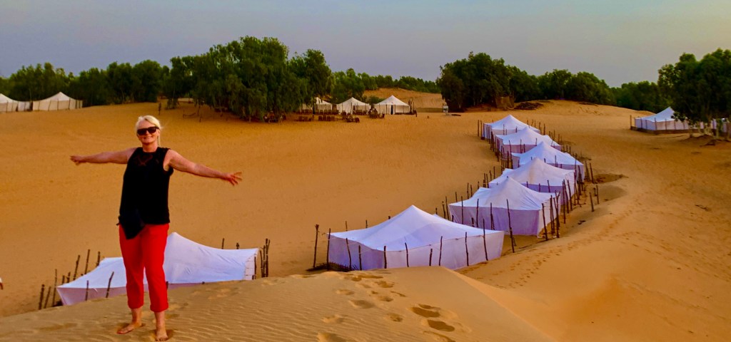
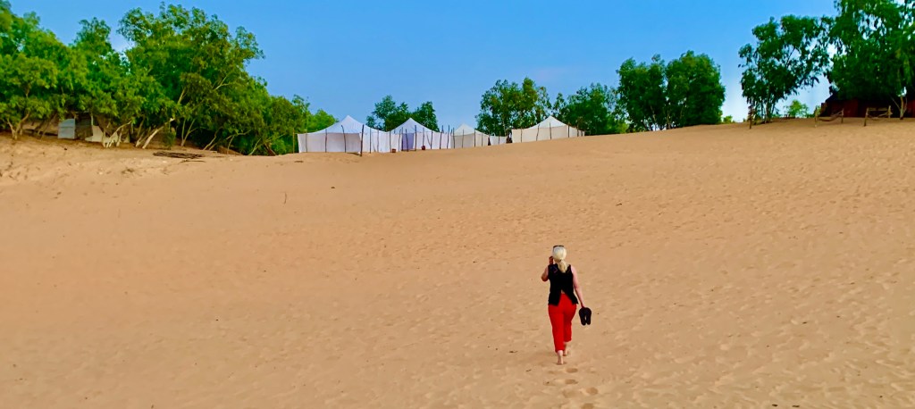
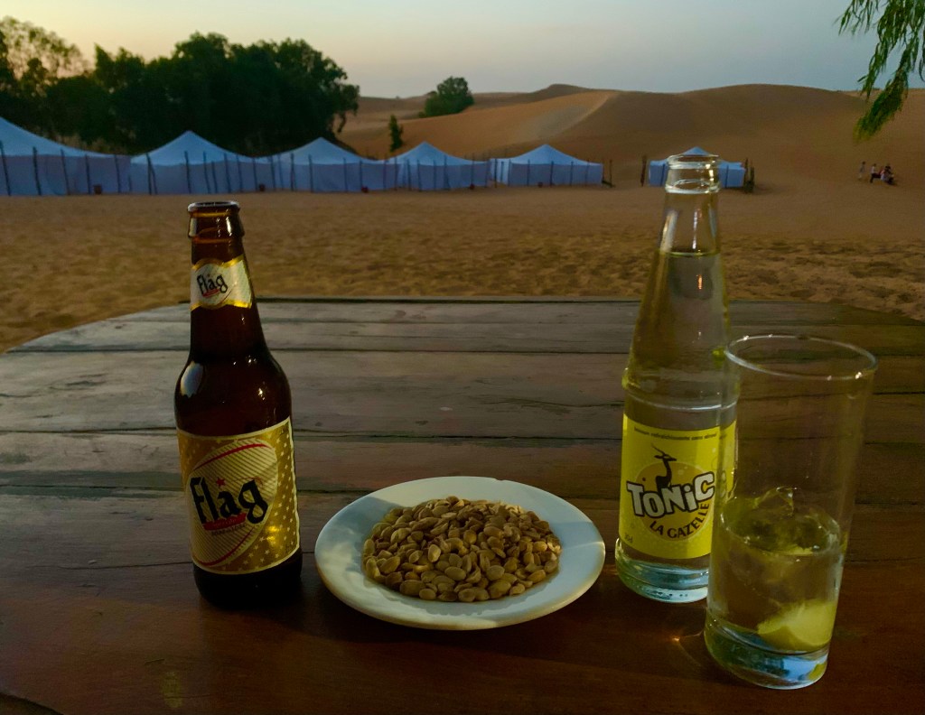
Overnight stay exploring the Lompoul Desert
It may not be as big as the mighty Sahara Desert. With an area of about 18 km2 located 145 kilometres south of Saint Louis.
To first get to the lodge we had to get a transfer from the nearest town Lompoul after which the desert is named. The journey takes about 20 minutes to get to the lodge, allowing the local vendors the opportunity to try and sell us some merchandise before our vehicle arrived.
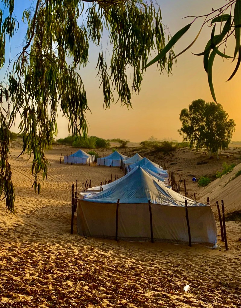
The lodge is nestled among the sand dunes
It’s orange sand dunes form a similar landscape similar to those of the Sahara in neighbouring Mauritania, rather than the more tropical climate usually found in Senegal.
In recent years the area has become something of a tourist hotspot. With several lodges available to stay where the visitor can sleep in the desert amongst the sand dunes
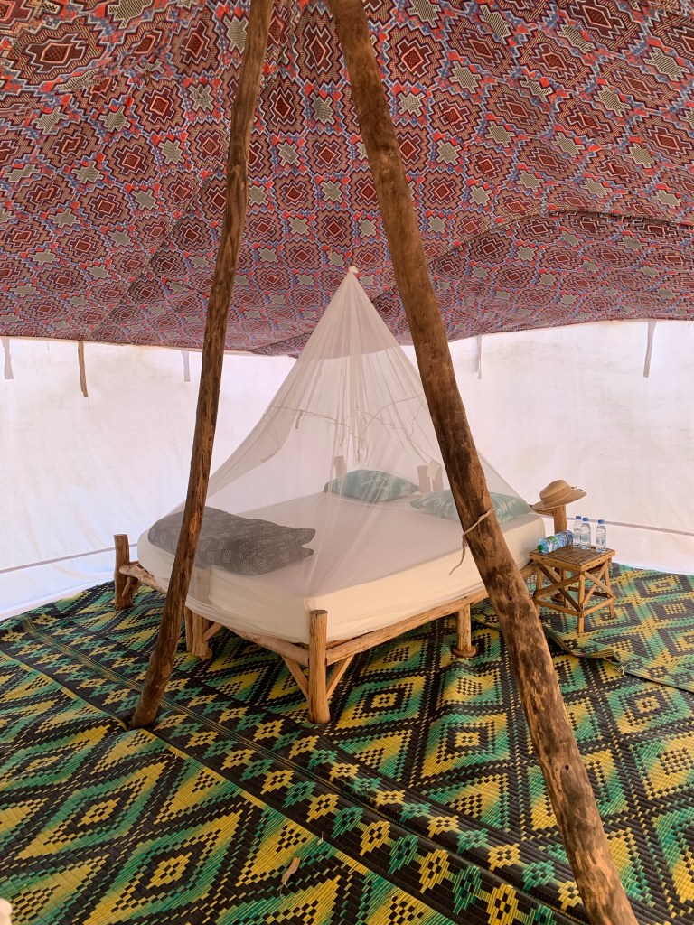
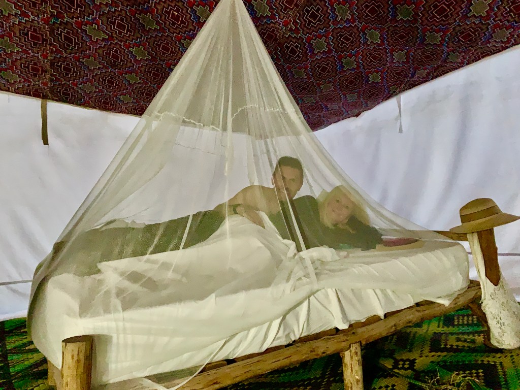
Whichever you choose the lodges catering to tourists are of a good standard. I was told they were going to be very basic, in all honesty, it was more akin to glamping with a flushing toilet, shower and a large double bed complete with mosquito net. The only real inconvenience was no charging points for phones and tablets in the tent but points were available in the main dining tent.
The only thing to consider is that once you are at the lodge that’s it, you will have to have your evening meal and drinks at the lodge as you are in the desert. Food at our lodge was simple, traditional Senegalese cuisine which was delicious, but make sure this is included in your itinerary as they generally cater for a set number of guests.
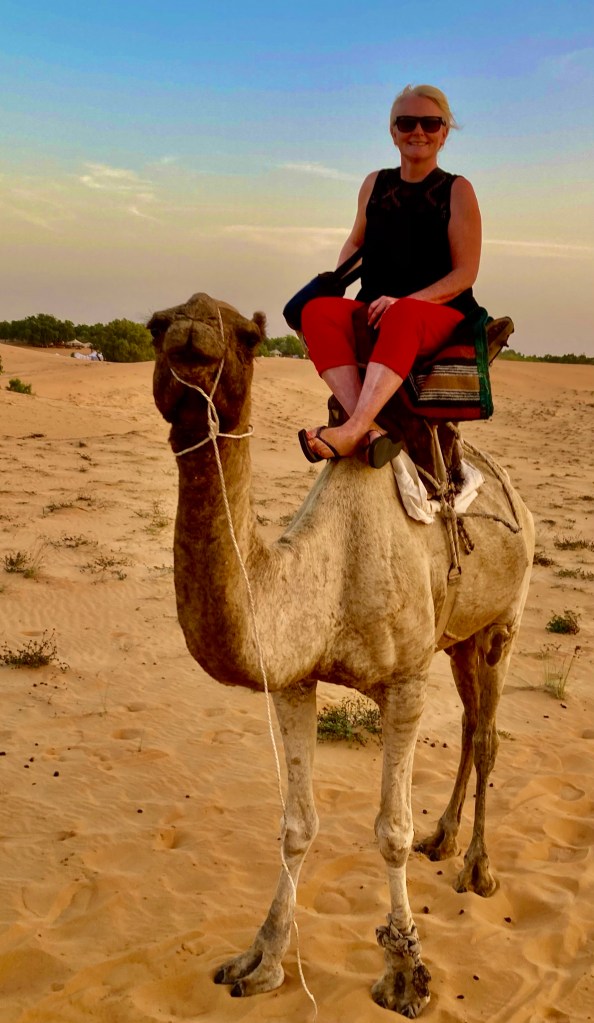
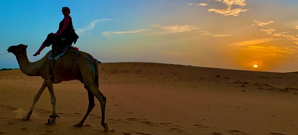
Before our evening meal, we were treated to one of the lodge’s signature activities. Being in a desert what can that activity be? A camel ride of course.
Have previously done these camel rides on a few occasions and have come away disappointed. However, on this occasion, the experience was simply incredible to catch the various shades of the desert as the sun was setting, in all honestly was a magical experience.
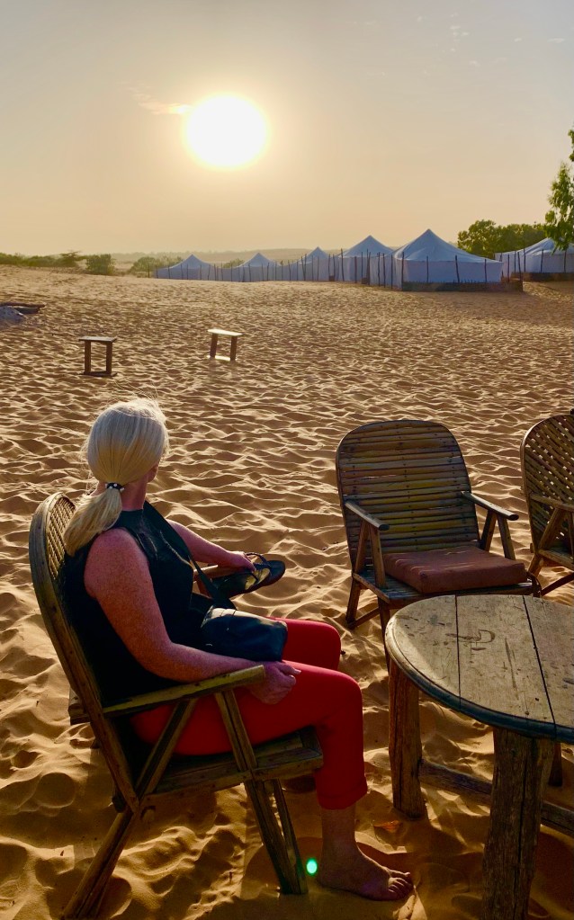
Sometimes you just have to sit down and contemplate and enjoy the moment
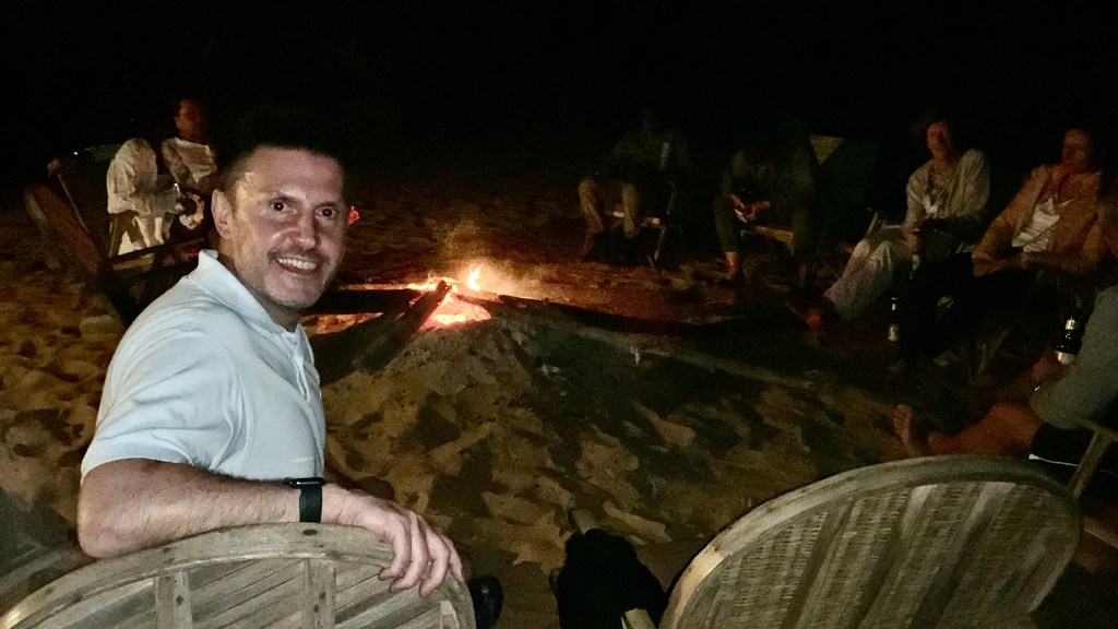
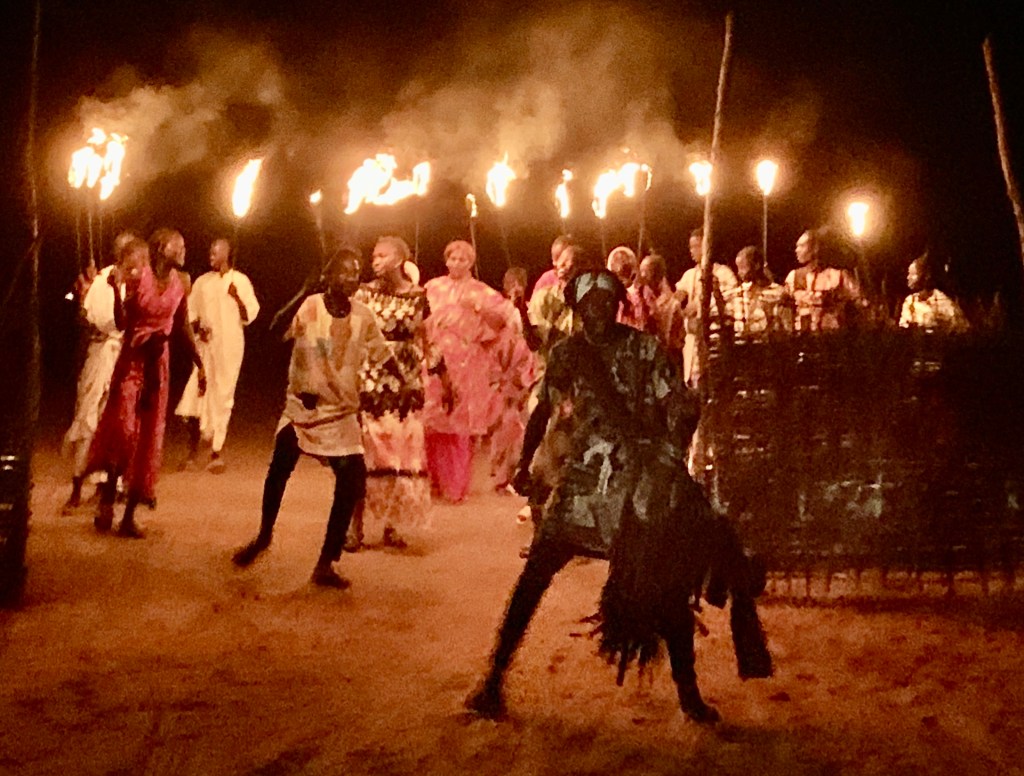
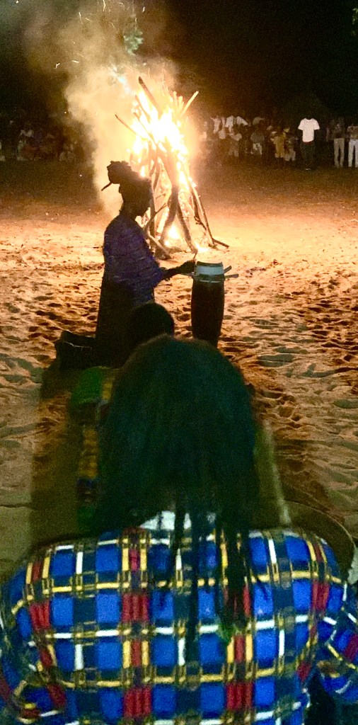
After the camel rides, back to the tent to freshen up, then time to reflect on the day’s experiences. Perhaps a pre-dinner drink was in order as it will soon be dark. The drinks at the bar were very reasonable and the service was excellent. In high season there is usually a pre-dinner show with Senegalese themed music and dance.
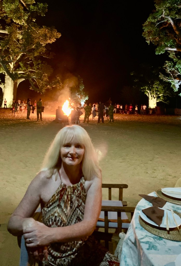
After a delicious dinner in the dining tent with our fellow guests, the evening focal point was the open-lit fire, where we enjoyed the rest of the evening gazing up at the moon and stars which illuminate the lodge at night, we got amazing views as the sky was clear and there is no light pollution. It may have been low key but a wonderful way to finish what had been a long but very rewarding day.
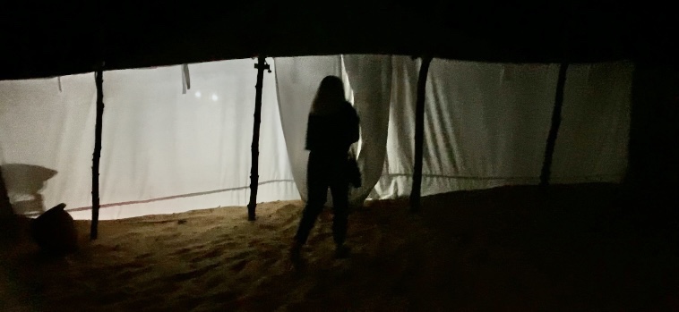
All that was left to do was find our way back to the tent, a torch is highly advised, as the lodge is pitch black at night, remember your tent number as you can walk into any tent, with potentially embarrassing situations. 😊
The sleep we had was good only being disturbed by the local wildlife once, a couple of the lodge’s resident cats 🐈 fighting 😆
Perched on Africa’s most westerly point and surrounded by water on three sides. Dakar is home to 4 million people. It can seem like a city of extremes where horses and carts share the road with shiny new SUVs, French Colonial architecture is interspersed with African buildings
Although due to its independently mined people, colonisation didn’t come to the area till the middle of the 19th century, more than 400 years after the Portuguese set up their first trading post just across the water in Goree Island.
Dakar ferry terminal to Goree Island
Such was Dakar’s strategic location and importance, little after 50 years of the city’s foundation it became the capital city of all French West Africa and one of its most important cities within the French Empire.
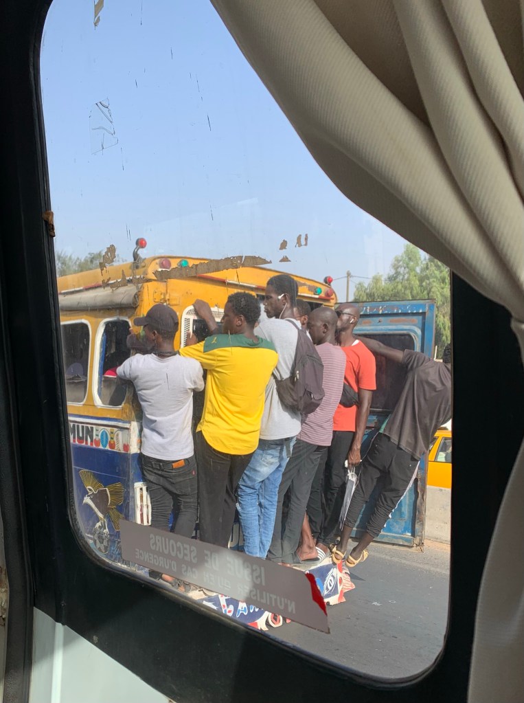
Experiencing rush hour in Dakar😲
Dakar is a city that wears its heritage with pride and takes comfort in its diverse history and identity, very much the exception to the rule in this part of the world. Senegal being one of the few African states not to experience a coup d etat or exceptionally harsh authoritarianism.
Today Dakar is a major financial centre home to over a dozen International banks, including the Central Bank of West Africa which manages the unified West African Franc.
The French have not severed ties completely, with over 20,000 French expatriates living in Dakar. The French still operate an air force base near the city and the French fleet is still serviced in Dakar’s port and the French language is used.
The Plateau District
The city of Dakar is certainly full of surprises. It is a member of the Organization of World Heritage Cities and contains several landmarks. Unfortunately for us, time was in short supply with a ferry to Goree to catch, so it was just a visit to some of Dakar’s prominent sights.
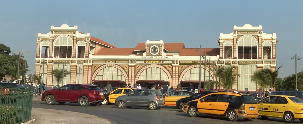
This compact area next to the ferry terminal is full of French Colonial relics, like the beautiful railway station and though Senegal currently has no operating train service, this and other buildings have been well maintained. They are considered proud parts of Senegalese heritage.
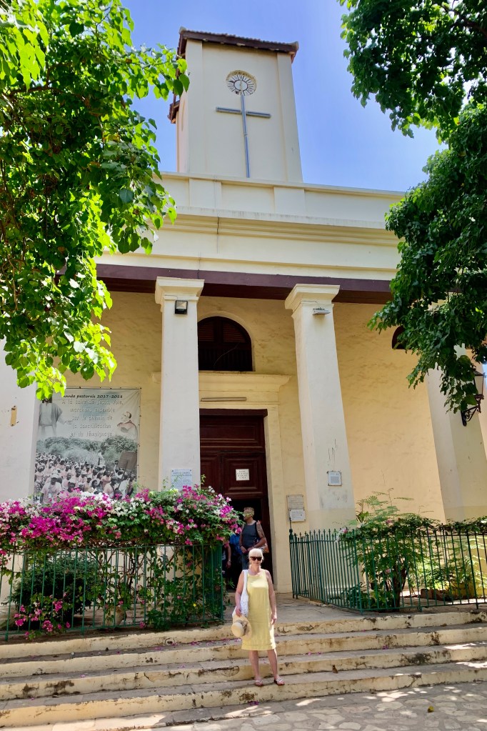
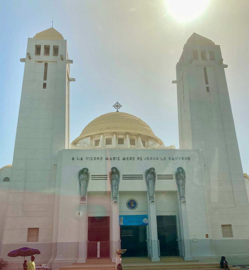
The Catholic Cathedral of Dakar built in 1936 can also be found in The Plateau district. Catholicism was brought by the French although today less than 5% of the population are Catholics, it stands as a symbol of Senegal’s multicultural society where all religious tolerance is respected.
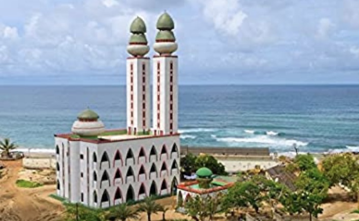
Ouakam
The beachside suburb is famous for surfing, The Mosque of Divinity and The African Renaissance Monument.
The Mosque of Divinity
The mosque is a relatively new building which was completed in 1997. Its structure has two minarets and is located in an impressive beachfront location with unobstructed views of the Atlantic Ocean.
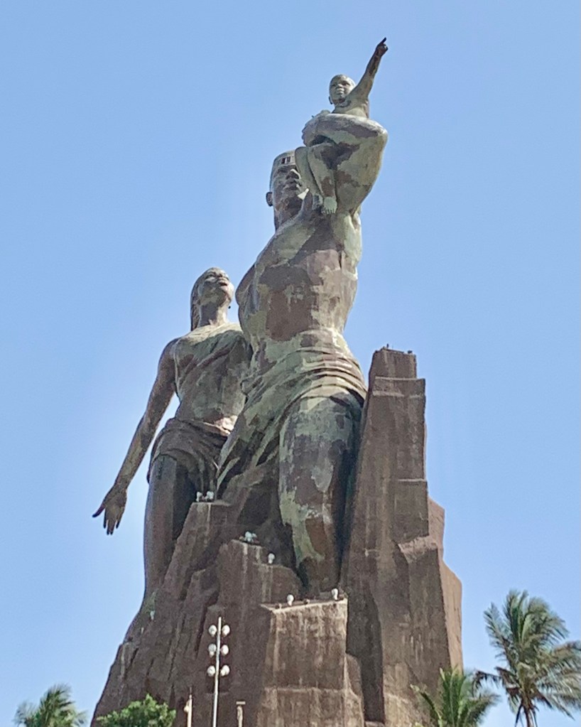
The African Resistance Monument
A statue which symbolises African liberation from centuries of oppression? or an expensive vanity project? Officially unveiled on April 4th 2010 National Day in Senegal.
The 160-foot statue is impossible to miss. Perched high on a hill, the mighty Soviet Esque bronze statue of a man, woman and child overlooks the Atlantic Ocean and dominates the horizon of the capital Dakar.
The project was launched by then Senegalese president Abdoulaye Wade, as a prestige project to provide monuments to celebrate African Renaissance. Designed by a Senegalese architect Pierre Goudiaby Atepa and built by a North Korean sculpting company.
The construction cost of £17 million deeply divided opinions at the time, even leading to public demonstrations a rare occurrence in Senegal, when many ordinary people were struggling to put food on the table. The rather austere design was poorly received by art aficionados. The former president owns intellectual property rights to the sculpture, which entitled him to profits raised by the sculpture, which further adds to the controversy.
The statue is certainly in a fantastic location on top of one of the twin hills known as Collines des Mamelles, giving fabulous panoramic views of Dakar and the Atlantic Ocean.
Goree Island
The primary reason for my visit to Dakar was to visit Goree Island which lies just off the coast of Dakar. This beautiful colourful island has a dark disturbing history.
Goree Island was declared a World Heritage Site in 1978.
The island is a UNESCO World Heritage Site. From the 15th to 19th Century it was the largest slave trading centre on the coast of Africa. Ruled in succession by Portuguese, Dutch, British and finally French colonial rulers.
The only way to reach Goree Island is by boat. Ferries depart regularly from the port at Dakar, the trip takes 25 minutes and boats depart every 1-2 hours and run from 7 am up until just past midnight.
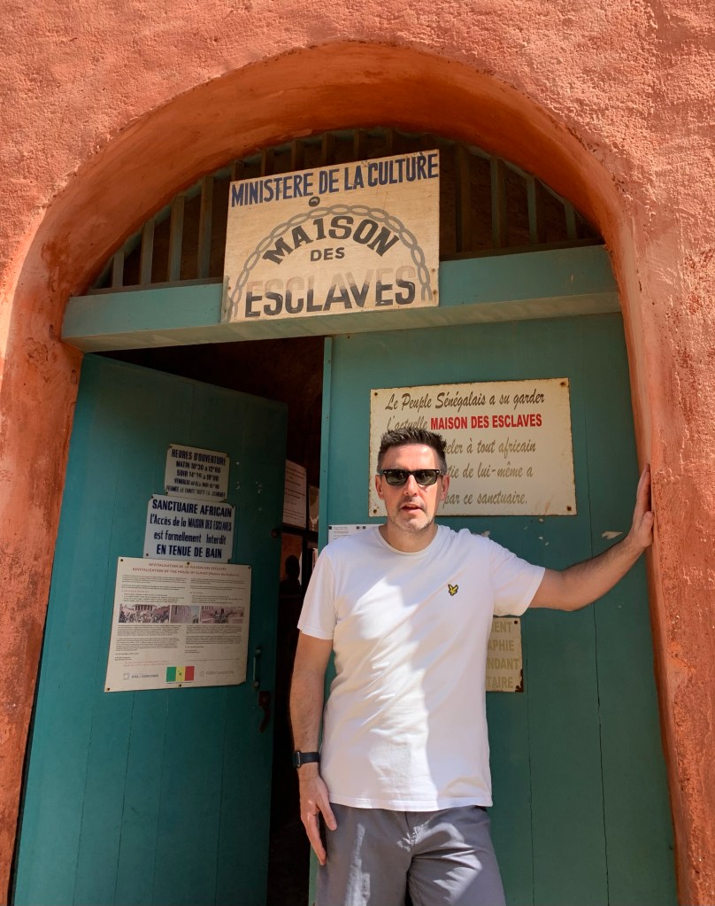
Maison Des Esclaves
The island of Goree was first discovered by the Portuguese in 1444 and used primarily as a transportation hub for slaves.
In 1780 the famous House of Slaves “for all the wrong reasons” was built. It was one of the first stone buildings on the island
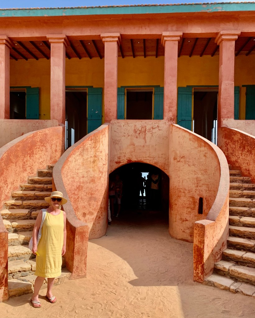
The House of Slaves had now been turned into a living history museum. For me, this is an unmissable and profound part of my travels to Senegal.
It is estimated that thousands if not millions of enslaved peoples passed through the chambers of Goree before they met their fate across the ocean in the Americas. An African Ellis Island if you like, with one major difference, none of these African people had a choice of seeking their new world and certainly wasn’t for a better future.
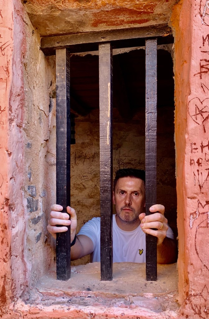
One of the holding pens used for the “storage of slaves” hundreds could be kept in these cramped conditions
Today it has been left more or less untouched, a permanent and important reminder of the human toll of the suffering and misery of the African people and the devastation of several centuries of European colonisation. Although judging by the rise of modern slavery have we learned anything at all?
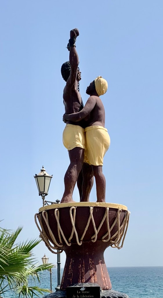
The sculpture was a gift from France unveiled in 2006.
On Goree Island, you will find the Statue Of Liberation, which is a very poignant sculpture of two free slaves one male and one female which is located overlooking the Atlantic Ocean. The statue was a gift from France, a symbol of the abolition of the slave trade and the reconciliation between the two nations.
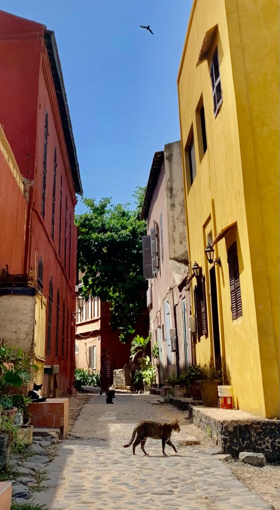
The rest of the island is in stark contrast to the House of Slaves, where you will find no cars, little crime and lots of cobblestone streets with prettily painted pastel-coloured houses.
Slavery ended in 1848 (it was previously abolished by the French in 1794 and 1815) but was never enforced in its colonies. Goree then became the first western-style municipality in French West Africa, complete with an elected mayor and council, finally gaining independence on the island from the French in 1929.
Today Goree feels like a million miles from the constant hustle and bustle of Dakar. Where I found colonial era houses with wooden shutters, painted in pastel colours weather beaten over time giving the houses a faded grandeur, where time slowly passes by.
Although Goree is not an island without life. The island is home to 1700 people, you will see many children playing in the public squares on the island, artists lining the main boulevard and many craft shops.
Too late to change your mind this item is already sold even if you don’t realise it yet 😂
Situated not from the ferry terminal you will find many vendors selling their goods to the many visitors who come to Goree for the day. Although they can be persistent they are generally good natured and prices were reasonable.
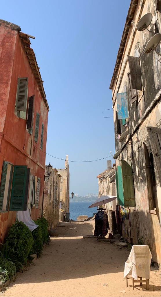
With my wife’s purchase safely packed away, it was time to take a walk along the beach back to the ferry terminal. The 3-kilometre ferry journey back to Dakar. Goree is a place with a very sad history, a place of pilgrimage for some, but it’s also vibrant and colourful, with a feeling of calmness.
Goree can look forward to the future but at the same time serves as a reminder of the human atrocities carried out on this idyllic island. We can move forward only if we remember the mistakes of the past.
A country which is known for its unassuming beauty and gorgeous tropical climate. My first instalment takes me to M’Bour on the Petite Coast to fully understand Senegalese life.
A first-time visitor to Senegal. Due to its French colonial history, the country for many English speakers has been very much under the radar. Although Senegal has been known as the Gateway to Africa and has been welcoming visitors for centuries.
This peaceful sub-Saharan country is one of the continent’s safest and most accessible, it’s also blessed with a rich culture, seven UNESCO world heritage sites no less, not to mention the dreamy beaches, wildlife, musical heritage and delicious cuisine.
Senegal is a predominantly Muslim country, although you needn’t worry about some of the usual protocols. In most areas, women don’t wear the hijab and you won’t be showing disrespect by not covering up. This is not set in stone so just be aware of the surroundings in which you may find yourself.
Parlez-vous francais? Def dangay wax Wolof? Unfortunately, my wife only speaks English
Another thing to consider is the language. There are 39 spoken languages in Senegal, Wolof is the predominant tribal language and French is spoken by some locals and is an official language. English is not widely understood, so it may be a good idea to brush up on some simple French and Wolof phrases.
M’Bour Petite Coast
M’Bour is the major town in the area, about 90 kilometres from Dakar, it lies on the Petite Coast. The Petite Coast is the main tourist hub in Senegal where you will find lots of hotels, restaurants and miles of beaches. Nicknamed the Senegalese Riveria it has been a popular destination for French visitors for many years.
A typical scene in a Senegalese town.
Travelling to an underdeveloped country can be somewhat of a culture shock for the uninitiated. Nevertheless, the positives of this for the traveller can include fresh cultural insights, friendly locals and affordable prices that can outweigh any possible difficulties.
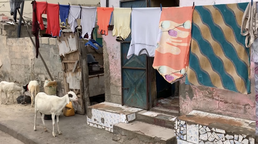
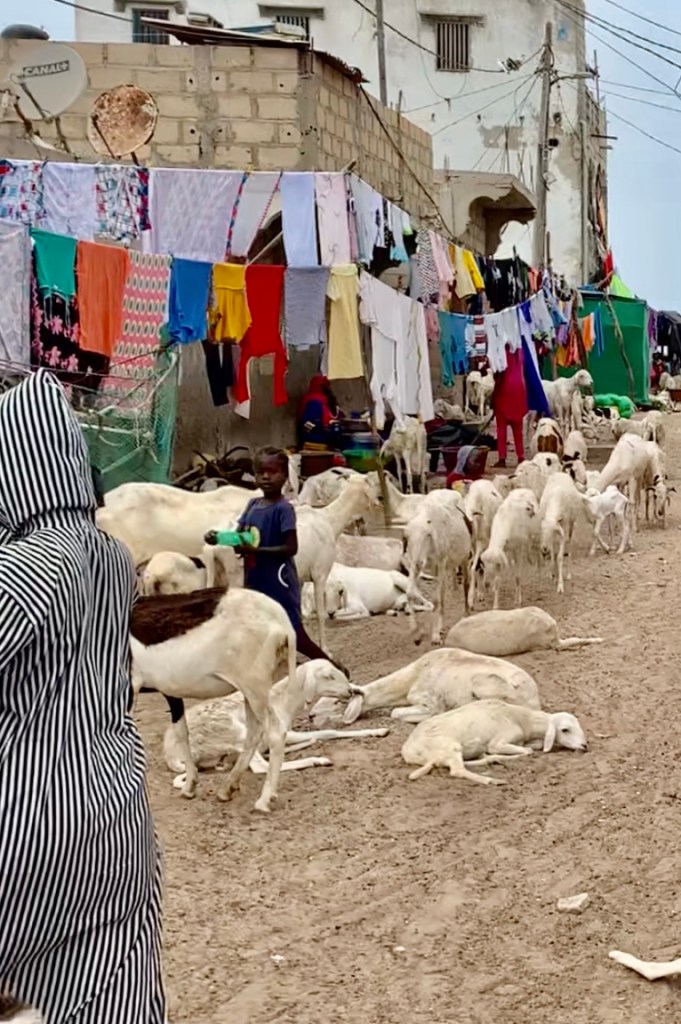
Don’t be surprised when you get there to find roaming goats, cows, chickens and horses and carts as well as buses crammed with locals all sharing the same roads with cars and pedestrians.
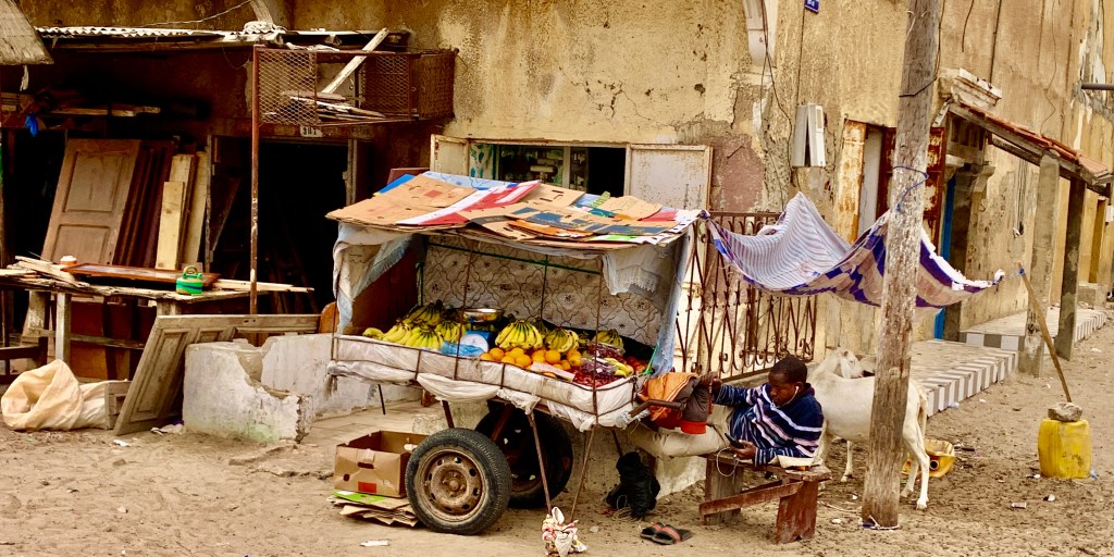
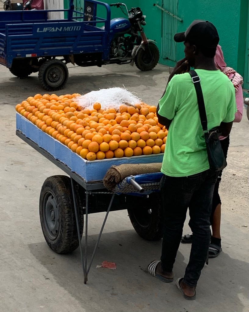
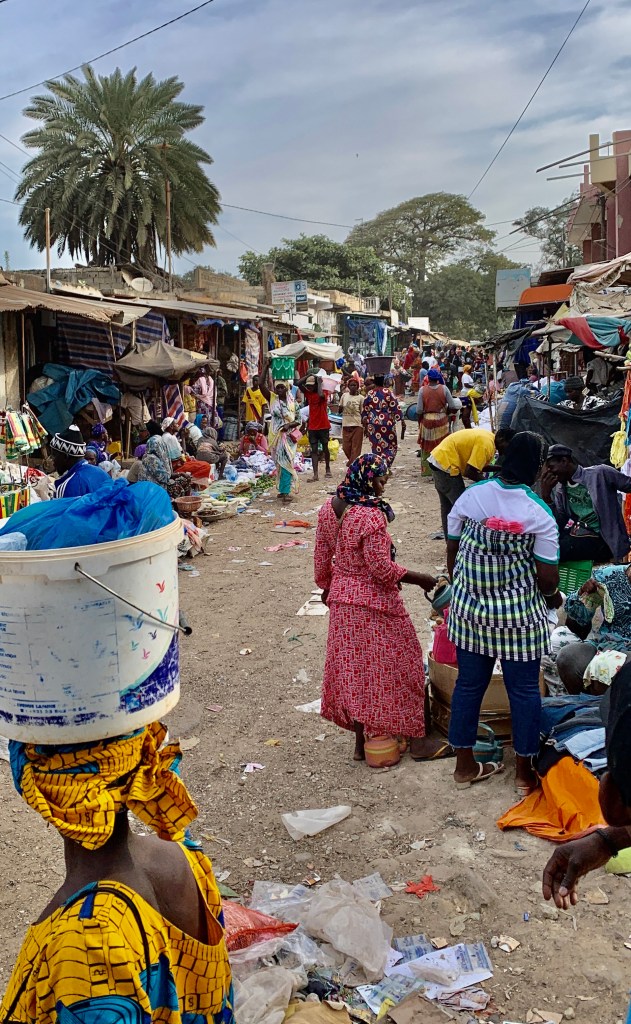
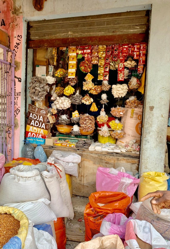
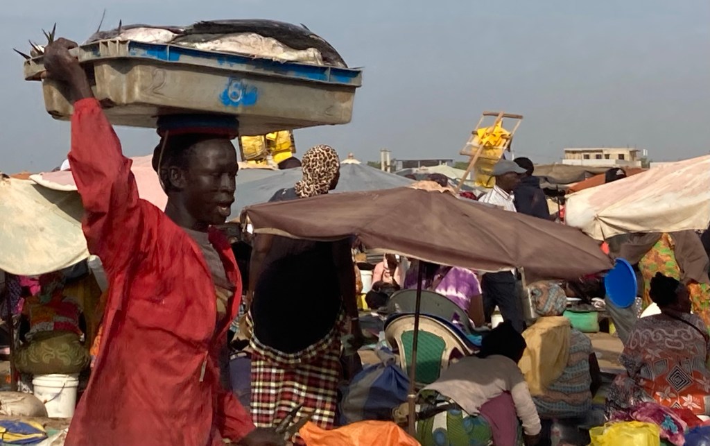
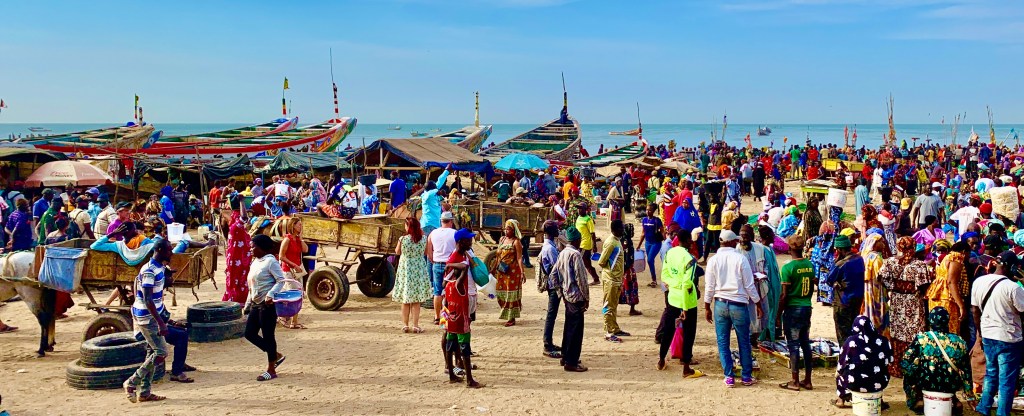
M’Bour market
I wasn’t quite sure where to start my Senegalese adventure. but what better place to start than a colourful Senegalese market where your able to buy a myriad of products.
You will find almost anything for sale at the market.
Discover the authentic Senegalese way of life by visiting a market at M’Bour. The colourful fishing and craft market was just a short distance from where we were staying at our hotel in Saly.
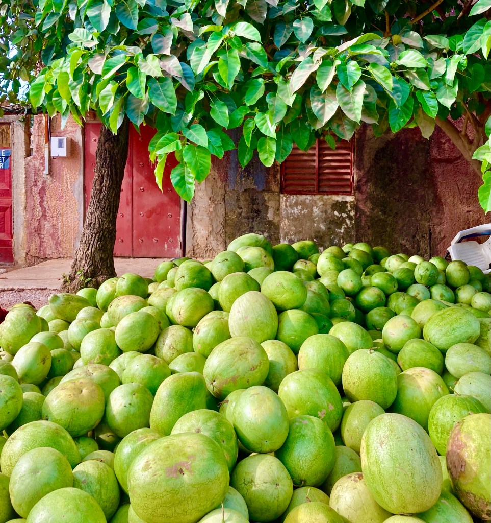
Watermelons everywhere
I have never seen so many watermelons. It is an ancient fruit native to Africa. Senegal has the perfect growing conditions for the fruit and is available in abundance, it’s fresh, deliciously sweet and very cheap, the perfect healthy snack on the go, and most vendors will prepare the watermelon 🍉 for you.
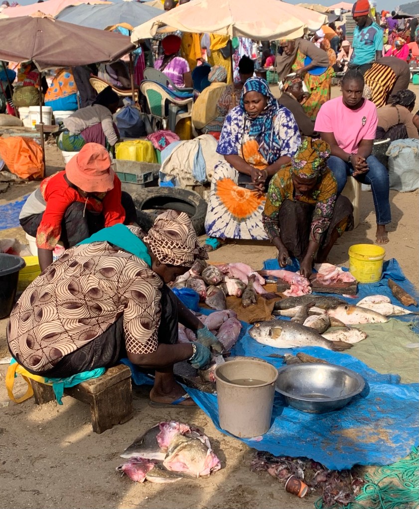
Fish being transported at the market
At the market, you will certainly find plenty of fish stalls. A staple food for many on the Senegalese coast. Where it can be purchased straight from the fishermen and sold fresh at the market.
Fish being prepared for sale.
One particular dish you will commonly find is thieboudienne which is rice and fish it doesn’t sound very exciting however you will find hundreds of variations around the country.
The market at M’Bour
Peanut and chicken dishes are also very popular. Senegal is a significant producer of peanuts and poultry is widely available so the food is relatively cheap to get.
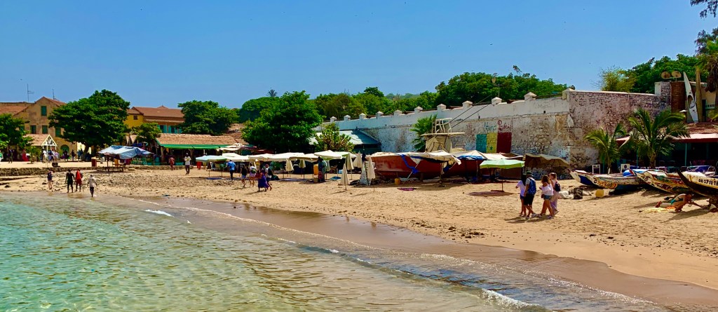
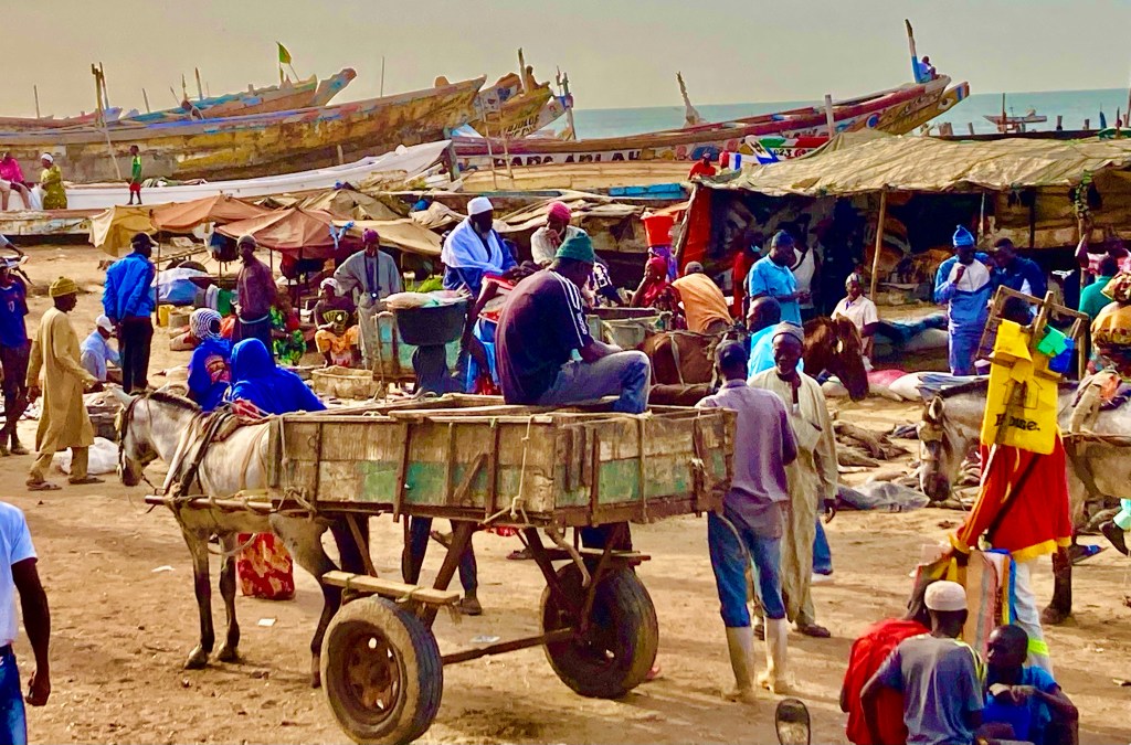
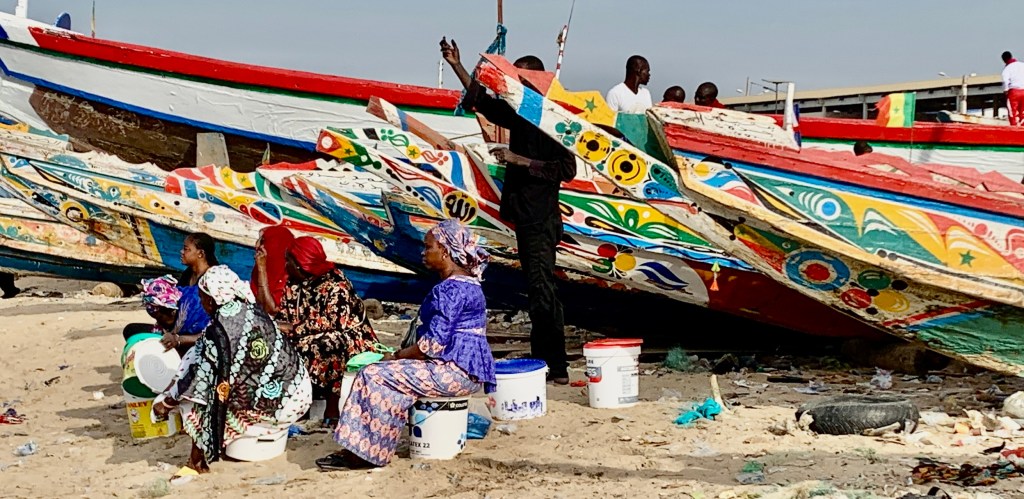
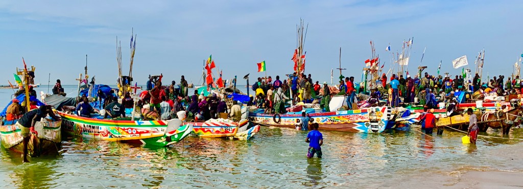
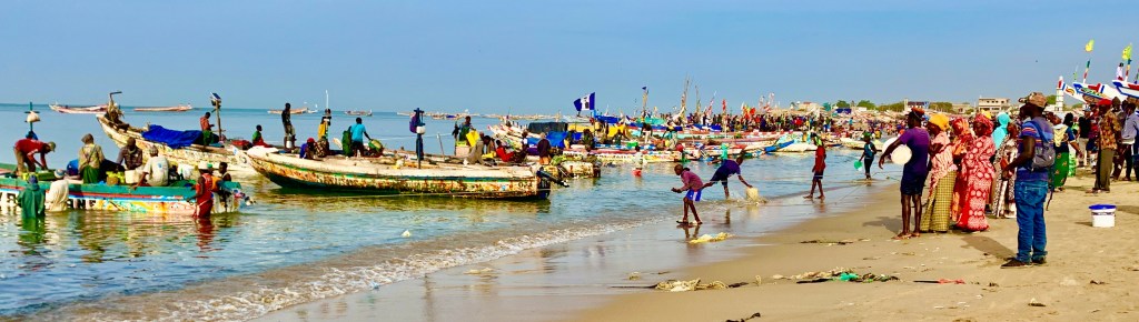
M’Bour fishing harbour
M’ Bour has one of the largest fishing fleets in Senegal.
We were staying on the Petite Cote the centre of tourism in Senegal. M’Bour is the major town in the region and the centre of the fishing industry with its busy harbour.
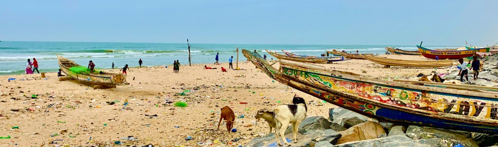
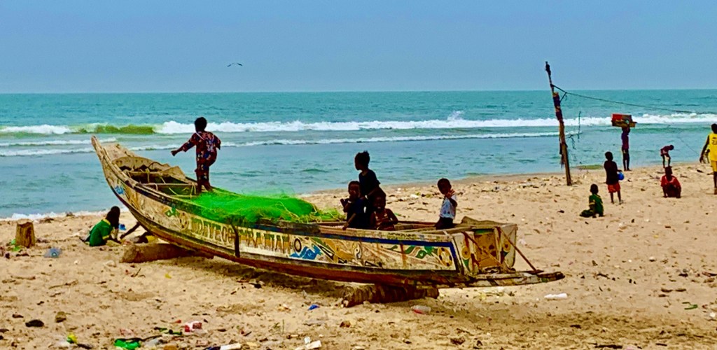
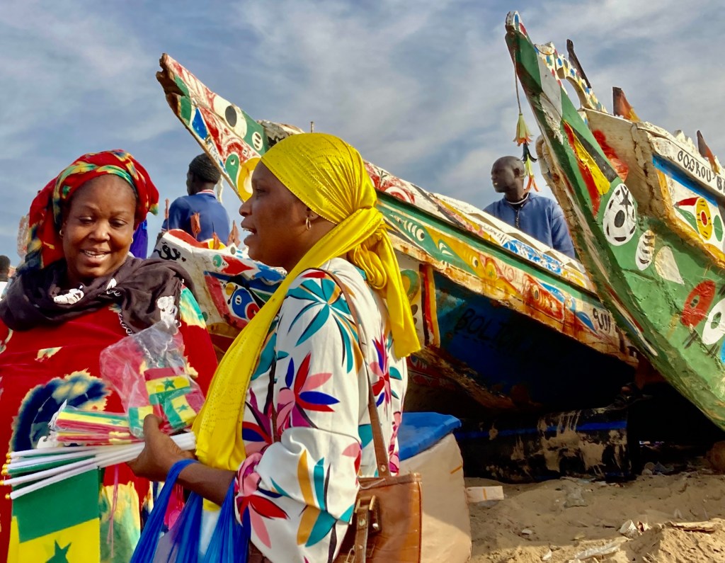
Colourful boats can be found at the fishing harbour, these are typical of the area.
The first thing we noticed was the beautifully painted fishing boats. It’s impossible not to be impressed when you see the boats lined up on the beach all painted in their striking designs.
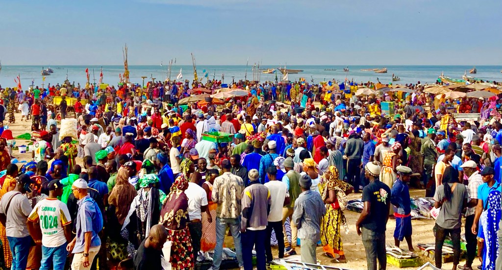
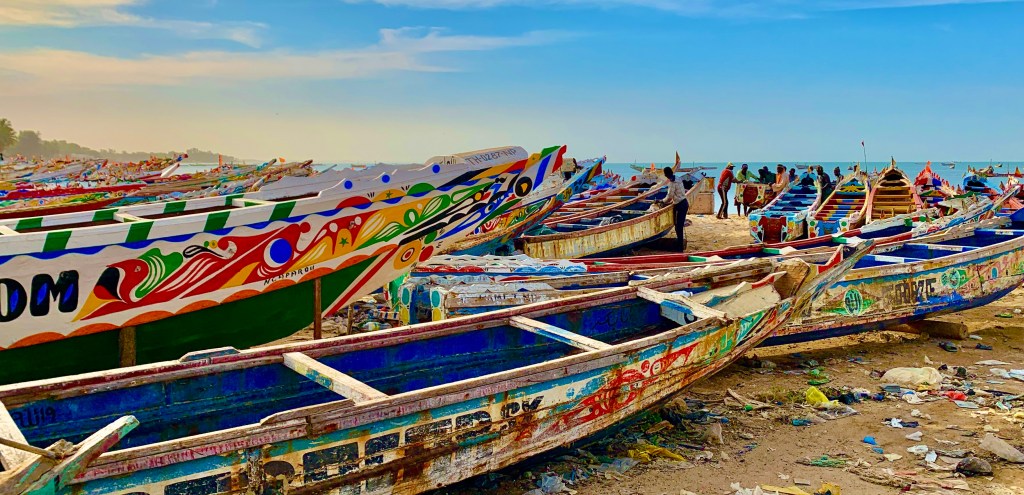
The days catch coming into the harbour.
M’Bour’s bustling fishing harbour and its geographical location on Senegal’s central west coast, make the town one of the country’s busiest fishing ports. This is a working beach and not a place for pleasure. Whoever comes here comes with the intention of fishing or purchasing fish.
From when the sun rises in the morning till well past sunset the fishing harbour of M’Bour is a hive of activities. It is especially busy when the morning catch is coming to the port. Where the boats will hopefully be full of grouper, snapper, swordfish, mackerel, tilapia and many more varieties of fish.
Fishermen, wholesalers and buyers will meet at this chaotic location where deals are continually being made, where fish are sorted by size and variety, before being transported to the market and beyond. A heaving mass of humanity tries to make a living amongst the chaos that ensues.
You can visit independently, but to get the best experience of the market and fishing harbour, it’s probably best to get a local guide. They will know the best times and locations to visit, will be able to speak to you in English and translate to locals, and keep away street traders although not aggressive can be very persistent with their sales patter.
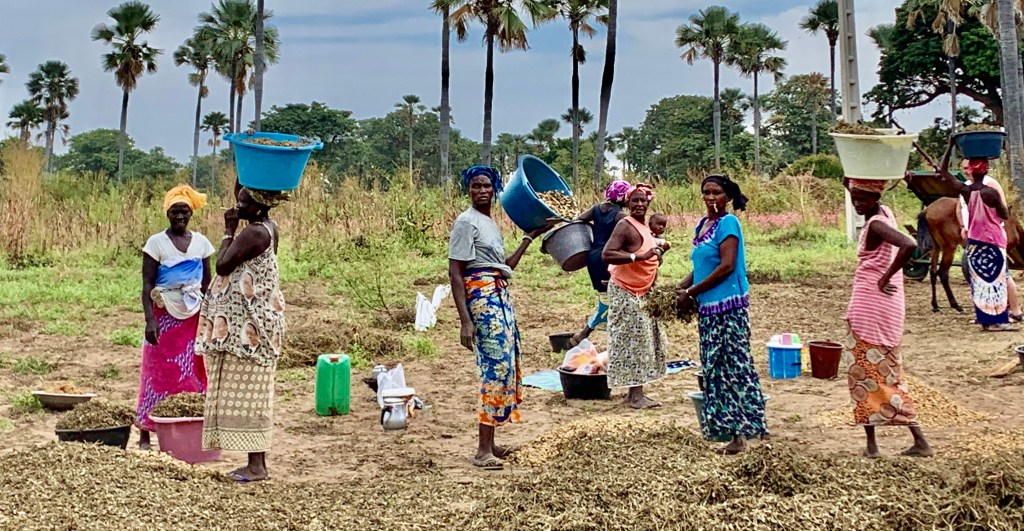
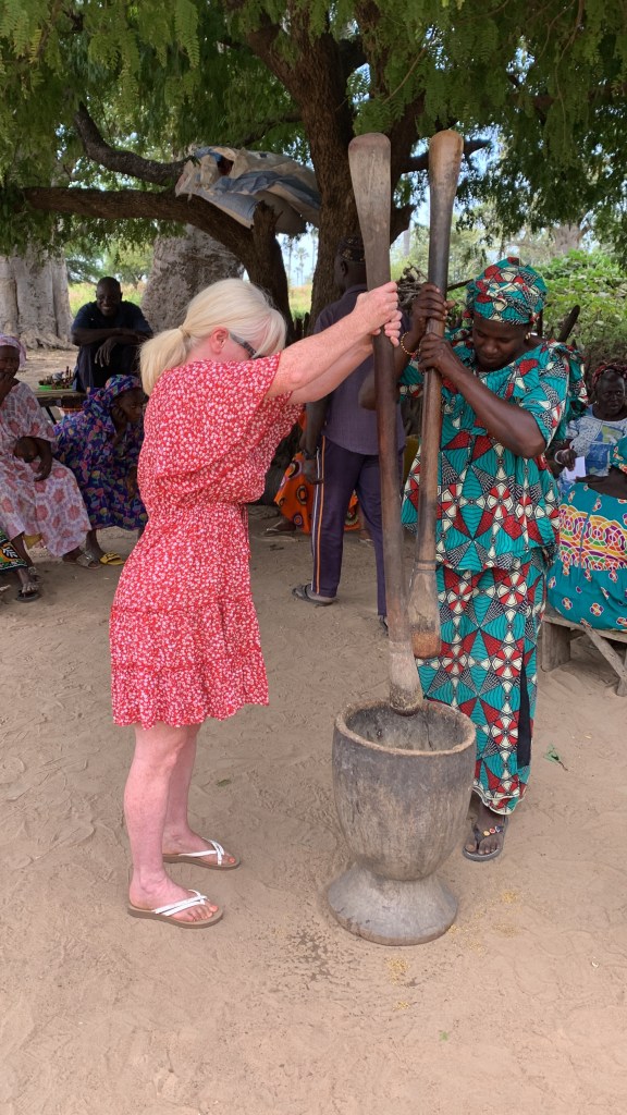
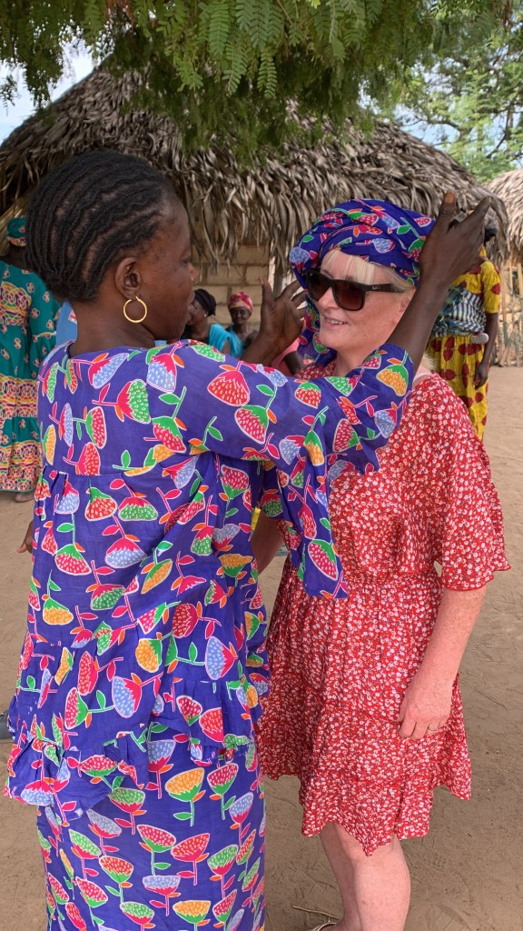
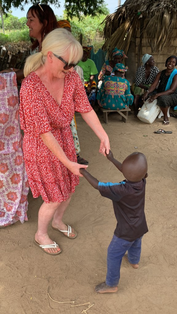
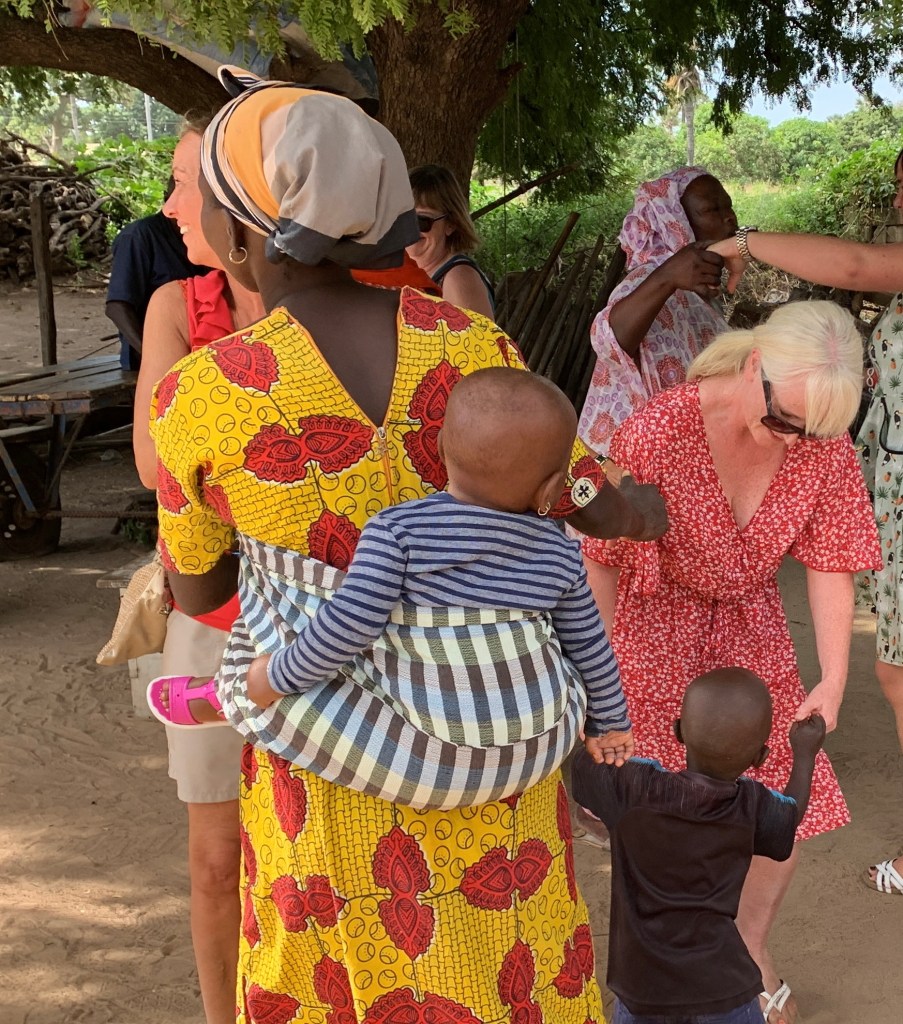
Senegalese rural village
If all the hustle and bustle of the market and fishing harbour is getting too much. An all together different pace of life to experience
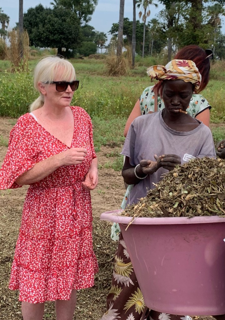
Agriculture methods are still very traditional.
I sometimes feel a little bit uncomfortable with these sorts of excursions. As if I am some sort of voyeur peering into someone else’s life.
Villagers working the land.
Nonetheless these tours are done very professionally, the company we used works closely with local communities and employs local people. I felt by visiting that we were providing a supplementary income besides farming, giving the community an opportunity that they can show visitors what a vibrant culture these rural villages have.
Workers taking a break in the field.
The guides giving us an insight about all the unique characteristics of the community. Being able to experience first-hand the tribe’s customs and how the community is organised, gave us a better understanding.
Helping out?
We were also very privileged and humbled to be able to share some moments with the people in these communities getting on with their daily lives. As they allowed us to experience some of the techniques they use when working the land.
Villagers in the country are very fit due to their hard-working nature, and my wife attempting to keep up with the local’s work ethic.
We were able to experience first-hand, villagers using traditional methods and techniques of farming and shepherding, which they have been employing for centuries, which to this day provide them with food and an income.
The Senegalese are very welcoming people.
Senegal is known as a country of hospitality and as a visitor, you will get to experience the concept of “terenga” a Wolof word, it is a term that defies strict translation but loosely translates to “the way you treat the guest.
Music and dancing start from a young age in Senegal.
This philosophy of sharing and giving and inclusion extends to strangers as well. We visited a local village with a tour company that works closely with local rural communities. As guests, it is only right that we should offer something to our hosts as a token of our appreciation, although not necessary we brought food and some things for the children which was accepted by the villagers.
Our small party of guests were warmly received at the village. Using local organizations that value their communities, our trip felt more meaningful, visiting the village we were able to pay for a service they provided, but in a more personal and meaningful manner than superficial tourism provided by multi-national travel companies interested in profits only.
Moonlight, music and dining amongst the Baobab Trees
Senegal is known for its traditional music and cuisine. It has a rich musical culture, together with a delicious cuisine which combines local, Arab and French influences.
A very impressive Baobab tree
We combined both of these with a majestic setting of the star-lit sky and the brooding presence of the Baobab Trees, whose trees are native to Africa and Madagascar. The trees can grow up to a height of 30 meters and are one of Africa’s most ancient trees.
A very impressive welcoming party
When we arrived at the village we were welcomed by a local welcoming party. If you want great music, stimulating culture and delicious cuisine, then Senegal certainly has all three in abundance.
An atmospheric location to enjoy our meal.
Classic African eats are accompanied by live African drumbeats and on this Senegalese evening, there was even some wrestling to watch which is the national sport, not football, in between much singing and dancing.
The drum beats provide the rhythm to Senegalese music, however, its close cultural connections to Arab, North Africa and Cape Verde can give the music a vibrant cosmopolitan sound.
Although during our evening musical entertainment we were in no doubt that the beating heart of this arrangement was the drums. These drums are unsurprisingly African drums, although their correct title is Djembe translated into English it means peace gather and its origins can be traced back to 1200 AD.
The performances were very entertaining a fantastic night of music and dance which exceeded my expectations. What could have been a very touristy Senegalese culture show which is usually little more than money earners for the tour operators, turned out to be very different giving us an insight into Senegalese culture, music and cuisine, who would have thought?
Belfast is an intriguing city and tends to be the main place to visit in Northern Ireland along with The Giant’s Causeway. The Antrim Coast which is situated between these two most popular destinations is well worth discovering.
I found lots of interesting things to do in the region. I had the opportunity to visit Cave Hill Country Park, Antrim Coast and Glens AONB, The Giant’s Causeway, Causeway Coast AONB, Bushmills Distillery and a few Game of Thrones locations, which meant nothing to me as I have never seen an episode but were still enjoyable nonetheless.
It’s a relatively small area and is close to Belfast so it’s very achievable in a day. Although Giant’s Causeway was the standout location, I enjoyed all stops on my trip of discovery to County Antrim.
Cave Hill County Park
Although Cave Hill County Park is run by Belfast City Council. I have included it in this blog due to its very naturalistic feel, and very imposing presence, as it looms large over Belfast and the surrounding area which forms County Antrim.
The park is located on the northern fringes of the city, it covers an area of 300 hectares, the park was established in 1993, and is one of the most frequented areas of the Belfast Hills.
The main purpose of our visit was to walk the popular Cave Hill County Park circular trail route. This 4.5-mile trail starts and finishes at Belfast Castle. It gave us some fantastic vistas of the city and beyond, it took two hours to complete this walk. There are some less challenging routes to walk to enjoy this wonderful Country Park.
The first part of the walk can be physically challenging if you have little in the way of fitness, but for us it was ok. The steepest section is at the start of the walk as we ascended the mountain trail, this evens out, and the walk from there on is flat, you then begin a descent back down to Belfast Castle. It’s a much easier route if you walk it anti-clockwise rather than clockwise.
The highlight of the walk for me was the panoramic views of Belfast taking in the green hillside in which the ruins of McArt’s Fort can be found. The mountain itself is visible from most streets in Belfast and provides an imposing backdrop to the city.
At McArt’s Fort, we continued to get unobstructed views of Belfast, Belfast Lough, Mourne Mountains, the Irish Sea and Scotland from the 1207 feet (368) meters summit, with views like this, the effort was undoubtedly worth the reward.
Belfast Castle
The castle sits in a prominent position in Cave Hill Country Park. As castles go it’s a little underwhelming, more stately home than a formidable castle. However, it was well worth a visit for the great trail walks and unobstructed views of Belfast.
Belfast Castle was the starting and finishing point of our walk to Cave Hill Country Park, we were able to enjoy a warm drink after we finished our trail walk, within the beautiful grounds, with the castle as a fabulous backdrop.
Although the castle looks relatively modern, built-in 1870 there has been a castle at this location since Norman times. The first castle was constructed in the late 12th century, and a second castle was built in 1611, which burnt down until the present castle was constructed.
The castle has extensive grounds and gave us spectacular views of Belfast and Belfast Lough. Unsurprisingly, because of its fantastic location, it is a very popular venue for weddings.
A rather unique aspect of Belfast Castle is the cat garden. As someone with four cats, this was always going to pique my interest. There has always been a cat at Belfast Castle, and it has been said that good fortune will come to those visiting the castle as long as this tradition is kept.
Within the immaculately kept castle grounds, nine cats have been added to the “cat garden” in the form of sculptures, topiaries and sculptures. It’s a bit like a cat treasure hunt, unsurprisingly there are no dogs allowed in the “cat garden” 🤣
Causeway Coast AONB
Established as an Area Of Outstanding Natural Beauty in 1989, it stretches from Larne to Ballycastle.
It may be small in area and less than thirty miles in length, nonetheless its rugged beauty soothes the eyes and soul, with an abundance of stunning views, historical sights and geological wonders to discover.
The Causeway Coast AONB is known the world over due to its Giant’s Causeway World Heritage Site, Northern Ireland’s first and to date only World Heritage Site. The Causeway Coast for me personally was certainly one of Northern Ireland’s highlights.
The unique geology of the area has formed this spectacular coastal scenery. Volcanic rocks have formed at this particular location which provides a dramatic backdrop as the cliffs plunge into the sea.
Due to time constraints, we were only able to discover a small section of the coast. We followed one of the trails from The Giant’s Causeway which hugged the cliff edge as we then descended to the seafront looping back to the Giant’s Causeway.
A walk that was just over 3 miles (5 kilometres) where the landscapes varied enormously. Contrasting with this wild coastal scenery are the gentler landscapes of woodland and farmland.
Giant’s Causeway World Heritage Site
The Giant’s Causeway is located in County Antrim on the northeastern coast of Northern Ireland.
It was affirmed as a World Heritage Site by UNESCO in 1986, and a nature reserve in 1987 by the Northern Irish Government. It is one of the UK’s greatest natural wonders.
The Giant’s Causeway is an area of 40,000 interlocking basalt columns, the result of an ancient volcanic eruption.
The tops of the columns form stepping stones that lead from the cliff foot and disappear under the sea. Most of the columns are hexagonal, although there are some with four, five, seven and eight sides.
For centuries The Giant’s Causeway has been a place where myth and legends meet. Where the spectacular basalt columns formed through the rapid cooling of lava from an underwater volcano, or as some may say, created by the legendary mythical Irish Giant Finn MacCool??
Today The Giant’s Causeway is one of Northern Ireland’s most visited locations. Situated on one of the world’s most spectacular coastlines, its unique rock formations have, for nearly 60 million years stood as a natural barrier against the continual ferocity of the North Atlantic storms.
Although I have seen pictures of The Giant’s Causeway many times, nothing compares to viewing it for yourself. The rugged symmetry of the columns amazed and intrigued me. One of the natural wonders of the world.
Today much of the Giant’s Causeway is owned and managed by the National Trust. Access to the Giant’s Causeway is free. There is a visitor site which charges an entry fee, being the National Trust this will not be cheap, and in all honesty, it won’t add any value to your visit to the Giant’s Causeway. Just enjoy the beautiful natural surroundings and unique geology.
Bushmills Irish Whiskey distillery
The old Bushmills Distillery is an Irish Whiskey Distillery. A popular visitor attraction, only a few miles from the Giant’s Causeway, well worth a short stop on your way back from The Giant’s Causeway.
Ireland has a long history of whiskey distillation and Bushmills is the oldest working distillery on the island of Ireland.
Tours are available which give a full guided tour of the distillery to see how this famous spirit is made and understand all about the distilling process.
You don’t have to take a tour of the distillery, part of the distillery is open to the public. This inevitably includes the Bushmills shop where whiskey and other merchandise are available to purchase. Whatever you decide it’s an interesting stop and worth a short visit.
Cushendun Caves
One of the Locations where Games of Thrones was filmed. A lot of Games of Thrones was filmed on location in this part of the Antrim Coast.
The caves are very old and situated on the picturesque Antrim Coast. They have only recently come to prominence due to the caves being a filming location for Games of Thrones.
Easily accessiblee next to Cushendun Beach. The area has been formed by over 400 million years of natural erosion.
It was a stop on an organised tour to The Giant’s Causeway. If I’m being honest it was of little interest to me, but Game of Thrones fans seemed to be pretty enthralled with the location.
The Dark Hedges
The Dark Hedges is an avenue of beech trees, which forms an atmospheric tunnel, another location that has been used in Game of Thrones.
Having never seen an episode of Games of Thrones this location although very atmospheric and picturesque meant very little to me, although unlike Cushendun Caves I found this location much more photogenic.
It’s a very popular area and is probably Northern Ireland’s most photographed location. To have the eerie, silence and picture-perfect opportunity you will have to visit very early. It is in a rural location so you will have to visit by car or organise trips.
Carrickfergus
Carrickfergus sits on the north shore of Belfast Lough and is one of Northern Ireland’s oldest towns.
Carrickfergus is close to Belfast although as a town it considerably predates Belfast and the town has great historical significance. It is the start of the Antrim Causeway Coastal Route.
It has great historical significance as it is the place where King William III first set foot in Ireland, his victory against the Catholics at the Battle of the Boyne is still celebrated by Protestants to this day.
It had a small but significant role in the American War of Independence where a naval battle between American and British forces took the place off the coast of Carrickfergus.
Although Carrickfergus is most famous for its castle, which dates back to the 12th century. During its long lifetime, it has survived multiple sieges from Scottish, Irish French and English, forces, despite this Carrickfergus Castle remains one of the best-preserved medieval structures in the country.